Forecast for the Logan Area Mountains

Toby Weed
Issued by Toby Weed for
Monday, November 28, 2022
A winter storm will elevate avalanche danger in the backcountry today. Expect rising avalanche danger as heavy new snow accumulates and is drifted onto slopes with preexisting weak snow. Heightened avalanche conditions and MODERATE danger will develop. People could trigger small avalanches on steep slopes with significant accumulations of storm snow or recently wind drifted snow at all elevations.
  • Evaluate the snow and terrain carefully, and avoid steep slopes with deposits of wind drifted storm snow.
  • The snow is still so shallow that people could be seriously hurt if they are caught and carried over rocks in even a small avalanche.
Low
Moderate
Considerable
High
Extreme
Learn how to read the forecast here
Special Announcements
Our annual party and fundraiser is coming up on December 6 in Logan at the Cache. 19th Annual Utah Avalanche Center Pray for Snow Party and Fundraiser information and tickets HERE.
Weather and Snow
The National Weather Service in Pocatello continued a Winter Storm Warning for the Bear River Range through 11:00 Tuesday morning. Snowfall has increased significantly this morning in the mountains, and 30 to 40 mph west-southwest winds are humming along the ridges. See Beaver Mountain Webcams
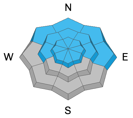
 HERE
Looks like 8 to 14 inches of accumulation is possible at upper elevations in the Northern Bear River Range by tomorrow morning, with much less, 4 to 8" expected in the Logan Peak Area and the southern part of the Logan Zone, Thankfully, it appears that active wintery weather will continue for a bit, with the next storm expected over the area on around Thursday night and another good chance next weekend.
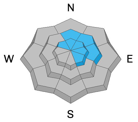
A couple inches accumulated on remote weather stations in the Central Bear River Range Saturday, and sustained westerly winds are blowing on Logan Peak this morning. Sensitive drifts or soft wind slabs are building up and getting thicker as snow is drifted onto steep upper elevation slopes. Ridge top winds are expected to be sustained and rather gusty, with 40 mph gusts expected during the storm.
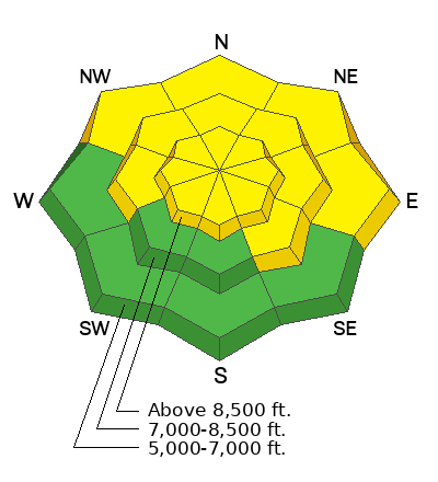
Shallow early season snow conditions exist across the Logan Zone, with only about a foot-and-a-half to three feet of total snow covering the rocks on upper elevation slopes. Although the sugary snow keeps you off the ground for the most part, there are numerous shallowly buried land mines out there. The snow is especially loose and sugary around rocks. Local snowmobile mechanics report a good number of A-arm replacements recently.
  • Keep your speed down! Caution is required to avoid hitting shallowly buried rocks, stumps, or down trees.
Recent Avalanches
See our updated list of observed avalanches from across Utah HERE
Ad
Avalanche Problem #1
Wind Drifted Snow
Type
Location
Likelihood
Size
Description
People could trigger small slab avalanches of wind drifted snow if they venture onto exposed upper elevation slopes. It is always wise to avoid travel on steep slopes with obvious deposits of wind drifted snow.
  • Suspect wind drifts or wind slabs are often smooth and rounded looking, like lenses or flying saucers.
  • Wind slabs often form on the lee side of exposed ridges and in and around terrain features. Watch for and avoid drifts on gully walls, under cliff bands, along sub-ridges, in scoops, saddles, and sinks.
  • Drifted snow is stiffer and more compacted than non-drifted snow, and hard drifts often produce hollow drum-like sounds when you walk on them.
  • Freshly formed wind slabs can be quite sensitive and are often remotely triggered. Older, harder wind slabs can be very stubborn and may not release until you get well out on them, suddenly failing like a big mouse trap.
  • Shooting cracks in drifted snow are a sure sign of instability.
Avalanche Problem #2
New Snow
Type
Location
Likelihood
Size
Description
People could trigger loose avalanches of fresh or storm snow on very steep slopes. These should be generally manageable, but could cause problems if you are pushed off a cliff or into trees or other terrain traps below.
Today's storm will cause rising danger throughout the day, and as new snow stacks up, soft slab avalanches of storm snow will probably become possible for people to trigger even on sheltered slopes.
The new snow is falling on bare ground or very shallow snow on many low and mid elevation sunny slopes, (W, SW, S, SE) so the danger of avalanches will be low, but potential might be high for hitting rocks.
Additional Information
  • Take the all-new online avalanche courses the UAC built for Know Before You Go or take other online courses listed on the KBYG website (Develop skills -> Online Learning).
  • Get your avalanche rescue gear ready for winter. Put fresh batteries in your transceiver and update the firmware. Inspect your shovel and probe. Get your airbag backpack ready by possibly doing a test deployment and update the firmware if it is an electric version.
General Announcements
Please submit your observations from the backcountry HERE.
For a list of avalanche classes from the Utah Avalanche Center go HERE
For information on where you can ride your sled or snowbike, check out this map of the winter travel plan for the Tony Grove and Franklin Basin Areas HERE.
The Tony Grove Road and other forest roads in the Logan Ranger District are not maintained for wheeled vehicles in the winter.
This information does not apply to developed ski areas or highways where avalanche control is normally done. This forecast is from the U.S.D.A. Forest Service, which is solely responsible for its content. This forecast describes general avalanche conditions and local variations always occur.