Check out our Holiday Auction - Sign Up for the Utah Snow and Avalanche Workshop (USAW)

Forecast for the Logan Area Mountains

Paige Pagnucco
Issued by Paige Pagnucco on
Monday morning, January 29, 2024
Dangerous avalanche conditions exist, and the avalanche danger is CONSIDERABLE. A poor overnight refreeze coupled with daytime heating and abundant sunshine will cause the snow to become saturated and unstable on southerly-facing slopes at all elevations. Natural avalanches are possible. Careful snowpack evaluation, cautious route-finding and conservative decision-making are essential for safe travel today.

Human-triggered avalanches remain possible in isolated areas as people can trigger dangerous slab avalanches up to three feet deep and a couple hundred feet wide, failing on a buried persistent weak layer.
Low
Moderate
Considerable
High
Extreme
Learn how to read the forecast here
Special Announcements
Sign up for forecast region-specific text message alerts. You will receive messages about changing avalanche conditions, watches, and warnings...HERE.
Weather and Snow
Is it January? The temperatures at some stations say otherwise. Tony Grove sits at 32°F this morning, and yesterday it reached 46°F. Logan Summit, 50°F! We'll see a few days of well-above-high temps in our zone making it feel more like late March. Observers yesterday used terms like rain forest, muggy, soggy, and dripping. Needless to say, riding and turning conditions have become sub-par as the snow surface is now crusty or damp. The good news is we have excellent coverage and very supportable snow creating excellent "touring" conditions.

This morning, the wind is blowing 15-20 mph from the northwest at the 9700' CSI Logan Peak weather station. At 9500' on Paris Peak, it’s 27° F. It's 31° F, and there's 53" of total snow at the new Card Canyon site (8750'). The Tony Grove Snotel at 8400' reports 32° F and 74 inches of total snow containing 123% of average SWE (Snow Water Equivalent).

Today, expect high temperatures at 8500' around 40° F, with sunny skies and light winds from the northwest. It looks the same until Thursday when the chance for snow returns to the forecast.
Recent Avalanches
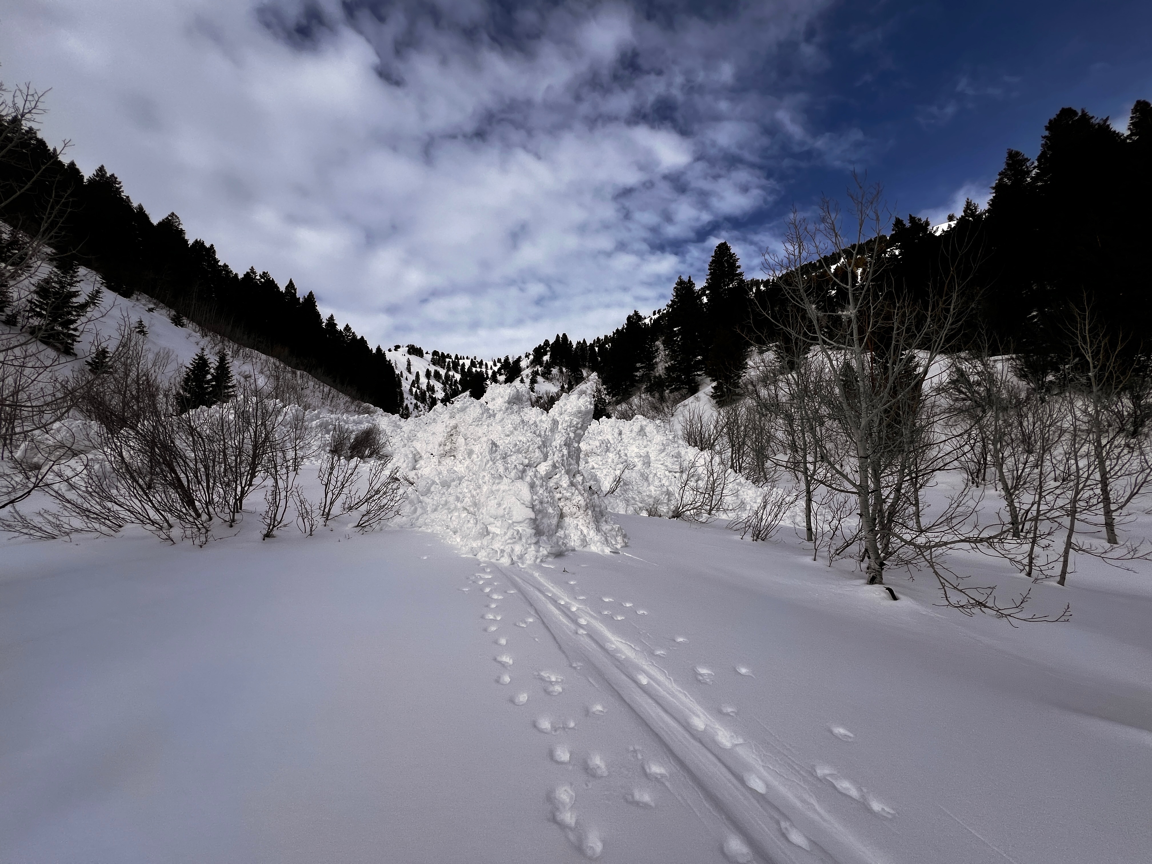
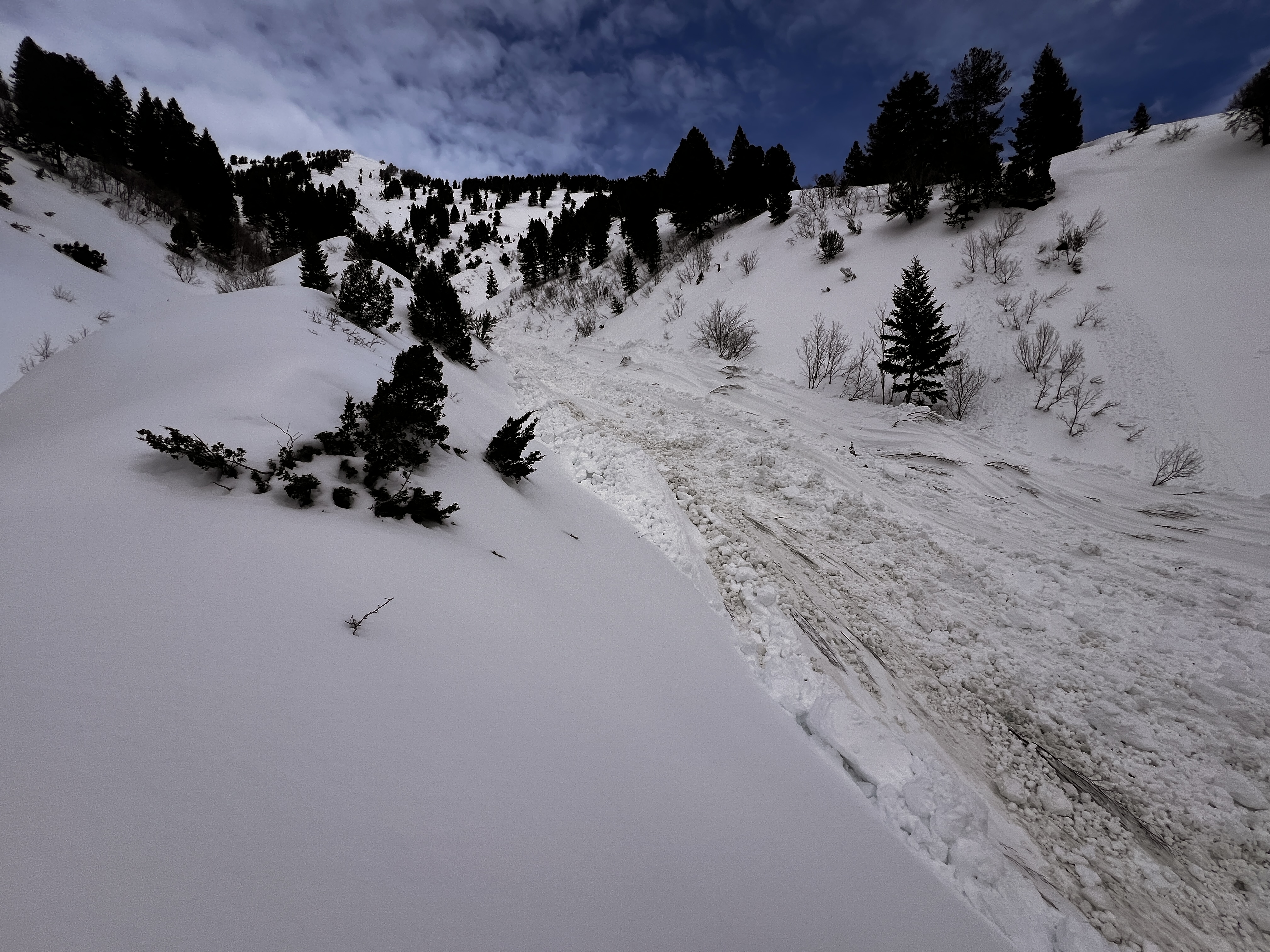
A natural wet avalanche cycle occurred yesterday due to rapid warming. The activity mainly occurred on south-facing slopes. UAC Pro Observer Chris Benson witnessed a large avalanche in upper Green Canyon that buried the previous day's skin track (pic below). Check out local observations and avalanches HERE.
Ad
Avalanche Problem #1
Wet Snow
Type
Location
Likelihood
Size
Description
Unseasonably warm temperatures and abundant sunshine will cause the snowpack to become saturated and unstable. If the snow surface feels sloppy and you sink in more than a few inches, move to a shadier aspect or lower-angle terrain. Roller balls and pinwheels are signs that the snow is becoming unstable.
It's a good idea to steer clear of places like Woodcamp, the Wellsvilles, and the Mt. Naomi Wilderness today. Avoid being in run-out zones as the day warms.
Avalanche Problem #2
Persistent Weak Layer
Type
Location
Likelihood
Size
Description
Today, human-triggered slab avalanches failing on a buried persistent weak layer could be large and life-threatening. During the last big storm, heavy snowfall and strong winds overloaded slopes plagued by a widespread persistent weak layer that formed throughout the December dry spell. This type of avalanche is becoming more stubborn, but if you do trigger one, the consequences will be high.

If you do choose to ride steep avalanche terrain, stack the odds in your favor by doing the following:
  • Ride one at a time in avalanche terrain and keep an eye on your partner the entire time from a safe spot.
  • Choose a slope where the runout is free of trees, rocks, or cliffs.
  • Do not stand or park underneath steep slopes, as avalanches can run long distances into the flats.
  • Be prepared for a rescue.
Additional Information
General Announcements
-Come practice companion rescue with your backcountry partners at the Franklin Basin TH beacon training park. video HERE.
-For all questions on forecasts, education, Know Before You Go, events, online purchases, or fundraising: call 801-365-5522.
-To report an avalanche or submit an observation from the backcountry: go HERE.
-We will update this forecast by 7:30 AM tomorrow.
This forecast is from the U.S.D.A. Forest Service, which is solely responsible for its content. This forecast describes general avalanche conditions, and local variations always occur.