AVALANCHE WARNING!! Tap for info
UDOT PLANNED AVALANCHE CLOSURES!!

Forecast for the Logan Area Mountains

Toby Weed
Issued by Toby Weed on
Tuesday morning, January 28, 2025
The snow on most slopes is stable, and the avalanche danger is LOW in the backcountry. Exceptions exist on recently drifted slopes steeper than 30°, where people might trigger avalanches of wind-drifted snow failing 1-2 feet deep on sugary, faceted snow. Small, loose, wet avalanches are possible on steep, sunny slopes as mountain temperatures rise above freezing for the first time in weeks.
Use normal caution and continue to follow safe travel protocols by exposing only one person at a time to avalanche risk.
Low
Moderate
Considerable
High
Extreme
Learn how to read the forecast here
Special Announcements
Urgent battery replacement is required for anyone who received batteries from one of our participating "Batteries for Beacons" shops. Please review the replacement notice for "Batteries for Beacons" on our blog, HERE. Batteries distributed through our "Batteries for Beacons" program this year are of inadequate length. We apologize and will provide you with new batteries.
Weather and Snow
Recent strong winds destroyed last week's nice powder in most areas, and stiff drifts, windboard, and satrugi are widespread across the zone, even in normally sheltered and forested areas. There are recently formed drifts in unusual or unexpected places at all elevations. The snow surface has taken a beating, and finding consistent areas with soft snow is challenging, even though an inch or two of new snow filled in tracks and smoothed out the snow surface on Saturday. Riding is a bit tricky because the snow is deceptively inconsistent. It's solid and supportable on most slopes, with interspersed pockets of recrystallized powder. Most slopes sport shallowly buried wind or sun crusts, and you never feel sure whether or not the crust will break under your weight and throw you off balance.
Subject to an extreme temperature gradient caused by a prolonged dry spell with cold temperatures and clear nights, the snow near the surface has become very weak and faceted. Strong winds blowing from all directions last week and over the weekend built stiff slabs on this layer of weak snow, and some could be balanced, awaiting someone to come along and trigger them. Watch for shooting cracks indicating instability, and avoid hollow-sounding or rounded pillows of snow. Today's winds are blowing from the east again, and east winds are unusual, so look for wind slabs in unusual places and avoid them.

-The Tony Grove Snotel at 8400 feet reports 27° F, with 56 inches of total snow. At the Card Canyon weather station at 8800 feet, it's 22° F and there is 43 inches of total snow.
-At the CSI Logan Peak weather station at 9700 feet, winds are blowing lightly from the east 34 mph, with gusts around 40 mph, and it's 22° F. On Paris Peak, at 9500 feet, it is 24° F, and the winds are blowing from the east-northeast at 10 to 12 mph.

NWS Point Fx for Naomi Peak area: Today: Sunny, with a high near 34° F. Wind chill values as low as -6° F. East-northeast wind around 10 mph. Tonight: Mostly clear, with a low around 13° F. Wind chill values as low as 3° F. East wind around 10 mph. Wednesday: Sunny, with a high near 35° F. Wind chill values as low as 2° F. East-northeast wind 7 to 9 mph becoming north in the afternoon.
Expect sunshine and warm temperatures in the mountains throughout most of the work week. Clouds will increase on Friday, and some light snowfall is possible. Snow is expected over the weekend in the Logan Zone, and it could be heavy at times...

For more information, visit the UAC weather page here: Weather - Utah Avalanche Center
For Logan-specific weather, go here: Logan Mountain Weather - Utah Avalanche Center
Recent Avalanches
Ad
Avalanche Problem #1
Wind Drifted Snow
Type
Location
Likelihood
Size
Description
East winds like those this weekend are always a bit strange for the Logan area. They rip the snow off reliable powder slopes, build drifts and stiff wind slabs in unusual or unexpected places, and crossload many normally protected slopes. Over the weekend, we observed drifting snow down to about 7000 feet, and we've found wind slabs in strange places. Some wind slabs formed on weak faceted surface snow, a persistent weak layer, and these may remain sensitive to human triggering for several days after they were formed.
  • Recent drifts and wind slabs are easy to identify. They are often lense-shaped or rounded and chalky looking and may produce hollow drum-like sounds when you move around on them. Wind-drifted snow is generally stiffer than the surrounding snow.
  • Wind slabs are most likely on the lee side of ridges, near cornices, and around terrain features like cliff bands and gullies.
  • Softer wind slabs may be sensitive and easy to trigger, and harder slabs may wait till you get out on them and then release suddenly.
  • Watch for shooting cracks, a clear sign of instability, and be aware that some wind slabs may be triggered remotely.
Avalanche Problem #2
Normal Caution
Type
Location
Likelihood
Size
Description
Warmer temperatures than we've seen in a while are expected today and tomorrow. Solar warming will probably moisten the surface snow, and small, loose wet avalanches are possible on steep, sunny slopes. Rapid warming, roller balls, pinwheels, and surface sluffs indicate potential for wet avalanche activity. If the snow you're in gets damp and sticky, move to shadier terrain.

Deep hard slab avalanches are unlikely, yet still possible in outlying or extreme mountain terrain. A dormant, persistent weak layer near the ground is still a potential problem on recently drifted outlying slopes, and rocky, windswept slopes in northerly-facing terrain with thin snow cover are suspect. Isolated hard slab avalanches might be triggered from a "sweet spot" or a shallower part of the slab. Check out Paige's Blog HERE
Additional Information
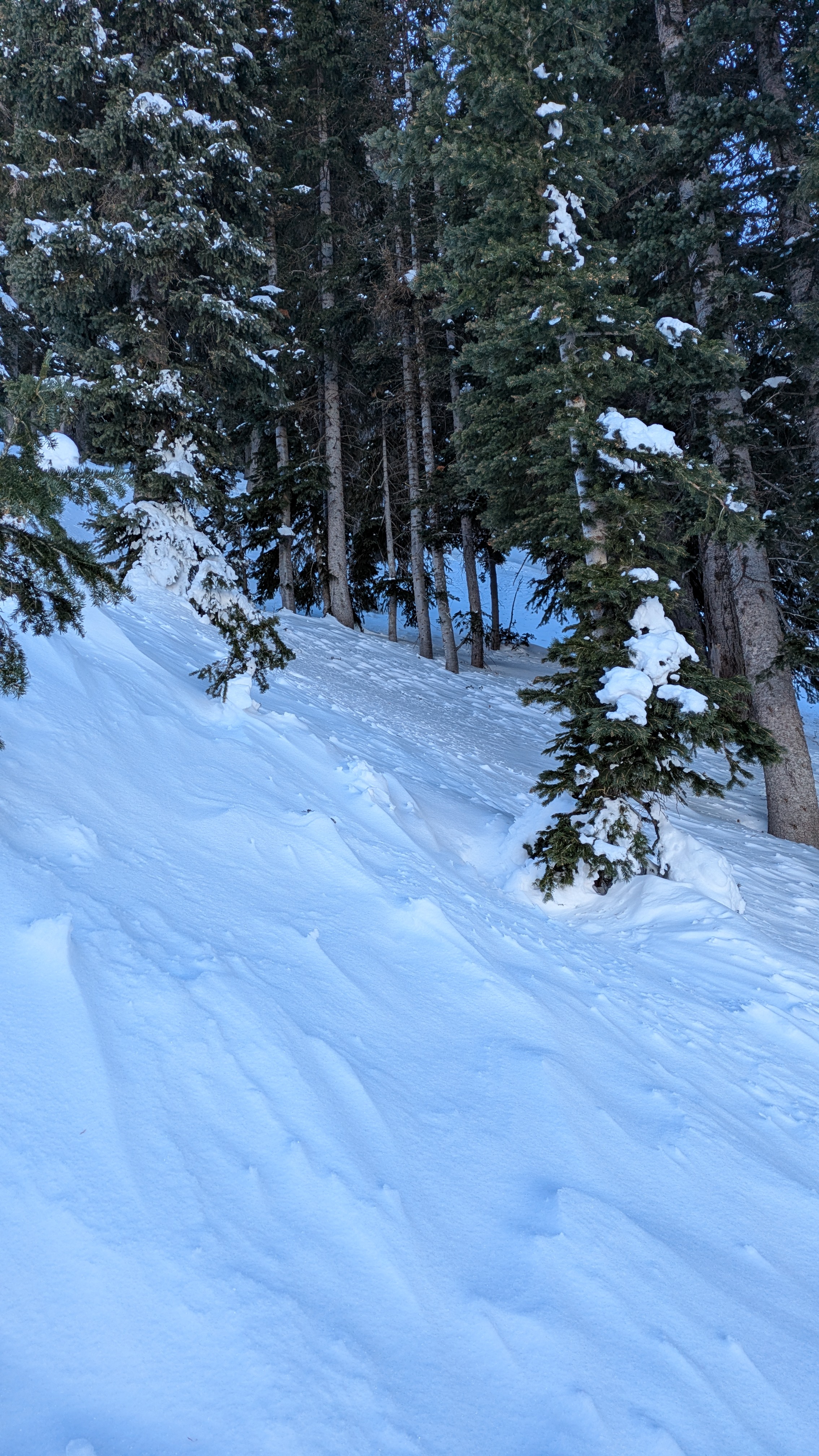
Anna R. found some wind-jacked snow in Logan Dry Canyon on Sunday, even in the normally sheltered forest. Her observation is HERE
General Announcements
-National Forest Winter Recreation Travel Maps show where it's open to ride: UWCNF Logan, Ogden LRD Tony Grove, Franklin Basin CTNF Montpelier
-For all questions on forecasts, education, Know Before You Go, events, online purchases, or fundraising, call 801-365-5522.
-Remember the information you provide could save lives, especially if you see or trigger an avalanche. To report an avalanche or submit an observation from the backcountry, go HERE.
-Receive forecast region-specific text message alerts to receive messages about changing avalanche conditions, watches, and warnings. Sign up and update your preferences HERE.

This forecast is from the U.S.D.A. Forest Service, which is solely responsible for its content. This forecast describes general avalanche conditions, and local variations always occur.