Forecast for the Logan Area Mountains

Toby Weed
Issued by Toby Weed for
Thursday, January 18, 2024
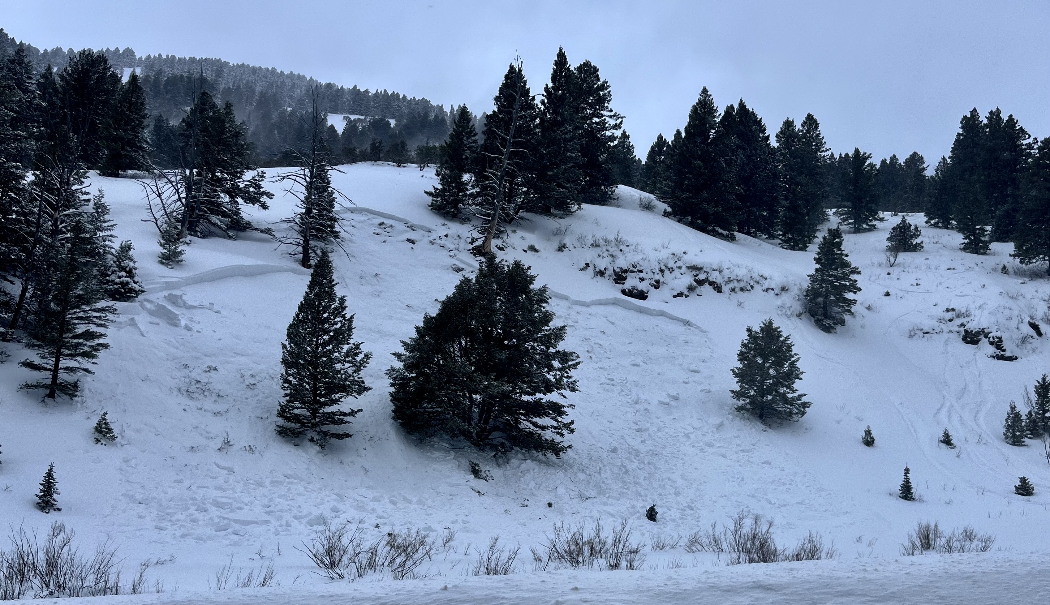
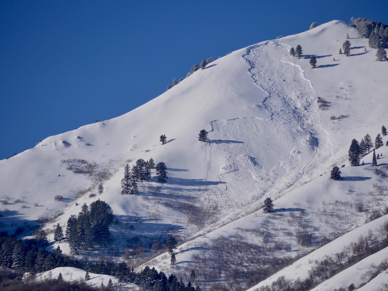
Heavy snowfall and drifting by strong winds blowing from the west have created a HIGH avalanche danger on drifted slopes at all elevations. Very dangerous conditions exist, and people are likely to trigger life-threatening avalanches failing on a widespread buried, persistent weak layer. Large natural and human-triggered avalanches avalanches are likely.

Avoid all travel in avalanche terrain. People should stay off of and out from under backcountry slopes steeper than 30° at all elevations.
Low
Moderate
Considerable
High
Extreme
Learn how to read the forecast here
Avalanche Warning
What: The avalanche danger for the warning area is HIGH at all elevations today.
When: In effect from 6am MST this morning to 6am MST Friday
Where: For the Northern Utah and Southeast Idaho mountains, including the Bear River Range.
Impacts: Recent heavy snow and drifting have overloaded slopes with widespread buried persistent weak layers and created areas of unstable snow. Human-triggered and natural avalanches are likely at all elevations. Stay off of and out from under slopes steeper than 30 degrees.
Warning Times: Thursday, January 18, 2024 - 6:00am to Friday, January 19, 2024 - 6:00am
Region: Logan, Southeast Idaho
Special Announcements
Sign up for forecast region-specific text message alerts. You will receive messages about changing avalanche conditions, watches, and warnings...HERE
Weather and Snow
Today's snow is inverted or heavier on top, which often enhances instability. Very dangerous avalanche conditions exist on drifted slopes steeper than 30° at all elevations. Natural avalanches are occurring, even in low-elevation terrain. People are likely to trigger long-running, destructive, and life-threatening avalanches. Poor snow structure exists on most slopes, with a stiff layer of wind-drifted snow now overloading a widespread layer of very weak, sugary, or faceted snow from the December dry spell.

Winds from the west are drifting snow again this morning, blowing 25 to 30 mph with a 54 mph gust at the 9700' CSI Logan Peak weather station. At 9500' on Paris Peak, the wind is blowing 25 to 35 mph from the west-southwest, and it's 19° F with a wind chill value of 3° F.
The Tony Grove Snotel at 8400' reports 26° F and 89 inches of total snow. 14 inches of new snow have accumulated at the site in the last 24 hrs, with a whopping 2.7" SWE (Snow Water Equivalent).

The National Weather Service has continued a Winter Storm Warning for the mountains in the Logan Zone extending through 11:00 this morning. Expect mountain snowfall to taper off in a few hours, with 2 to 4 inches falling during the day. Expect cloudy and comparatively mild conditions, with snow flurries on Friday and a few inches of snow on Saturday. Unsettled, snowy weather will continue well into next week before high pressure builds over the area later in the work week.
Recent Avalanches
There were a few small natural avalanches affecting Logan Canyon yesterday, and a few more were reported last night. Yesterday afternoon, a snowboarder remotely triggered a good-sized slab avalanche near the Backside pullout in Beaver Canyon. The avalanche on a southeast-facing slope at 6900' in elevation was 2 to 3.5 feet deep and around 100 feet wide. It highlights the fact that the Backside is the backcountry, and unexpected avalanches are occurring at low elevations, which can catch people off-guard.
A remotely triggered avalanche on the Beaver Mt Backside at 6900' in elevation, right off Hwy 89.

Check out local observations and avalanches HERE.
Ad
Avalanche Problem #1
Persistent Weak Layer
Type
Location
Likelihood
Size
Description
Today, human-triggered slab avalanches failing on a buried persistent weak layer could be large and life-threatening. Large, long-running, and destructive natural avalanches are likely today as heavy snowfall and drifting by winds from the west overloaded slopes plagued by widespread buried layers of weak, sugary snow or facets and feathery surface hoar that developed during the prolonged December dry spell.
  • Avalanches could be triggered remotely, from a distance, or worse, from below!
  • Collapsing or whumpfs and shooting cracks indicate unstable snow.
Avalanche Problem #2
New Snow
Type
Location
Likelihood
Size
Description
  • Heavy storm snow and wind-drifted snow overloaded slopes with poor snow structure and large avalanches failing on the December persistent weak layer are likely.
  • Loose and soft slab avalanches of heavier, inverted storm snow failing within the new snow or on Tuesday's surface are possible.
  • Exposed slopes, where the wind drifted the new snow, developed dangerous wind slabs. Watch for and avoid stiffer drifted snow on the Lee side of prominent ridges and in and around terrain features like sub-ridges, gully walls, mid-slope rollovers, and cliff bands.
Additional Information
On Tuesday, we went for a short tour in Logan Canyon to check the stability of the low-elevation snow. Paige explains what we found in this short video.
A large natural avalanche was visible on Monday in the Wilderness above Wellsville. (1-15-24)

Always follow safe travel protocols on or under slopes steeper than 30°.
  • Be sure everyone in your party has working avalanche rescue equipment, including a transceiver, probe, and shovel. Practice with this equipment regularly, and include and instruct new partners.
  • Cross avalanche paths and runout zones one person at a time, with the rest of the party watching from a safe place.
  • Reevaluate and be willing to change your plans if you encounter any signs of instability, like recent avalanches, audible collapses (whumpfs), or cracking in drifted snow.
General Announcements
-For all questions on forecasts, education, KBYG, events, online purchases, or fundraising: call 801-365-5522.
-To report an avalanche or submit an observation from the backcountry: go HERE.
-We will update this forecast by 7:30 AM tomorrow.
This forecast is from the U.S.D.A. Forest Service, which is solely responsible for its content. This forecast describes general avalanche conditions, and local variations always occur.