Forecast for the Logan Area Mountains

Issued by Toby Weed on
Friday morning, January 10, 2020
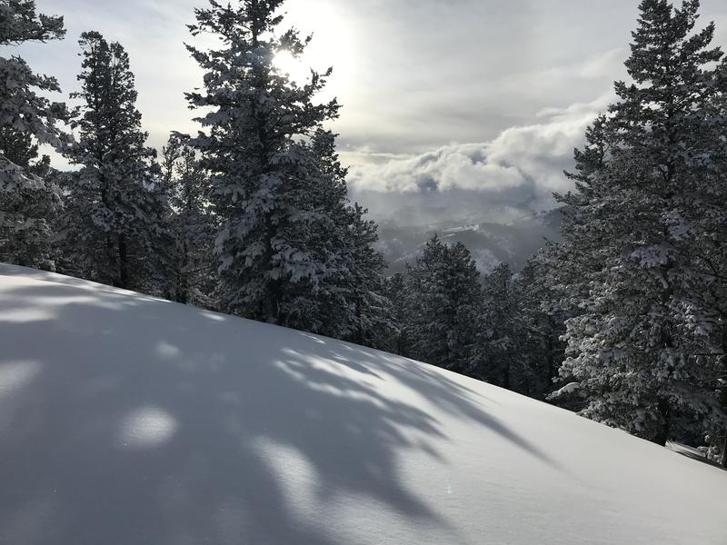
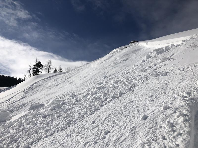
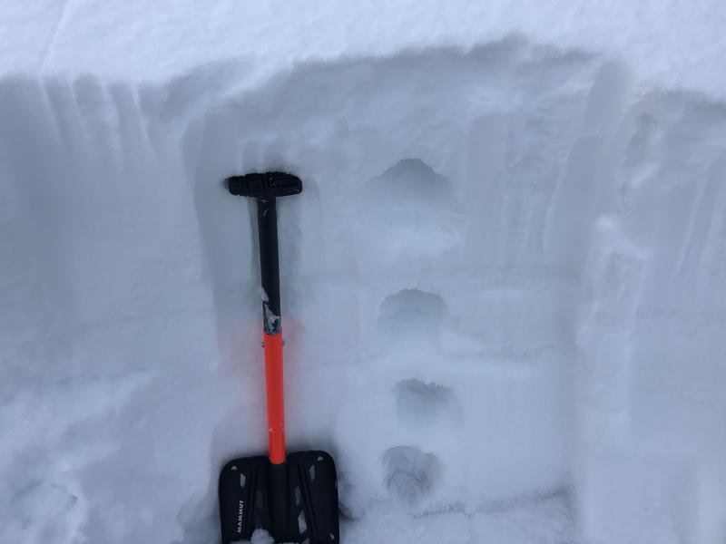
A CONSIDERABLE avalanche danger exists on drifted upper and mid elevation slopes. People are likely to trigger 1 to 3-foot-deep avalanches of wind drifted snow. Avalanches could fail on a persistent weak layer buried by the New Years Storm. Smaller avalanches of soft wind drifted or new powder snow are possible on many steep slopes and at all elevations. You can find safer conditions in lower angled and sheltered terrain.
- Evaluate snow and terrain carefully. Use caution while route finding, and make conservative decisions.

Low
Moderate
Considerable
High
Extreme
Learn how to read the forecast here
Special Announcements
New UAC Podcast - An Avalanche Forecaster, a Meteorologist, and an Economist Walk Into a Bar..... HERE
Weather and Snow
It's 10°F at the 8400' Tony Grove Snotel this morning, and there is about 20 inches of new snow in the last 48 hours, with 1.6" SWE. There is 75 inches of total snow, with 124% of average SWE for the date. It's 0°F at the CSI weather station at 9700' on Logan Peak, and northwest winds are currently blowing about 18 mph. It was breezy again overnight at the UDOT highway 89 Logan Summit, with gusts in the twenties and 1°F
Wind chills will be around -12°F today, so dress warm and keep an eye on your partners' exposed skin. We found fine powder conditions in the backcountry yesterday, but dangerous avalanche conditions exist on drifted upper and mid-elevation slopes. So, don't let your guard down.

We found nice powder in the backcountry near Beaver Mountain yesterday.
Expect mostly sunny skies today, 8500' high temperatures around 18°F, west wind 7 to 13 mph, and wind chills around -12°F.! Clouds will increase and snow showers are possible tonight, with 1 to 2 inches possible. Low temperatures are expected to be around 20°F, with 15 mph west-southwest winds, and wind chills around -9°F. Expect snow tomorrow, with 4 to 8 inches possible, high temperatures around 24°F, and west-southwest winds 13 to 15 mph. Active and snowy weather is expected to continue through the middle of next week with several storms in the forecast.
Recent Avalanches
A natural avalanche was spotted yesterday afternoon on the southeast side of White Pine Knob @ 8800'. Reported as about 1' deep and 100' wide.
A rider triggered a 2' deep and 100' wide avalanche on an east facing slope at around 8200' in elevation near White Pine Creek on Tuesday, 1-7-2020. No one was caught or injured.
A close call occurred Saturday (1-4-2020) when a rider was caught, carried, and partially buried at about 9000' on an east facing slope above Hidden Lake in Gibson Basin, a couple miles north of the state line out of Beaver Creek Canyon. The avalanche of wind drifted snow was about 2' deep and around 150' wide.
Avalanche Problem #1
Wind Drifted Snow
Type

Location

Likelihood

Size

Description
Yesterday like the day before, west winds dropped down into the terrain in the upper Logan Canyon Area, moving snow around and increasing the danger at lower and mid elevations. People are likely to trigger 1 to 3 foot deep avalanches of wind drifted snow on upper and some mid elevation slopes. Avalanches are possible on many other mid elevation and some lower elevation slopes as well.
- Watch for and avoid stiffer drifted snow near ridge lines and in and around terrain features like cliff bands, scoops, gully walls, and sub-ridges.
- Wind slabs are often rounded and chalky looking, and they might sound hollow, like a drum.
- Soft fresh wind slabs can be quite sensitive, and are often remotely triggered. Hard wind slabs can be more devious, sometime allowing one to get out on them before releasing.
- Avoid ridge top cornices, which can break much further back than expected and start avalanches on slopes below.
Avalanche Problem #2
Persistent Weak Layer
Type

Location

Likelihood

Size

Description
Human triggered avalanches failing on a buried persistent weak layer are possible on slopes steeper than about 30 degrees at upper and mid elevations. The cold weather Christmas week created sugary weak surface snow in many areas, and some slopes were plagued by feathery surface hoar before the New Years Storm. Some avalanches of wind drifted snow today might be triggered remotely, from a distance or below. Some slopes in the area may stay unstable for a while.

We found very weak sugary snow throughout the snowpack yesterday near the Spring Road at about 7500' on the Beaver Backside.
Avalanche Problem #3
New Snow
Type

Location

Likelihood

Size

Description
Loose powder sluffs and shallow soft slabs of new snow are possible on steep slopes at all elevations. Even small avalanches can be quite dangerous if you get dragged into trees or other terrain traps below.
Additional Information
Paige discusses our concerns about the drifted in east faces in upper Providence Canyon:
We had a great time with the Avalanche 101 class up at Tony Grove on Saturday, 1-4-2020
General Announcements
The anual CROWBAR backcountry ski race will be on Saturday, February 8. The unique and classic backcountry race will be held at the Swan Flat/Garden City Trailhead in upper Logan Canyon. There are four divisions (Junior, Recreation, Heavy Metal & Race) with different climbs, descents, and technical booters. Participants must carry avalanche rescue gear (beacon, shovel, probe) and can use alpine touring gear, telemark skis, or splitboards. Register on UltraSignup, or sign up to volunteer at this year's race!
Thanks to the generous support of our Utah ski resorts and Ski Utah, we have discount lift tickets available. All proceeds from these go towards paying for avalanche forecasting and education! Get your tickets HERE.
EMAIL ADVISORY. If you would like to get the daily advisory by email you subscribe HERE.
Remember your information can save lives. If you see anything we should know about, please help us out by submitting snow and avalanche observations....HERE. You can also call us at 801-524-5304, email by clicking HERE, or include #utavy in your tweet or Instagram.
This forecast is from the USDA Forest Service, which is solely responsible for its content. The forecast describes general avalanche conditions and local variations always occur.
I will update this forecast before about 7:30 tomorrow morning.