Forecast for the Abajos Area Mountains

Eric Trenbeath
Issued by Eric Trenbeath for
Monday, March 27, 2023
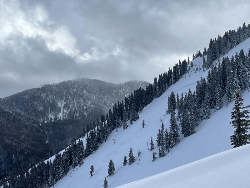
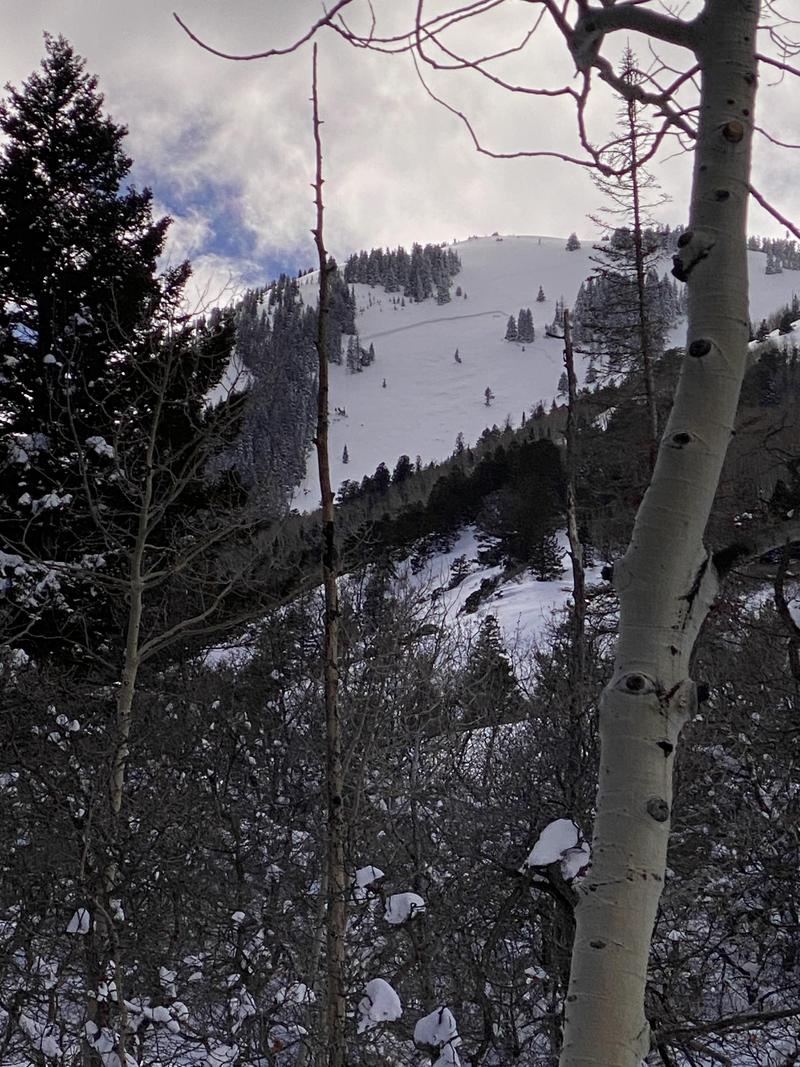
The likelihood is decreasing, but dangerous, human triggered avalanches remain possible. The danger is greatest on steep, wind drifted slopes with a north or east facing component.
Though it's going to remain cold, the strong March sun may heat up the snow surface. Look for signs of loose, wet instability such as rollerballs or pinwheels and get off of, and out from under steep slopes if these signs are present.
Low
Moderate
Considerable
High
Extreme
Learn how to read the forecast here
Weather and Snow
NWS forecast for the Abajo Mountains.
Snow totals and temps at Buckboard Flat (8924')
Snow totals and temps at Camp Jackson (8858')

Snowpack Summary and General Conditions
2' of heavy, wet snow, driven by winds created dangerous conditions last week producing large, natural, and human triggered avalanches. In my travels over the weekend I found the snow to be gradually stabilizing, but dangerous, human triggered avalanches remain possible. You are most likely to find trouble on steep slopes facing North through East, where strong winds have built slabs 2'-4' deep. Conditions are unusual for this time of year. Cold temperatures and successive storms are creating winter-like conditions in the snowpack and things are not stabilizing as rapidly as they normally would in March and you still need to travel with a high level of avalanche awareness. Avoid steep, wind drifted slopes that have a smooth rounded appearance, and terrain that has steep convexities or blind breakovers.
Though its going to remain cold, the strong March sun may heat up the snow surface. Look for signs of loose, wet instability such as rollerballs or pinwheels and get off of, and out from under steep slopes if these signs are present.
Recent Avalanches
A skier triggered an avalanche yesterday that was large enough to bury him.
Taylor Martin sent in this report of a natural avalanche on Horse Head Mountain that occured on Wednesday. He estimated it to be 2' deep and 250' wide.
Cory Noonan sent in another view:
Additional Information
If you are getting out in the backcountry, we'd love to hear what you're seeing. Please submit observations here. For the most recent snowpack observations click here. You can also send an email to [email protected] or give me a call with anything noteworthy, especially avalanches! 801-647-8896
General Announcements
This forecast is from the U.S.D.A. Forest Service, which is solely responsible for its content. This forecast describes general avalanche conditions and local variations always occur.