Nikki Champion
Forecaster
Week in Review: Avalanche Conditions and Snowpack Developments (November 29 - December 5, 2024)
Each week, we look back at the key snowfall, weather, and avalanche events from the previous week. For archived forecasts, visit the Salt Lake Mountains’ past updates.
The danger roses for the Salt Lake mountains from Friday, November 29th through Thursday, December 5th:

Overall Summary:
This week, avalanche danger transitioned from MODERATE to LOW as high pressure settled in. The Persistent Weak Layer (PWL) in the snowpack remained the primary concern throughout the week. Several skier- and snowboarder-triggered avalanches occurred, with slides up to 2' deep, highlighting ongoing instability—especially on northerly to easterly mid- and upper-elevation slopes. As the weather remained cold and clear, the snowpack continued to weaken and form facets, reducing the likelihood of triggering avalanches as the slab became less cohesive. However, this does not eliminate the risk entirely. By December 5th, avalanche danger had decreased to LOW, and normal caution was advised. However, future concerns remain regarding upcoming storms and the potential development of PWL issues. Shallow, soft snow continues to be found in sheltered, sun- and wind-protected areas.
November 29th: A period of high pressure settles in. Avalanche danger is MODERATE at upper elevations, with the possibility of avalanches up to 2' deep on persistent weak layers, shallow wind drifts, and small wet-loose slides. Recent skier-triggered avalanches highlight ongoing instability:
- West Monitor Bowl (NE aspect, 9,800'): 18-24" deep, 150' wide, 600' vertical.
- Scott’s Bowl (NE aspect, 9,800'): 18" deep, 100' wide, 150' vertical.
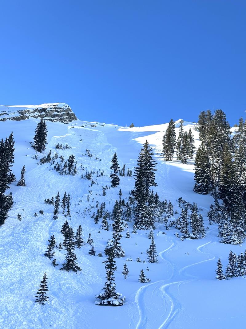
- Two Dogs (Days Fork) (NE aspect, 9,600'): 18" deep, 100' wide, 450' vertical; a second slide triggered during exit. Photo below.

November 30th: Avalanche danger remains MODERATE under continued high pressure. The total number of avalanches reported since November 27th rises to seven, all failing on weak, faceted snow near the ground:
- Natural: Honeycomb (Big Cottonwood)
- Skier-triggered: Davenport Hill (Silver Fork), Silver Fork Headwall (Silver Fork)
- Unknown trigger: Lanes Leap (Big Cottonwood Canyon)
The primary concern remains the Persistent Weak Layer (PWL).
December 1st: High pressure persists with MODERATE avalanche danger. The snowpack is adjusting to the recent load, but a valley inversion begins to develop.
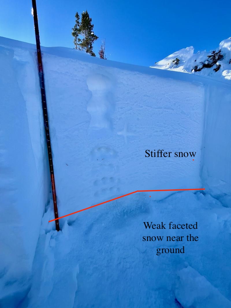
Silver Fork headwall avalanche crown, north facing slope at 9,900'. An example of the snowpack and how it was failing.

December 2nd: After five days of cold, clear weather, the snowpack weakens as facets form throughout. Avalanche danger remains MODERATE, with a shift in focus from failures directly on the PWL to the broader faceting process occurring within the snowpack.
December 3rd: Triggering avalanches on the PWL is becoming less likely, with no recent activity and fewer signs of instability like cracking or collapsing. However, inconsistent snow test results and the unpredictable nature of weak layers still warrant a MODERATE danger on steep, northerly to easterly mid- and upper-elevation terrain.
December 4th: After a team discussion, the avalanche danger is dropped to LOW, as the likelihood of triggering slides on the PWL becomes very low, though not impossible.
December 5th: Avalanche danger remains LOW, and normal caution is advised. Our primary concern now shifts to future storms, as the snowpack is primed to develop a persistent weak layer problem. On the positive side, soft snow continues to be found in sheltered, sun- and wind-protected areas, though coverage remains very shallow.
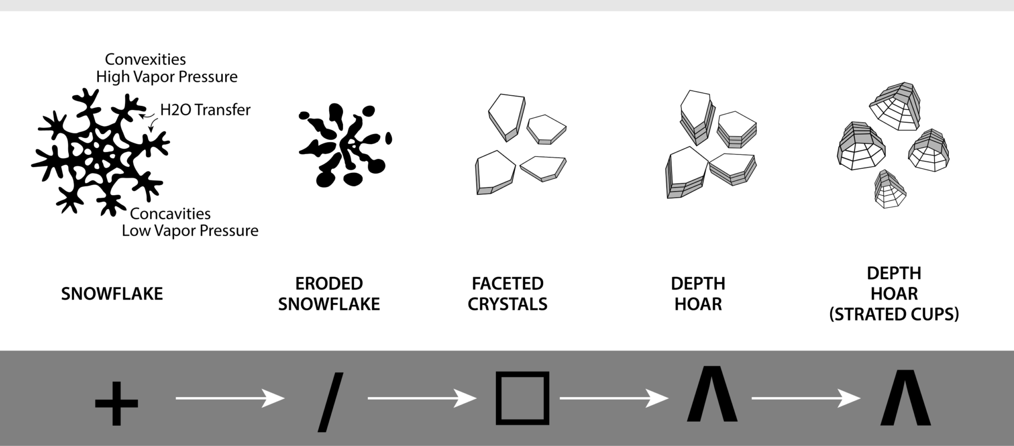
A visual representation of what is currently happening to the snowpack.


