Greg Gagne
Forecaster
Our Week in Review highlights significant snowfall, weather, and avalanche events of the previous week. (Click here to review the archived forecasts for the Salt Lake mountains.)
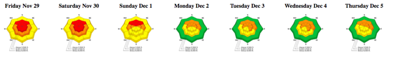
The danger roses for the Salt Lake mountains from Friday, November 29 through Thursday, December 5, 2019:
Summary: A storm system moved into the state over the Thanksgiving holiday period, bringing several rounds of heavy snow through Saturday, with an avalanche warning through Sunday.
By Sunday morning, storm totals include:
- Cottonwood Canyons 50-70" snow (3.5-4.3" water)
- Park City Rigeline 30-40" snow (2.5-3.0" water)
- Ogden Mountains 40-50" snow (4.0-4.8" water)
- Provo Mountains 24-33" snow (1.6-2.1" water)
There was also widespread natural and human-triggered avalanche activity, with several large avalanches triggered remotely. A heat map showing the distribution of avalanches by aspect and elevation in the Salt Lake mountains:
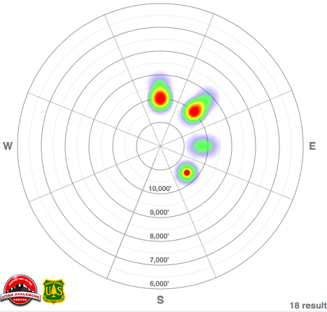
Avalanche activity was focused on mid and upper elevation slopes facing north and northeast. This edition of the Week in the Review only mentions a few of the significant slides that were reported, to look at all avalanche activity reported from the backcountry in the Salt Lake mountains, visit this page.
In the video below, Trent Meisenheimer explains why mid and upper elevation shady slopes hold dangerous, weak, faceted snow down near the ground:
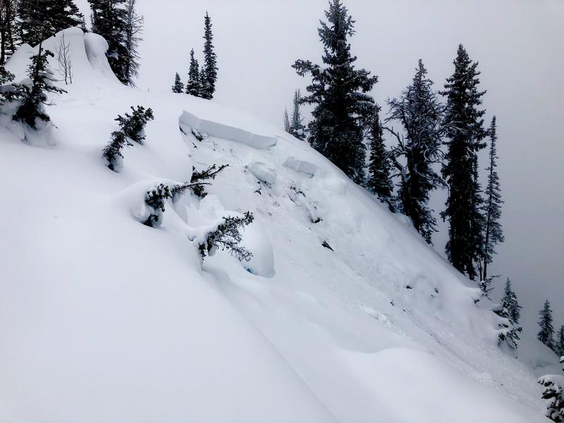
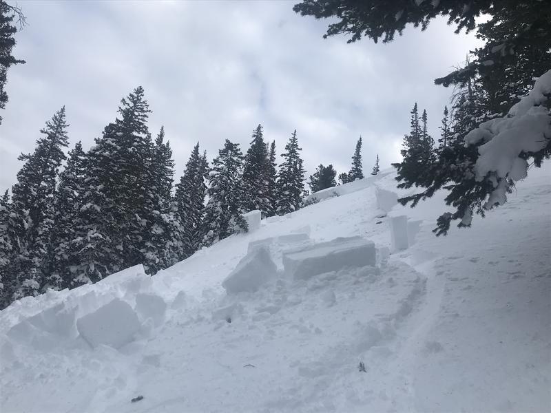
Friday, Nov 29 - Heavy snowfall, with a natural avalanche cycle overnight Thursday into Friday, including several avalanches along the ridgeline separating Big and Little Cottonwood Canyons. (Observation) These slides were failing on faceted snow down near the ground, creating slides 2-4' deep and running several hundred feet wide.

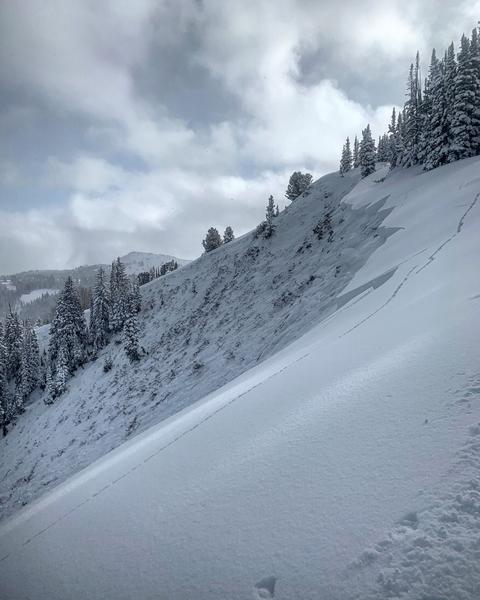
Saturday, Nov 30 - UAC Pro observer Mark White remotely triggers a large avalanche in No-Name Bowl along the Park City ridgeline (observation) failing on facets near the ground.
Sunday, Dec 1 - No human-triggered avalanches are reported. A period of southwest winds with a gradual warming of temperatures.
Monday, Dec 2 - Continued warm temperatures. A human-triggered avalanche in the Hidden Canyon area of the Brighton backcountry is reported (observation).
Tuesday, Dec 3 - Backcountry travelers report continued collapsing and full-propagation of extended column tests. Another slide reported, a natural avalanche in Jaws in Days Fork. This slide broke down to faceted snow at the ground, and possibly could have been a repeater avalanche. (Observation)

Wednesday, Dec 4 - No human-triggered avalanches are reported, with continued warming and an increase in winds from the south overnight into Thursday.
Thursday, Dec 5 - 3-5" storm snow with a period of south winds. Storm snow is unreactive, with a few observers noting cracking in pockets of fresh wind slabs. A remotely-triggered slide is reported in Patsy Marley area area (observation). Other observers note collapsing and full propagation with snow stability tests.