
Progression of danger roses for the Salt Lake mountains for 3/30 - 4/5. (Click on the day of the week for the archived forecast for that day.)
Friday Saturday Sunday Monday Tuesday Wednesday Thursday


 Low Moderate Moderate Low Low Low Low
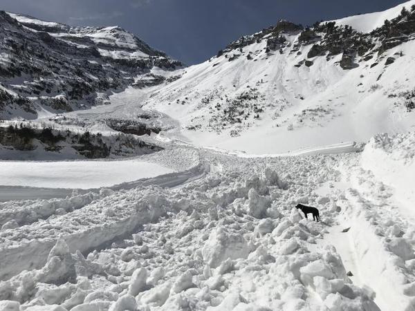
 Summary - A period of general stability in the central Wasatch. For those interested in alpine pursuits on Mount Timpanogos in the Provo mountains, an excellent summary of a recent avalanche cycle can be found here. The photo below highlights some of this activity:
Friday/Saturday/SundayMarch 30/31 - April 1 - Generally sunny skies, but some clouds, cool temperatures, and light winds keep expected loose, wet avalanche activity to a minimum.
Monday April 2 - A few inches of snow and a period of strong winds create small pockets of fresh wind drifts at the upper elevations.
Tuesday/Wednesday/Thursday April 3-5 - Stability reigns ahead of a period of warming temperatures with increasing clouds and increasing chances of precipitation. A trace to 2" of damp new snow at the upper elevations.


