Sign Up for the Utah Snow and Avalanche Workshop (USAW) on December 7th!

Forecast for the Salt Lake Area Mountains

Greg Gagne
Issued by Greg Gagne on
Friday morning, November 22, 2024
Watch for a rising avalanche danger this weekend with strong winds and heavy snow possible overnight Saturday into Sunday.

Updates will follow as conditions warrant. This update is from 6 pm on Friday, November 22, 2024.
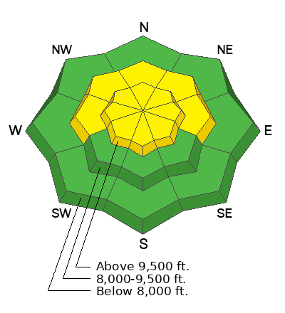
Low
Moderate
Considerable
High
Extreme
Learn how to read the forecast here
Special Announcements
Weather and Snow
There is 1 - 2.5' of snow on northerly slopes in the upper Cottonwoods, with depths over 3' on isolated, wind-loaded slopes at the upper elevations. There is 1 - 1.5' of snow on northerly slopes along the Park City Ridgeline.
Saturday - Winds will be from the south/southwest gusting near 30 mph at the mid elevations and over 60 mph at the uppermost elevations ahead of a storm on later Saturday evening. Snowfall could be heavy overnight Saturday into Sunday morning, with snow totals exceeding a foot in the upper Cottonwoods by mid-day Sunday.
Sunday - Slowly clearing skies with snow showers ending during the morning. A brief break with more snow possible on Tuesday.

Photo from Twin Lakes Pass (McKinley Talty photo]
Recent Avalanches
While no avalanches have been reported this past week, we have received several excellent observations.
On Friday, I traveled along the Park City Ridgeline where I found 1 - 1.5' of snow on aspects facing northwest/north/northeast. UAC Education Manager McKinley Talty traveled in upper Little Cottonwood Canyon and focused on aspects facing west and east where he also found some weak faceted snow. Many observers and UAC staff have been finding weak snow on aspects facing west through north and east. With wind and snow in the forecast for this weekend, we may see avalanches breaking down into these weaker layers on aspects facing west/north/east.
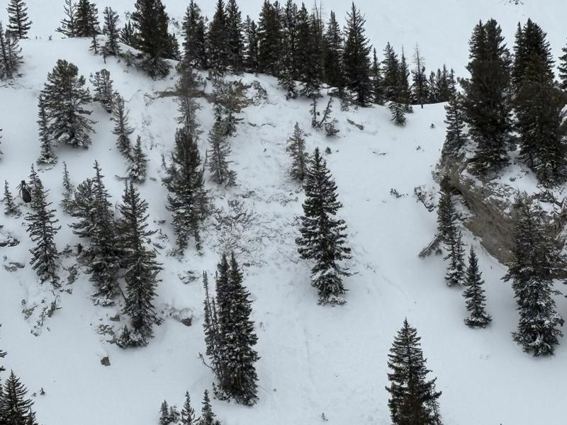
The photo below shows the current snowpack structure with weak snow down near the ground.

Check out all recent observations and avalanches HERE.
Ad
Avalanche Problem #1
Normal Caution
Type
Location
Likelihood
Size
Description
Continued incremental loading (wind, snow, and water) has started to sneak up on us and the places that are holding the most snow (upper elevation northerly facing aspects) are the places that are most suspect right now. Dig down on any slope you intend to travel on to see if there is a slab of new or wind loaded snow with soft weak snow underneath before committing to ascend or descend a slope over 30° degrees. I still think the biggest concern is the summer surface and I am still sticking to lower angle ridges and slopes where I can't get enough speed to hit a rock or stump just under the surface. Some avalanche problems you may want to keep on your radar:
  • New Snow - The new snow may not bond well to the different crusts and weak faceted snow in our shallow snowpack. There will be a potential for sluffing and even shallow soft slabs of storm snow, especially during any period of higher precipitation
  • Wind-Drifted Snow - Blowing winds will cause snow to drift at the upper elevations. Watch for signs such as cracking in fresh wind slabs. Although these drifts should be small, you will want to avoid getting caught in one in steep, consequential terrain
Additional Information
Before traveling within one of the ski resort boundaries, check out Resort Uphill Policies.