Forecast for the Salt Lake Area Mountains

Issued by Nikki Champion on
Tuesday morning, December 9, 2025
Tuesday morning, December 9, 2025
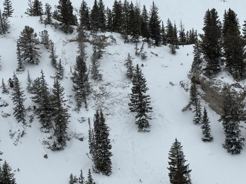
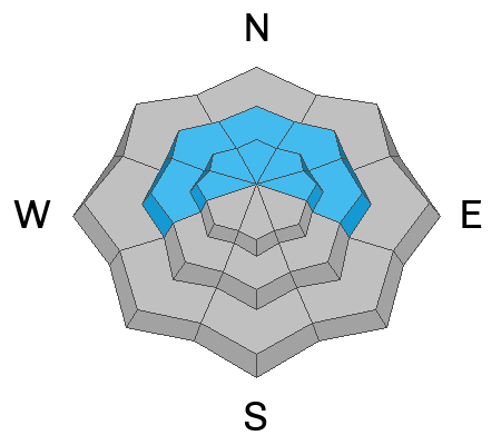
Today, mid and upper-elevation steep slopes facing west through north and east have a MODERATE avalanche danger. Here, it will be possible to trigger an avalanche on the weak October and November facets, now buried 1 to 2 feet deep.
Across all upper elevations, there is also a MODERATE avalanche danger due to wind-drifted snow. Slopes that have recently been wind-loaded are the most suspect today, and extra caution is advised, as these drifts could step down deeper in the snowpack and trigger larger avalanches.
Most accidents happen after peak instability. Avalanche terrain can be avoided, and fun riding is still possible on lower-angled slopes.

Low
Moderate
Considerable
High
Extreme
Learn how to read the forecast here