
Week in Review
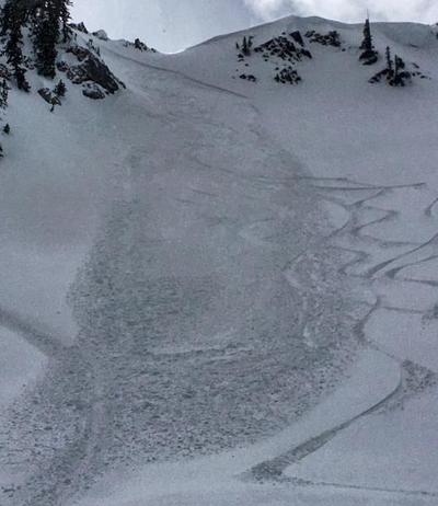
4-6” of snowfall fell in the Cottonwoods and Park City mountains from Thursday Feb 2 through Saturday Feb 4, with some favored locations along the Park City ridgeline receiving upwards of 8”. Persistent winds also resulted in isolated human-triggered wind slabs releasing in upper elevations over the weekend. [Mark White photo]
Monday marked the beginning of a period of warm and very windy conditions with heavy, wet snowfall and a rain/snow line reaching 8000'. Snow and water totals by Wednesday included:
- Salt Lake area mountains 6-8" snow with 1" water. As is often the case with this winter's storm track, Brighton fared the best with 17" of snow and 1.75" water.
- Park City mountains 9-11" snow with 1" water.
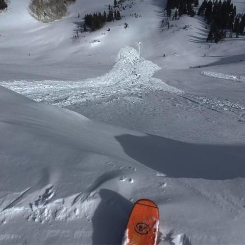
- Provo mountains 15" snow with 4.7" water. Much of the precipitation fell as rain at the lower and mid elevations. A significant natural cycle occurred at the upper elevations in the Provo mountains, as well as wet avalanches that went to the ground from both natural avalanches as well as through control-work.
- Ogden mountains 10-17" snow with 3" water. The Ogden mountains had especially strong winds, gusting to over 80 mph, including Mt Ogden clocking in at 94 mph. Road closures included North Ogden Divide as well as SR158 leading to Powder Mountain.
Temperatures warmed significantly beginning on Wednesday, with overnight lows only dropping to the mid 30's F. A few natural avalanches were reported on Wednesday from cornice falls.

On Thursday, the base of Alta reached 50 F, with many mid and upper elevations rising into the mid 40's F with increasing winds.


