Here is the narrative of the person that triggered the avalanche:
I was trying to get out of this area quickly. There were a few tracks along the ridge before our party reached it and two ahead of me did not have any issues. I went about 40 yards past where my buddy dropped. The aspect changed slightly north at this point and was a bit more exposed and wind blown. The snow pack was about 2 feet deep on the slope and it was a bit more open at the top than areas surrounding it. Forecaster's note - see small arrow in middle of second picture for location. The slope started to break apart around me on my first turn it. It was a soft sugary slab that I though would just sluff off. Fortunately I let my momentum carry me skiers right to get on more stable ground and let it sluff off. I was scraping rocks by the time I got good footing and could grab a tree. The slab actually gained strengh and widened quickly. It sheared at the snow/ground interface and moved into the trees. The trees did not provide an anchor and it continued to widen and gain strength. It finally ran out after 400 or so vertical feet. Getting caught would not have been good.
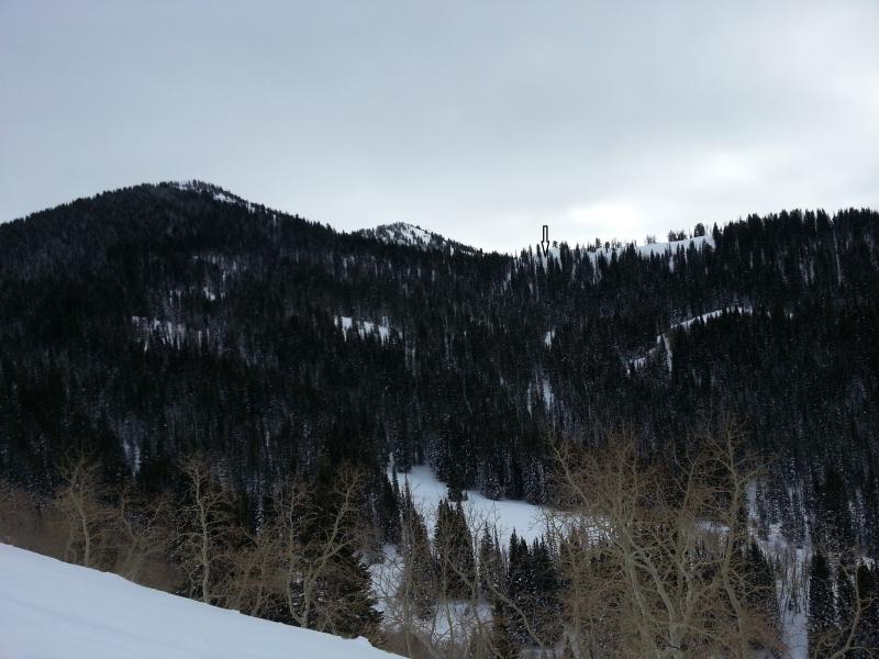
Location of the slide taken from near the Guradsman's Pass road looking south. The terrain is very subtle because from the ridge it slowly gets steeper and steeper until you get into 44 degree, rocky slope with lots thick trees that the avalanche will strain through on the way down. This is the same slope that caused a fatality in 1994.
Profile at crown varies from as little as 12" to 24". Snow profile is for area of 24" crown in which videos were made on west side of slide.

Slope angle on the steepest part of the bed surface is > 40 degrees, we were not able to surmise where the initial point of propagation started. This would have been a nasty ride and the skier who triggered it is very fortunate to have escaped. The bed surface contained large areas of exposed rock and fed into a treed area.
It's possible that this is a repeater based on the thin snow cover and the looks of the profile. But in poking around on many similar slopes on the forest edge the snowpack structure looks similar. So we're not sure...
Photos:
Looking down along east flank.
West flank, mid-pack crust is visible.
West portion of crown.
East portion of crown, note thin snow pack.
The last two photos show that it is very high consequence avalanche terrain because there are so many trees and rocks.


Snow on both flanks of this slide is very weak, easy to push a pole basket to the ground.
Some notes on shear testing on the crown. the shallow east flank failed in basel facets ranging from ECTP 3 to ECTP 6. The deeper west flank failed at scores up to ECTP21 and propagation Saw test after cutting only 6" or so of the block. These are great tests to calibrate results for day to day testing (e.g. if it propagates, it can slide....).
Very educational and humbling visit to this area today.


