
Observer Name
Canyons Snow Safety
Observation Date
Wednesday, January 7, 2015
Avalanche Date
Tuesday, January 6, 2015
Region
Salt Lake » Park City Ridgeline » Murdock Peak
Location Name or Route
Murdock Peak
Elevation
9,400'
Aspect
Northeast
Slope Angle
39°
Trigger
Skier
Trigger: additional info
Remotely Triggered
Avalanche Type
Hard Slab
Avalanche Problem
Persistent Weak Layer
Weak Layer
Facets
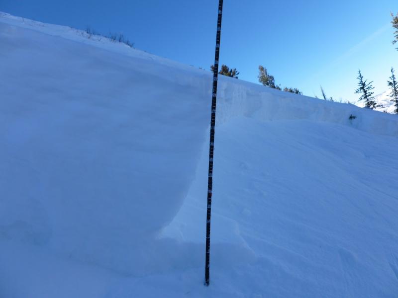
Depth
2'
Width
300'
Vertical
600'

Comments
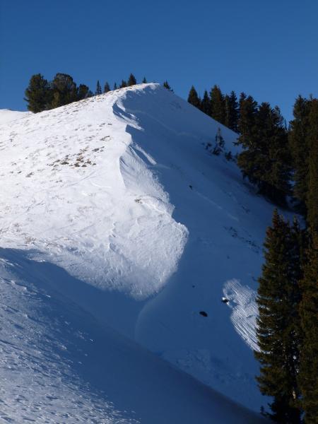
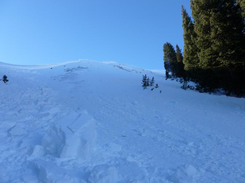
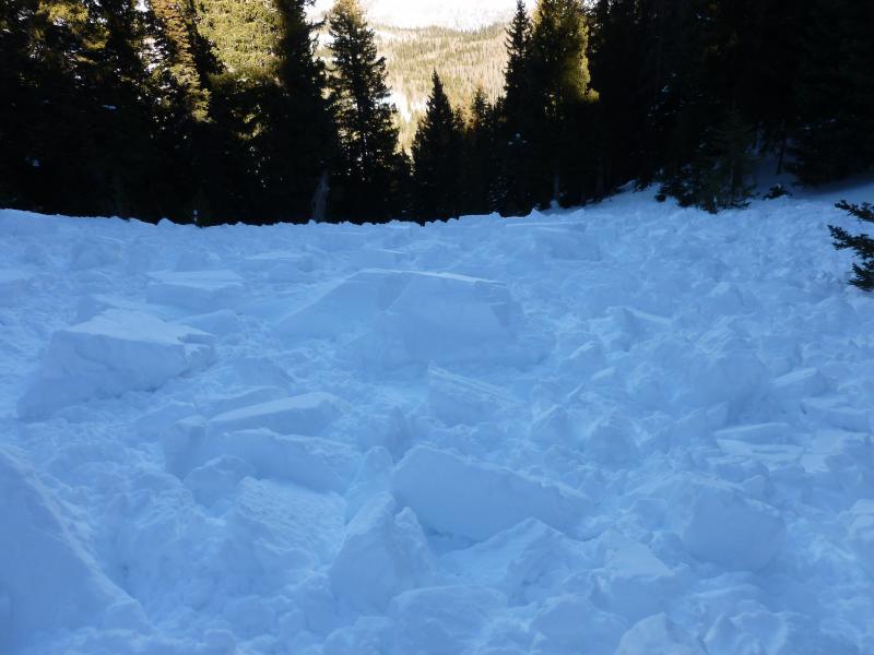
Went to investigate slide reported to UAC on Murdock Peak yesterday afternoon. Sounded like a small wind slab but turned out to be a much more significant avalanche failing on mid-pack facets that formed in mid-December. Significant in that most have thought we have turned the corner on this problem till the next loading event. Strong northwest winds on January 3rd and 4th may have contributed to additional stress on this weak layer but this was not a wind slab avalanche. The avalanche was 300ft wide (initially reported as 150ft) and an average of 2ft deep with some areas up to 3.5ft deep. Tried to include crown profile from Avanet but wasn't able to attach. Didn't really need to perform any stability tests but did anyway...ECTP7 SP (textbook sudden planar) on bottom of 2"-3" facet layer. Also PST End 40/125, the block rocketed down the slope. Weak depth hoar still at ground but no results in tests and the avalanche did not step down to ground in any areas.
Comments by the party that triggered the slide:
I was standing on the summit of Murdock Peak today around noon and as the second skier approached the summit (elevation 9,600 ft) we heard a collapse that resulted in a shooting crack that propagated eastward resulting in the sympathetic release of of a wind-slab pocket , skier's right of Todd's Bowl (towards Dirt Chute). Although we didn't visibly see the avalanche crown because the ridgeline obscured our sight and we were in a hurry due to a south exit and increasing temperatures, we did see the the debris run down the slope through the spruce/fir. By the amount of debris we could tell it was not a large avalanche. I know some of the people that read this are going to say WTF?, you're reporting an avalanche and you don't know the size? The bottom line is two skiers standing on the Murdock ridge (estimated weight 320 lbs) caused an audible collapse that resulted in a shooting crack on the surface that ran 100 ft east and triggered a sympathetic pocket hardslab avalanche, immediately below the ridgeline, about 25 feet vertical feet below and 100 feet right of us. To quote Fesler I would say that's bull's eye. We avoided the open bowl and skied the north ridge so we weren't in any danger.
Coordinates


