Went up to Ben Lomond along the Cutler Ridge after looking at Snotel snow/water numbers of 30"/4" and 32"/7" for the BL 'trailhead' - 5800' and 'peak' - 8000'. Easily found a settled 2' at the trailhead and 3' at 8000'. Trailbreaking not difficult due to the medium density snow and the wind effect.
Found many many - innumerable natural avalanches both in upper Cold Canyon and Cobble Creek (to the south of BL) - with some running over 1000' (est.) and visible from the north fork park. Most avalanches from the 12/29 cycle ran 2-3' deep and 150' wide running within the storm snow, at the old snow surface, or within the previous storm snow from last week. "Persistent weak layers' were searched for but never found though 'needles', interestingly enough, were often at the interfaces we looked at.
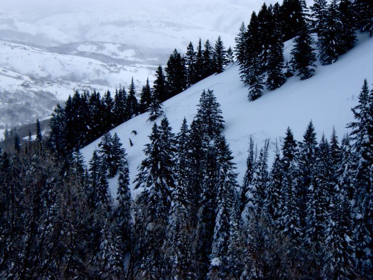
The pattern for the great majority was evident - north, northeast or east - and a function of heavy snowfall or heavy snowfall and strong wind-loading. Elevations ranged from 6500' to near the summit. Of note, the photo below shows some debris coming up to near the standard uptrack/summertrail there at roughly 6300'. The second photo shows the avalanches that threaten the trail.
For today, we saw no new avalanches, cracking, collapsing or any other signs of immediate instability. Avalanche failure planes were often difficult to replicate with tests nearby. Seemed like the overall danger was at the higher end of Moderate.
The terrain above the standard route down low. Northeast facing slope - mid-slope fractures - and 1-2' deep perhaps 150' wide. Mid-slope fractures like these seemed like potential surface hoar habitat (esp. at this elevation, but I failed to find any SH or very weak faceted snow as a culprit.)
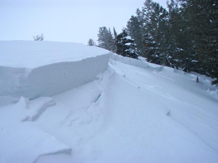
Slides like these were commonplace along the route along the Cutler ridge. 2-3' deep and 150' across. Hard slab, heavily wind-loaded. Upon inspection, one could tell that there were multiple failure planes within the storm snow and from the windloading. The cracks on the bed surface demonstrated that the avalanche and load had collapsed the 5" thick old rain crust and wanted to run near the ground. Unfortunately, too much tensile and compressive strength of the 'slab' kept it in place.