Forecast for the Salt Lake Area Mountains

Issued by Brooke Maushund on
Monday morning, December 22, 2025
Monday morning, December 22, 2025
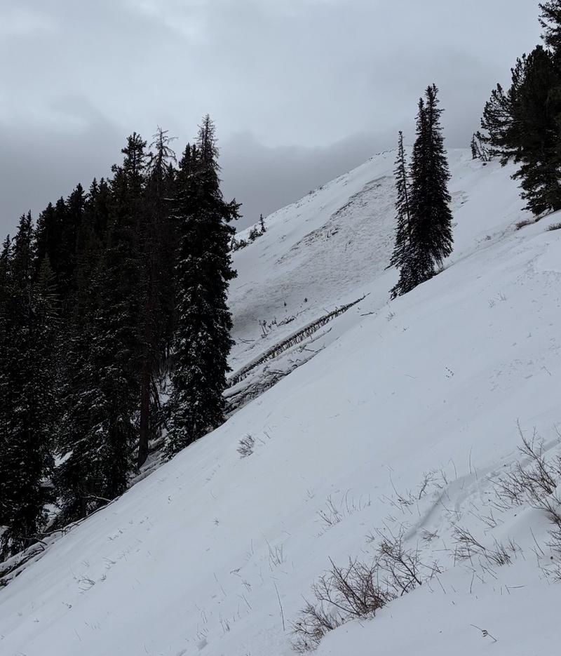
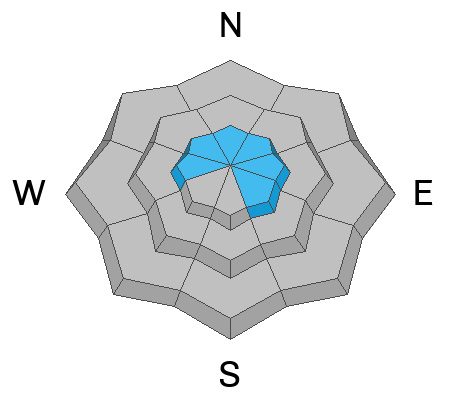
A MODERATE avalanche danger exists on higher W-N-E facing slopes, where you can trigger a shallow slab of wind-drifted snow, or a larger avalanche 1-2 feet deep on a persistent weak layer. These are most likely in upper elevation areas where the wind has drifted snow into denser slabs. You are unlikely to receive any warning signs—like cracking or collapsing—before triggering a slide.
If cloud cover and temperatures pan out as forecast, be aware of how wet the snow surface is becoming under your feet, as there is a potential for wet, loose avalanches.

Low
Moderate
Considerable
High
Extreme
Learn how to read the forecast here