Forecast for the Salt Lake Area Mountains

Issued by Trent Meisenheimer on
Sunday morning, December 7, 2025
Sunday morning, December 7, 2025
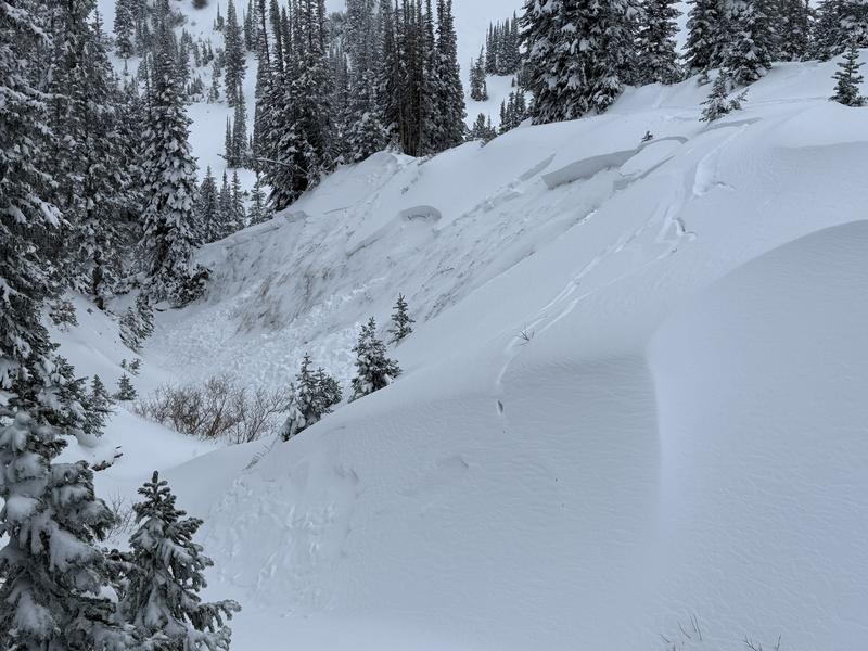
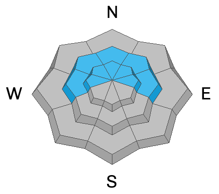
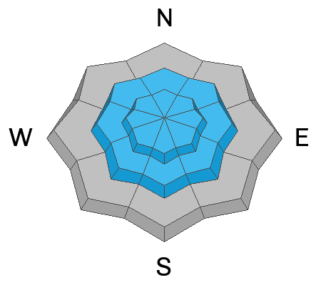
On mid and upper elevation steep slopes facing west through north and east, you will find CONSIDERABLE avalanche danger for triggering a Persistent Weak Layer avalanche. Avalanches in this terrain can be triggered remotely from a distance. Across all upper elevations, you will also find CONSIDERABLE danger for wind-drifted snow. Everywhere else will have MODERATE danger for new-snow avalanches.
Careful snowpack evaluation, cautious route-finding, and conservative decision-making will be essential today. Do not let your guard down with the sunny skies and fresh powder. It is still dangerous, and any avalanche you trigger could have severe consequences with how shallow the snowpack is.

Low
Moderate
Considerable
High
Extreme
Learn how to read the forecast here