Be mindful of avalanche workers - IF YOU TRIGGER an avalanche near a ski area, please report it to the ski patrol dispatch or Alta Central (801-742-2033). Rescue personnel don’t want to be subjected to dangerous conditions if the scene is clear. More on this in Backcountry Emergency Protocols
As of 5 am, 24-hour snow/water totals (in inches) include:
-> Little Cottonwood: 15"/2.5"
-> Big Cottonwood: 14"/2.8"
-> Park City Ridgeline: 8"/1.5"
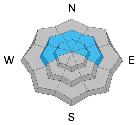
Winds are from the west/southwest and sustained, averaging in the teens and 20's mph (perfect wind speeds for creating fresh wind drifts) with overnight gusts in the 30's mph along exposed mid and upper-elevation ridgelines. 11,000 foot gusts are in the 50's mph. Temperatures range through the 20's °F.
For today, expect periods of heavy snowfall this morning and moderate to strong winds, with another 4-8 inches of snow expected. Snowfall rates will be the highest this morning, before tapering to snow showers this afternoon. Temperatures will rise into the upper 20's °F.
After a short break, another storm is expected later Wednesday. This will be a more traditional storm featuring colder temperatures and lower-density snowfall.
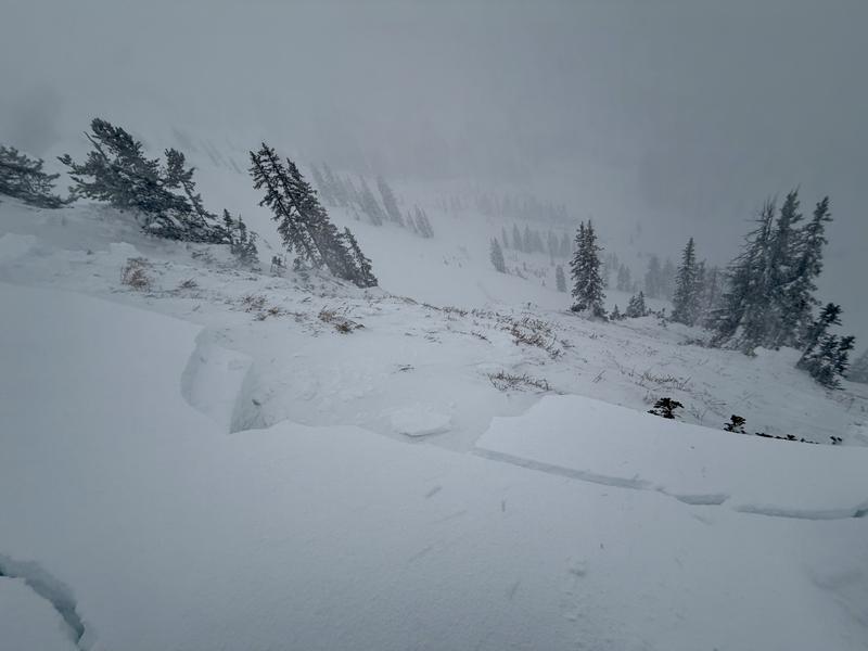
On Sunday afternoon, a party on the ridgeline above Two Dogs in Days Fork unintentionally released a cornice onto the slope below which triggered an avalanche that initially failed above the Christmas rain crust (CERC) layer, but stepped down to facets and depth hoar at the ground. The slide was on a northeast-facing slope at 10,100 feet and was 4.5 feet deep, 250 feet wide, and ran 700 feet, snapping trees along the way.
Based upon an investigation by Brighton Ski Patrol, it appears that two riders were caught and carried in a large avalanche on Saturday in the Hidden Canyon area of the Brighton backcountry. Most likely, the party exited the ski area boundary and entered the dangerous terrain, triggering the 2-4 feet deep and 200 feet wide avalanche, and were carried for 500 feet down the slope. It appears that one was partially buried and the other fully buried. They were very lucky. This was the third significant avalanche in the Brighton backcountry of Hidden Canyon in the past week.
Utah leads the nation in fatalities of skiers and riders who have left ski area boundaries and never made it home. UAC Forecaster Drew Hardesty broke down Utah accident data in an article for The Avalanche Review in 2016 if you want to dig in. Note that these numbers were before the backcountry traffic uptick during COVID.
Read all backcountry observations here.