UDOT PLANNED AVALANCHE CLOSURES!!

Forecast for the Moab Area Mountains

Eric Trenbeath
Issued by Eric Trenbeath for
Thursday, December 1, 2016

The avalanche danger is MODERATE on steep upper elevation slopes that have areas of wind drifted snow. There is also a MODERATE danger for triggering a deeper, persistent slab in upper-mid to upper elevation, north facing terrain.

Elsewhere the avalanche danger is generally LOW.

Low
Moderate
Considerable
High
Extreme
Learn how to read the forecast here
Weather and Snow

It's officially game on. Though the snow pack is still shallow, the base is supportable with up to a foot of light fluffy, powder sitting on top. Wind affected snow exists above tree line, and some southerly aspects may have developed a thin sun crust from the strong sun yesterday, but in sheltered areas conditions are nothing less than sublime. Just don't let your excitement get the best of you as there are still plenty of buried land mines out there such as rocks and dead fall. But by choosing more open, grassy slopes and meadows, it's possible to ride and have a good time doing it. I've even heard reports of people skiing in the North Woods, but I'd advise extra caution in wooded areas, especially as you get lower in elevation.

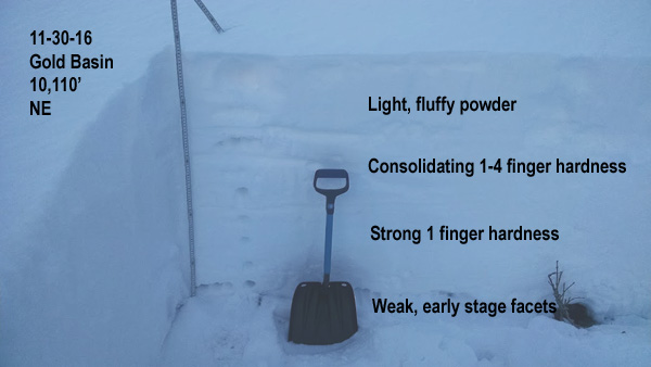
Northwesterly ridge top winds have been mostly light overnight and are currently blowing in the 5-10 mph range. It's a chilly 7 degrees on Pre-Laurel Peak and 13 degrees at the Geyser Pass Trailhead. Base depth in Gold Basin is 32" and 22" at the Geyser Pass Trailhead.

Storm totals in Gold Basin.(10,000')

Wind, temperature and humidity on Pre Laurel Peak.(11,700')

Snow totals, temperature and snow/water equivalent at the Geyser Pass Trailhead.(9600')

I ran into Evan Clapper out and about yesterday and he provided us with these lovely photos.

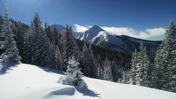
From nothing on the ground two weeks ago to this. Not bad for December 1.


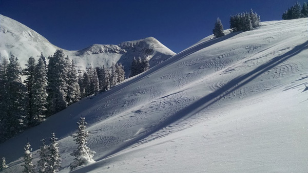
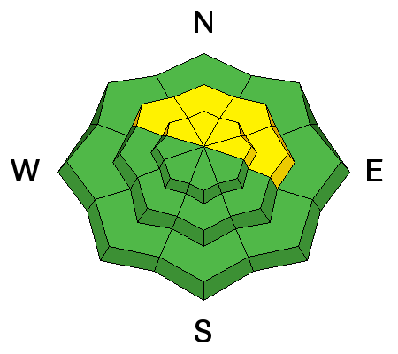
Snow is wind affected above tree line.


But drop down below, and it's powder!

Recent Avalanches

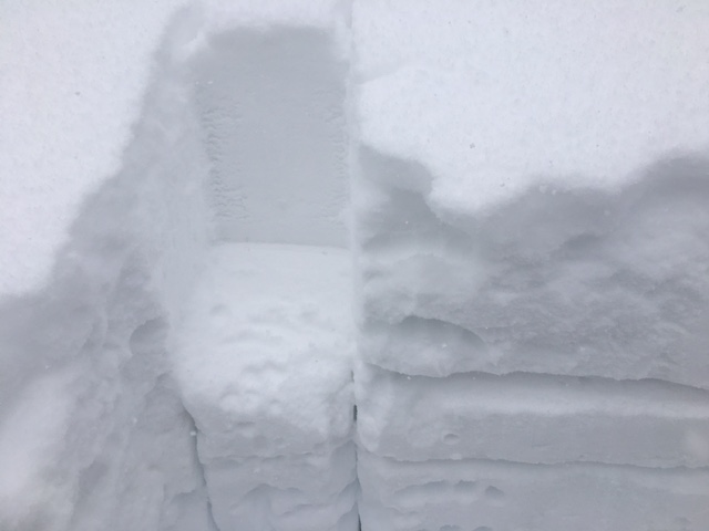
I got a good look around yesterday and didn't see any recent avalanche activity beyond some loose snow sluffs that ran during the storm.

Ad
Avalanche Problem #1
Wind Drifted Snow
Type
Location
Likelihood
Size
Description

Winds slabs formed earlier in the week are stabilizing and will be stubborn to trigger. But the high country is plastered with drifts and pillows on the lee sides of ridge crests and terrain features. Many of them are located further down slope requiring commitment beyond the point of no return to investigate. For a long and healthy season, my money is on continuing to avoid steep, wind drifted, upper elevation terrain for awhile longer.

Avalanche Problem #2
Persistent Weak Layer
Type
Location
Likelihood
Size
Description

So far we are setting up what Western Uintah forecaster Craig Gordon is calling a "designer snow pack." With virtually no snow on the ground prior to the first 9" storm on 11-16, we've had a succession of storms pile up in short order that have given us an instant snow pack 24"-36" deep. There are some early stage, basal facets developing, and I've been able to tease out a layer of buried near surface facets. Stability tests are producing sheers but without propagation. These things aren't huge red flags for me, but their presence prevents me from giving it the green light, and I'd continue to let things adjust and stabilize before I went big on any steep, north faces.

Sheers like this continue to show up but they aren't propagating.

Additional Information

Today

A slight chance of snow before 3pm, then a slight chance of snow after 4pm. Mostly cloudy, with a high near 18. North wind around 5 mph becoming west in the morning. Chance of precipitation is 20%.

Tonight

A 30 percent chance of snow, mainly after 4am. Mostly cloudy, with a low around 12. North wind around 5 mph becoming east after midnight.

Friday

A 30 percent chance of snow. Cloudy, with a high near 18. North northeast wind 5 to 10 mph.

Friday Night

A 20 percent chance of snow before 11pm. Mostly cloudy, then gradually becoming mostly clear, with a low around 11. North northeast wind around 5 mph.

Saturday

Sunny, with a high near 22. North wind 5 to 10 mph.

Saturday Night

Mostly clear, with a low around 14.

Sunday

Sunny, with a high near 27.