25th Annual Black Diamond Fall Fundraising Party
Thursday, September 13; 6:00-10:00 PM; Black Diamond Parking Lot
25th Annual Black Diamond Fall Fundraising Party
Thursday, September 13; 6:00-10:00 PM; Black Diamond Parking Lot
| Advisory: Uintas Area Mountains | Issued by Craig Gordon for Sunday - January 29, 2017 - 4:33am |
|---|


|
bottom line Today, a MODERATE avalanche danger exists on steep, shady slopes at all elevations and human triggered avalanches are POSSIBLE. Remember- any avalanche that breaks to weaker snow, now buried deep in the snowpack will get out of hand quickly, resulting in a dangerous slide. Most low and mid elevation south facing terrain offers LOW avalanche danger.
|
 |
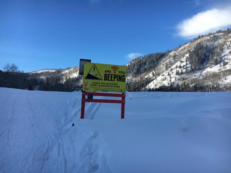
special announcement Do you buy groceries at Smiths? When you register your Smith’s rewards card with their Community Rewards program, they will donate to the Utah Avalanche Center whenever you make a purchase. It's easy, only takes a minute, and doesn't cost you anything. Details here.
Also... if you're at the Nobletts Trailhead, make sure to swing by the beacon checker at the south end of the parking lot and take a minute to practice your rescue skills at Beacon Basin on the northeast side. These are the types of projects your generous donations help fund and maintain. And finally...we still have a few spots open for our February 9th and 11th sled specific avy and riding skills work shop. Details are found here. |
 |
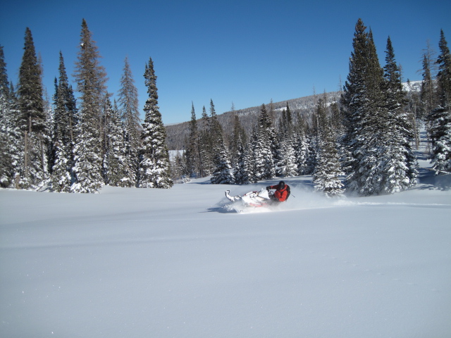
current conditions Skies are clear and temperatures in the teens and low 20's... slightly warmer than the Salt Lake Valley. Unfortunately, northeast winds continued blowing steadily along the high ridges Saturday and increased slightly late last night. Needless to say, our big open bowls and upper elevation terrain has taken a hard hit. However, it doesn't take much effort to find wind sheltered terrain where you'll be rewarded with cold, creamy pow.
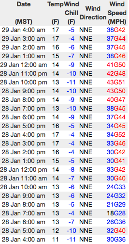
24 hour run of Lofty Lake Peak wind data above. Real time wind, snow, and temperatures for the Uinta's are found here
Ted was in the Whitney basin and found stable snow and amazing riding conditions. His trip report is found here. Snowpack observations and trip reports are found here. |
 |
recent activity No new avalanche activity to report from Saturday. A full list of Uinta avalanche activity is found here. |
| type | aspect/elevation | characteristics |
|---|

|

|
LIKELIHOOD
 LIKELY
UNLIKELY
SIZE
 LARGE
SMALL
TREND
 INCREASING DANGER
SAME
DECREASING DANGER
|
|
description
For the past 48 hours, northeast winds have been blowing along the high ridges, finding enough loose snow to blow around and forming dense drifts in unusual locations. Found along the leeward side of mid and upper elevation ridges and around terrain features like chutes and gullies, todays slabs are gonna be a bit more stubborn than the past few days. In fact, in many locations they'll feel welded in place. However, once triggered any avalanche can grow into a bigger problem if it breaks into weaker snow now buried several feet deep in the snowpack. Your best strategy is to simply avoid fat looking, rounded pillows of snow, especially if they feel or sound hollow like a drum.
Cross-loaded, upper elevation chutes and gullies like the terrain pictured above, are the kind of places you could trigger a fresh wind drift today. (Boyer photo) |
| type | aspect/elevation | characteristics |
|---|

|
|
LIKELIHOOD
LIKELY
UNLIKELY
SIZE
 LARGE
SMALL
TREND
INCREASING DANGER
SAME
DECREASING DANGER
|
|
description
This is where it gets tricky. Our unmanageable avalanche problem is harder to detect unless we spend a little time and dig into the snow to investigate. What you'll find with minimal effort are weak, sugary, near surface facets and surface hoar. These notoriously tricky and persistent weak layers are now buried a couple feet deep in our snowpack and until recently, have been pretty well-behaved. However, now that the storm snow is starting to consolidate and settle, these dormant layers are coming back to life. Adding to the complexity is that this layering isn't widespread and found mostly in terrain where these fragile crystals didn't get destroyed by the wind prior to last weeks big storm. Suspect terrain includes mid and low elevation creek bottoms and terrain features where cold air pools. It's a deceptive setup for sure, but it doesn't have to be a roll of the dice and the solution for the next couple of days is easy. Either do a little homework, dig around and identify slopes that have a suspect snowpack or simply avoid being on, under, or connected to steep slopes, especially those facing the north half of the compass. Remember- any avalanche that breaks into weak layers buried deep in the snowpack will be dangerous.
I rolled up to this freshly triggered slide Thursday near Wolf Creek Pass just as the dust was settling. It was a nice sized pocket measuring 2 feet deep and 150 feet wide, only running 100 feet vertically due to terrain features. This slide occurred on a wind sheltered North aspect at 9,500 feet and failed on well preserved Surface Hoar. This is the kind of avalanche issue we're dealing with the next couple days. (Gordon photo)
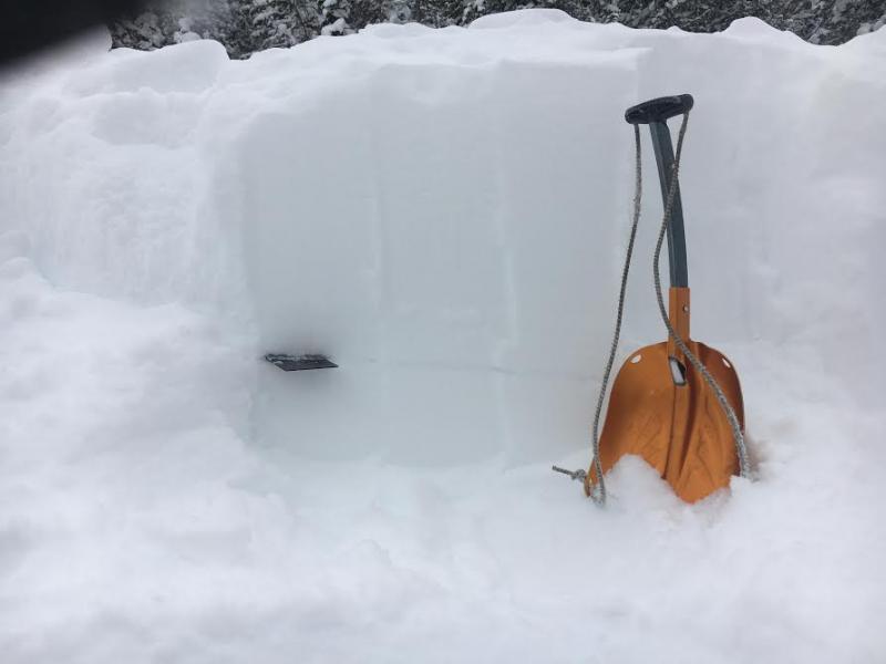
With a little homework you can clearly identify the weak snow. In this pit, clean shears reveal a persistent buried weak layer. |
 |
weather Sunny skies are on tap with temperatures climbing into the upper 20's and low 30's. Northerly winds are gonna be a nuisance along the ridges where they'll be blowing in the mid to upper 30's. Overnight lows dip into the teens. Not much going on in the weather department the next couple of days. It looks like sunny skies and warming temperatures in the mountains with increasing valley gunk. |
| general announcements Remember your information can save lives. If you see anything we should know about, please participate in the creation of our own community avalanche advisory by submitting snow and avalanche conditions. You can call me directly at 801-231-2170, email [email protected] The information in this advisory is from the US Forest Service which is solely responsible for its content. This advisory describes general avalanche conditions and local variations always occur. The information in this advisory expires 24 hours after the date and time posted, but will be updated by 7:00 AM on Monday January 30th. |