25th Annual Black Diamond Fall Fundraising Party
Thursday, September 13; 6:00-10:00 PM; Black Diamond Parking Lot
25th Annual Black Diamond Fall Fundraising Party
Thursday, September 13; 6:00-10:00 PM; Black Diamond Parking Lot
| Advisory: Logan Area Mountains | Issued by Toby Weed for Thursday - January 11, 2018 - 7:04am |
|---|


|
bottom line Dangerous avalanche conditions exist on many slopes in the backcountry, and large triggered avalanches are likely.
|
 |
current conditions We've allowed the Avalanche Warning to expire, but you should continue to stay off and out from under steep hills and avoid travel in avalanche terrain. Dangerous avalanche conditions exist on many slopes in the backcountry, and large very scary human triggered avalanches are likely. The Tony Grove Snotel at 8400' reportes about 6 inches of new snow, and it's much cooler, currently 19°F. There's 49 inches of total snow at the site containing 99% of normal SWE (Snow Water Equivalent). It's 17°F at the UDOT Hwy 89 Summit weather station, with light west wind.
|
 |
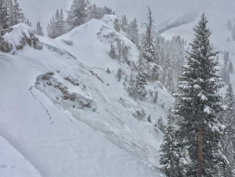
recent activity The backcountry was very active in the Wasatch Range yesterday, with numerous large triggered avalanches reported, some remote triggered from a distance.
One of many on 1/10/18; a remote triggered avalanche on the Silver Fork Headwall in Big Cottonwood Canyon in the Wasatch Mountains above Salt Lake City. |
| type | aspect/elevation | characteristics |
|---|

|

|
LIKELIHOOD
 LIKELY
UNLIKELY
SIZE
 LARGE
SMALL
TREND
 INCREASING DANGER
SAME
DECREASING DANGER
|
|
description
Dangerous persistent slab avalanches are likely today on slopes with poor snow structure, which exist in many areas. Sugary faceted snow is so weak in some areas that the weight of only a few inches of new snow might be enough to cause avalanches.
|
| type | aspect/elevation | characteristics |
|---|

|

|
LIKELIHOOD
LIKELY
UNLIKELY
SIZE
 LARGE
SMALL
TREND
 INCREASING DANGER
SAME
DECREASING DANGER
|
|
description
Dangerous wind slab avalanche conditions exist, and 1 to 3 foot deep human triggered avalanches are likely in exposed upper and mid-elevation terrain today. Drifting snow will continue to build wind slabs today and tonight, and the danger could increase further and become more widespread.
|
 |
weather A moist west to northwest flow aloft will remain over northern Utah through Friday. High pressure aloft strengthening over the western states will bring dry conditions to the area with increasing urban haze and valley fog expected this weekend through early next week.
|
| general announcements Discount lift tickets for Alta, Snowbird, Brighton, Solitude, Deer Valley, Snowbasin, and Beaver Mountain are now available, donated by the resorts to benefit the Utah Avalanche Center. Details and order information here. All proceeds go towards paying for avalanche forecasting and education! We're excited to introduce for the 2017/2018 winter the Utah Avalanche Center podcast, hosted by forecaster Drew Hardesty and produced by KUER's Benjamin Bombard. The podcast will include engaging stories, interviews, and lessons learned - all things avalanche to help keep people on top of the snow instead of buried beneath it - and easily found on ITunes, Stitcher, the UAC blog, or wherever you get your podcasts. Now is a great time to practice companion rescue techniques with your backcountry partners. Here's our rescue practice video. Go HERE for a list of UAC classes. EMAIL ADVISORY: If you would like to get the daily advisory by email you will need to subscribe here. Benefit the Utah Avalanche Center when you shop from Backcountry.com or REI: Click this link for Backcountry.com or this link to REI, shop, and they will donate a percent of your purchase price to the UAC. Both offer free shipping (with some conditions) so this costs you nothing! Benefit the Utah Avalanche Center when you buy or sell on ebay - set the Utah Avalanche Center as a favorite non-profit in your ebay account here and click on ebay gives when you buy or sell. You can choose to have your seller fees donated to the UAC, which doesn't cost you a penny. Remember your information can save lives. If you see anything we should know about, please help us out by submitting snow and avalanche observations. You can also call us at 801-524-5304, email by clicking HERE, or include #utavy in your tweet or Instagram. This advisory is from the U.S.D.A. Forest Service, which is solely responsible for its content. This advisory describes general avalanche conditions and local variations always occur. |