Current Conditions: Clouds moved in mid day on Sunday with continued mild temperatures. Temperatures got up to around 40˚F and only dropped back into the low 30s overnight. Wind stayed in the light to moderate speeds from the west and increased in speed overnight with breezier conditions. Warm temperatures are taking a toll on the riding conditions making the snow damp in many places. You'll find crusts in lower and mid elevations on all aspects. Dense cold powder remains on upper elevation more northerly facing terrain.
Mountain Weather: We'll see a fair amount of clouds today with some sun poking through. Wind should decrease and shift and come a little more from the southwest. Temperatures will most likely make it into the 40s. Tuesday looks cloudy and fairly warm again. As of this morning, the next chance for any significant snow looks to be around March 4.
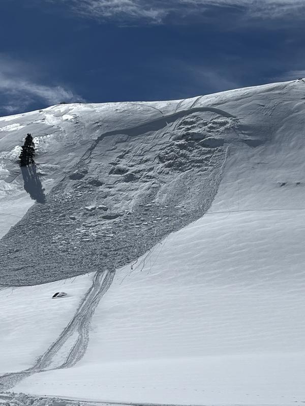
There were two snowmobile triggered avalanches reported on Sunday from the Gooseberry zone. No one was caught. It appears that both broke into weak faceted snow. This is the exact same situation that we have in most areas on the Skyline.
Photo: Scout Cabin Hill, Burkley Johnson
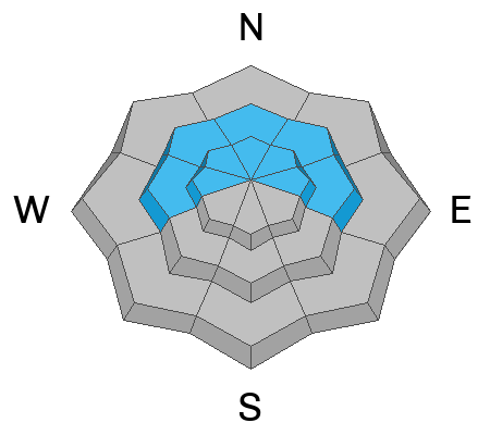
I received a report of a snowmobiler triggered avalanche from Saturday on the Skyline. This one also most definitely broke into faceted weak layers deeper in the snowpack. Exact location is unknown but it looks like somewhere between Ephraim Canyon and 12 Mile.
Photo: Brad Barton