Forecast for the Uintas Area Mountains

Issued by Craig Gordon on
Friday morning, January 31, 2025
Friday morning, January 31, 2025
Heads up-
A wet, warm, windy system is on the doorstep and we expect avy danger to rise in step and around the dial with the storms arrival later today.
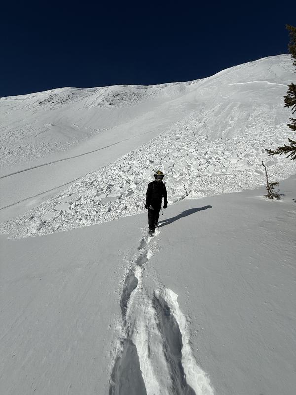
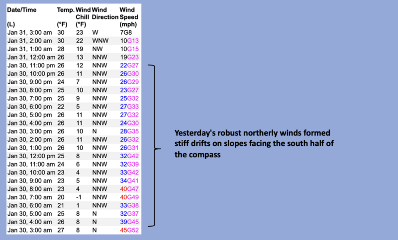
While we wait... northerly winds blasted the ridges for over 24 hours and we kick the day off with MODERATE avalanche danger on upper elevation, leeward, solar aspects. Human triggered wind drifts are POSSIBLE in steep terrain facing the south half of the compass. Switching over to the north half of the compass and becoming more the exception than the rule, once initiated, today's avalanches on polar slopes, could fail deeper into old, sugary facets now buried 1'-3’ beneath the snow surface, delivering a body-bruising slide breaking deeper and wider than we might expect.
All other aspects and elevations offer generally LOW avalanche danger. Riding conditions are a bit of a mixed bag, yet still register in the "this is better than a good day at work" category, especially on low angle slopes in wind sheltered terrain.
Low
Moderate
Considerable
High
Extreme
Learn how to read the forecast here