AVALANCHE WARNING!! Tap for info
UDOT PLANNED AVALANCHE CLOSURES!!

Forecast for the Salt Lake Area Mountains

Nikki Champion
Issued by Nikki Champion on
Monday morning, January 27, 2025
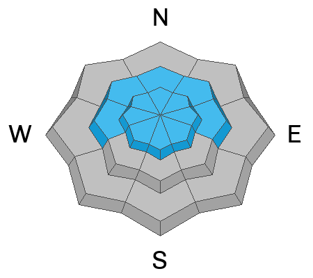
Avalanche danger is MODERATE on all aspects at upper elevations and on mid-elevation slopes facing west, north, and east. Today, it’s possible to trigger older hard slabs or newly formed shallow soft slabs of wind-drifted snow. Typical signs of wind-drifted snow, like textured surfaces, might be hidden under a few inches of recent snow. Give extra caution to ridgelines, sub-ridges, and other features that could act as a catch for the wind.
On northerly and east-facing slopes at the mid and upper elevations, it is possible to trigger an avalanche that fails 2-4 feet deep in a persistent weak layer.
As the sun heats southerly slopes today, watch for shallow wet-loose avalanches.
Low
Moderate
Considerable
High
Extreme
Learn how to read the forecast here
Special Announcements
Urgent battery replacement required for anyone who received batteries from one of our participating "Batteries for Beacons" shops. Please review the "Batteries for Beacons" replacement notice on our blog. Batteries distributed through our "Batteries for Beacons" program this year have shown to be inadequate length.

Join the UAC at Deer Valley on January 30th for the 2nd Annual Blizzard Ball Gala. Bruce Tremper, the Former Director of the Utah Avalanche Center, will deliver the keynote address.
Weather and Snow
Under clear skies, there’s a temperature inversion in the mountains, with trailhead temperatures in the single digits and ridgetops in the mid to upper teens (°F). Southeasterly winds remained calm, with the highest elevation ridgelines gusting below 30 mph.
Today, expect clear and sunny skies, with temperatures rising into the mid-30s (°F). The east-southeasterly winds will stay light, with gusts below 30 mph at the highest ridgelines. An easterly weather pattern will continue through midweek as a low-pressure system slowly tracks east across Arizona. Otherwise, stable conditions and mostly clear skies will stick around across northern Utah.
Despite the high winds earlier this week, the few inches of new snow have really improved riding conditions in a lot of areas.
Recent Avalanches
Yesterday, several avalanches occurred in the Salt Lake area mountains, averaging 1-2' deep. Additionally, loose dry avalanches were reported throughout Saturday, and a few wet-loose avalanches occurred late Sunday afternoon.
  • Little Superior Bowl (Cardiff Fork): Skier-triggered 2-foot-deep hard slab on a northeast-facing slope at 10,100', running 500 feet. Strong southern winds loaded snow onto a poorly bonded layer.
  • Little Water Peak (Mill D North): Skier-triggered 1 to 2-foot-deep hard slab on a north aspect at 9,400'. The slide was 100 feet wide, and the skier escaped uninjured.
  • Birthday Chutes (White Pine): Likely a natural hard slab avalanche on a northwest aspect at 10,600'. Crown depth was approximately 1 foot, and the 125 feet wide.
  • Mongo No (Mineral Fork): Natural soft slab avalanche on a north aspect at 9,900', likely occurring late Saturday or early Sunday, running 800-1,000 feet. Exact dimensions unknown.
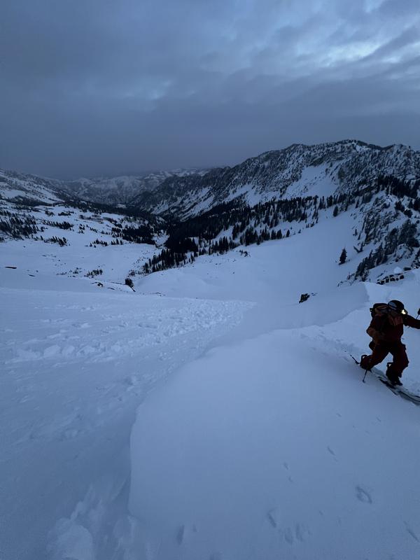
Photo from LSB North - Derek
Directly outside the Central Wasatch, there was a large avalanche that likely failed on facets near the ground:
  • Tibble Fork (Forest Lake Drainage): Skier-triggered 3.5-foot-deep hard slab on an east aspect at 9,400', 150 feet wide, running 200 feet downhill.
Ad
Avalanche Problem #1
Wind Drifted Snow
Type
Location
Likelihood
Size
Description
We’re dealing with two main wind-related avalanche problems right now.
This weekend's southeast winds, averaging 15–20 mph for about 16 hours, created new shallow soft and hard slabs of wind-drifted snow. These slabs may be found in unexpected locations due to the unusual southeast wind direction.
Additionally, strong winds over the past week have formed widespread hard slabs of wind-drifted snow on a faceted snow surface. These slabs remain highly sensitive and are most common on north through east slopes but can be found on all aspects and often extend well beyond ridgelines. Hard slabs are particularly tricky because they can fracture unexpectedly, often allowing you to move far onto or below a slope before they release.

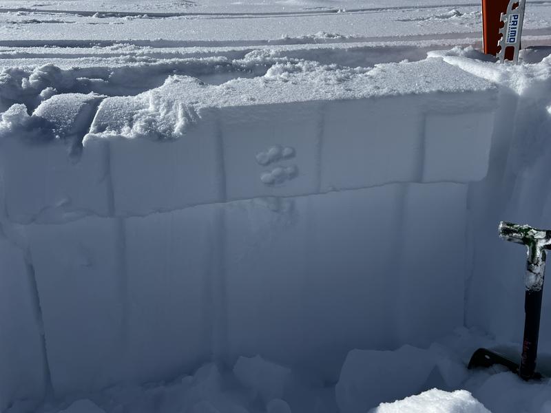
An example from yesterday from 10,420 shows fist hard weak snow sitting beneath a 1-finger hard slab. Pit results showed ECTP12.
Avalanche Problem #2
Persistent Weak Layer
Type
Location
Likelihood
Size
Description
This winter’s challenge is inconsistent snowfall. Buried facets near the ground, present since early December, have caused most avalanche activity since Christmas. As snow accumulates, this early-season persistent weak layer (PWL) is gradually heading toward dormancy. The last known avalanche on this layer was skier-triggered in Upper Big Cottonwood on January 16. However, yesterday’s Tibble Fork avalanche appeared to involve wind-drifted snow on these facets near the ground—a detail we hope to confirm during fieldwork this week.
Cracking, collapsing, and whumpfing have largely subsided, but the weak layer remains tricky.
Most likely areas to trigger a 2'–4'-deep avalanche up to 100' wide:
  • Thin, rocky zones
  • Steep gullies
  • Slopes that have previously avalanched and reloaded with new snowfall or wind-drifted snow
If you’re riding this terrain, plan carefully, assess consequences like trees and terrain traps, and travel one at a time.
Additional Information
Check out this insightful blog by Paige, Jeremy, and Drew where they break down the complexities of Persistent Weak Layer (PWL) avalanches, why thin and rocky areas are especially dangerous, and how to manage the risks effectively in the backcountry.
General Announcements
This information does not apply to developed ski areas or highways where avalanche control is normally done. This forecast is from the U.S.D.A. Forest Service, which is solely responsible for its content. This forecast describes general avalanche conditions and local variations always occur.