Join us at our 2nd Annual Blizzard Ball

Forecast for the Logan Area Mountains

Toby Weed
Issued by Toby Weed on
Thursday morning, January 16, 2025
The snow is stable; the avalanche danger is LOW on most slopes. Exceptions exist on slopes steeper than 30°, with isolated deep slab avalanches unlikely yet still possible. Heightened wet avalanche conditions could develop in sunny terrain.
  • Use normal caution and continue to practice safe travel protocols by only exposing one person at a time to avalanche risk.
Low
Moderate
Considerable
High
Extreme
Learn how to read the forecast here
Weather and Snow
Nice, fast, shallow powder riding conditions can be found on many slopes across the Logan Zone. The surface snow is becoming recrystallized with clear nights and cold temperatures, but the settled powder is especially nice in sheltered northerly terrain and on lower-angled slopes. We found great snow and nice weather in the mountains west of Bear Lake yesterday.
On most slopes, the snow is stable, and avalanches are generally unlikely, but people should know that LOW danger does not mean No danger. We've observed increasing snow stability in the first weeks of 2025, and dangerous avalanches breaking on the sugary, persistent weak layer near the ground are increasingly unlikely. Even so, potential deep hard slab avalanches could be devastating, and we are leery of slopes with poor snow structure facing the north half of the compass. There are other avalanche concerns as well. People could trigger small avalanches of wind-drifted snow at upper elevations near ridgelines and in terrain features, where a thin layer of last week's weak surface snow may still be reactive today. Also, solar warming in the middle of the day could cause a potential for loose wet avalanches on sunny slopes.

-The 8400' Tony Grove Snotel reports 30° F, with 59 inches of total snow, (101% of normal SWE for the date).
-On Logan Peak at 9700 feet, the wind is blowing from the southwest around 15 mph, and it's 31° F.
-It's also 31° F at 8800' at our Card Canyon station, with 43 inches of total snow.
-On Paris Peak at 9500' in Bloomington Canyon, it is 30° F, the winds are blowing from the southwest 11 mph.
NWS point forecast for Naomi Peak area: Today: Sunny, with a high near 31. Wind chill values as low as 9. West southwest wind 5 to 9 mph. Tonight: Mostly clear, with a low around 17. Wind chill values as low as 6. West wind 8 to 10 mph. Friday: Snow likely, mainly after 11am. Mostly cloudy, with a temperature rising to near 22 by 11am, then falling to around 15 during the remainder of the day. Wind chill values as low as zero. West wind 9 to 17 mph. Chance of precipitation is 60%. New snow accumulation of 1 to 2 inches possible.
Snow is likely on Saturday as well, with 1 to 2 inches of accumulation possible. Very cold temperatures are expected in the wake of the (Friday/Saturday) dry cold front, and they will become established during the MLK Day weekend. Nighttime temperatures well below 0° F are expected, with daytime highs in the mountains in the low teens and single digits. Cold, clear, and dry weather is expected in the mountains through most of next week.

For more information, visit the UAC weather page here: Weather - Utah Avalanche Center
For Logan-specific weather, go here: Logan Mountain Weather - Utah Avalanche Center
Recent Avalanches
  • No avalanches were reported recently in the Logan Zone. However, the Salt Lake Zone continues to be pretty active. A list of those avalanches is HERE
  • Read about all avalanches and observations in the Logan Zone HERE.
  • Remember, the information you share about avalanches you see or trigger could save lives.
Ad
Avalanche Problem #1
Normal Caution
Type
Location
Likelihood
Size
Description
  • Dangerous hard slab avalanches failing on a persistent weak layer buried 2 to 4 feet deep are unlikely but remain possible in isolated or outlying terrain with poor snow structure. Weak faceted snow exists near the ground on almost all northerly-facing slopes at upper elevations. While the snow is becoming more stable, the buried, sugary, persistent weak layer near the ground is still a potential problem. Rocky windswept slopes with thin snow cover are the most suspect. Isolated avalanches might be triggered remotely (from a distance) or from below.
  • People might trigger small avalanches of previously wind-drifted snow. Recent drifting created stiff wind slabs in exposed upper-elevation terrain. Shallow slabs of wind-drifted snow sit on top of weak surface snow from last week, and some may still be sensitive today. Avalanches of wind-drifted snow are most likely to occur on the lee side of major ridges, especially on slopes capped by cornices. Wind slabs may be found in and around terrain features like cliff bands, sub-ridges, gullies, and scoops.
  • Loose wet avalanches are possible on sunny slopes in the afternoon. Solar warming will probably moisten the surface snow on sunny slopes, and small, loose wet avalanches may become possible. Rapid warming, roller balls, pinwheels, and surface sluffs indicate potential for wet avalanche activity. If the snow you're in gets damp and sticky, move to shadier terrain.
Additional Information
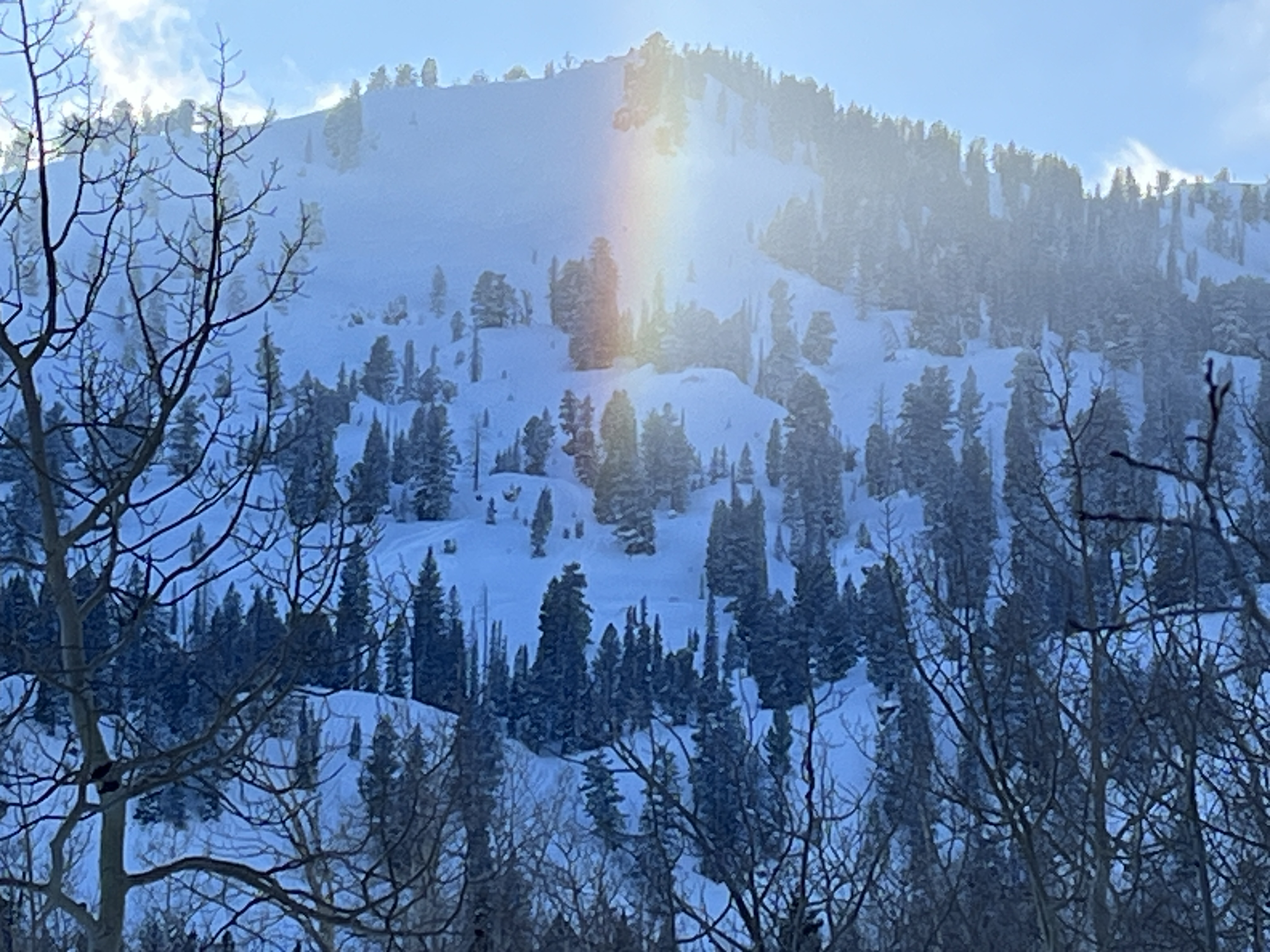
Cold temperatures are apparent as suspended ice crystals create a colorful sun dog above Tony Grove Lake (1-14-25).
General Announcements
-National Forest Winter Recreation Travel Maps show where it's open to ride: UWCNF Logan, Ogden LRD Tony Grove, Franklin Basin CTNF Montpelier
-For all questions on forecasts, education, Know Before You Go, events, online purchases, or fundraising, call 801-365-5522.
-Remember the information you provide could save lives, especially if you see or trigger an avalanche. To report an avalanche or submit an observation from the backcountry, go HERE.
-Receive forecast region-specific text message alerts to receive messages about changing avalanche conditions, watches, and warnings. Sign up and update your preferences HERE.

This forecast is from the U.S.D.A. Forest Service, which is solely responsible for its content. This forecast describes general avalanche conditions, and local variations always occur.