Join us at our 2nd Annual Blizzard Ball

Forecast for the Ogden Area Mountains

Nikki Champion
Issued by Nikki Champion on
Thursday morning, January 9, 2025
Avalanche danger is CONSIDERABLE on upper-elevation slopes facing northwest through east. Large, destructive avalanches could break 1–3+ feet deep on a weak layer, potentially triggered from a distance or below.
Watch for blowing and drifting snow today, as avalanches triggered in wind-drifted snow may step down deeper.

Conditions remain dangerous despite becoming slightly more stubborn over the last few days. Remember: If you're heading out of bounds, you are likely entering potentially dangerous conditions.
Low
Moderate
Considerable
High
Extreme
Learn how to read the forecast here
Special Announcements
Receive forecast region-specific text message alerts to receive messages about changing avalanche conditions, watches, and warnings. Sign up and update your preferences HERE.
Weather and Snow
This morning, there are a few scattered clouds in the sky. Temperatures are in the mid to upper teens. Overnight, strong winds shifted to an east-northeast direction, with gusts up to 65 mph on high ridges. Winds have now dropped a bit to 15–20 mph at mid-elevations, with gusts up to 50 mph on the highest peaks.
Today, Low clouds may linger until mid-morning, but skies will clear, and the sun should be out by mid-afternoon. Temperatures will rise into the mid-20s°F. Northeasterly winds will stay moderate, averaging 15-20 mph at mid-elevations and 20–25 mph at upper elevations, with gusts up to 40 mph on the highest peaks.
Outlook: A storm system will arrive Friday evening and continue through the weekend. Snowfall will be light due to limited moisture and unfavorable wind patterns.
Recent Avalanches
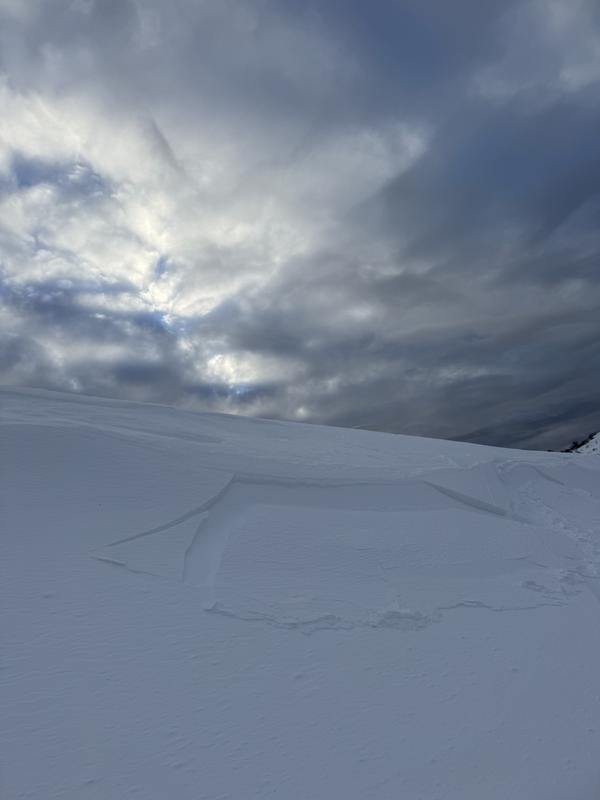
The backcountry remained relatively quiet overall. A skier intentionally triggered a small, 4-inch-deep soft slab avalanche caused by wind-drifted snow on a steep north-facing slope at 6,000 feet near Skyline South Ridge, with additional observations of wind effects and isolated surface hoar in the area.
Small chunk of wind-drifted snow near the Skyline South Ridge - Titensor
Be sure to check recent observations and avalanche reports to get a better understanding of current conditions across the range.
Ad
Avalanche Problem #1
Persistent Weak Layer
Type
Location
Likelihood
Size
Description
The main concern is triggering a large, deadly hard slab avalanche on a persistent weak layer buried 1–3+ feet deep, especially on mid- and upper-elevation slopes facing northwest through north to east.
While the snowpack shows fewer signs of instability and is slowly strengthening, this layer remains highly dangerous.
Thinner snowpack areas are particularly risky, and avalanches can still be triggered remotely or from below. Exercise caution and stay safe.
Avalanche Problem #2
Wind Drifted Snow
Type
Location
Likelihood
Size
Description
Overnight, northwesterly winds ramped up to nearly 65 mph in the Ogden area mountains, and this morning, northeasterly winds have moved back into the range. Easterly winds in the Wasatch can be unpredictable and often lead to unusual avalanche conditions. One local patrol said "East wind event reshuffled the deck..."
With elevated winds and soft snow available for transport, expect sensitive slabs of wind-drifted snow on upper-elevation features where drifting snow accumulates.
Look for signs of wind-drifted snow, such as pillow-shaped deposits, and avoid those slopes. The best and safest riding conditions will be in sheltered, lower-angle terrain out of the wind.
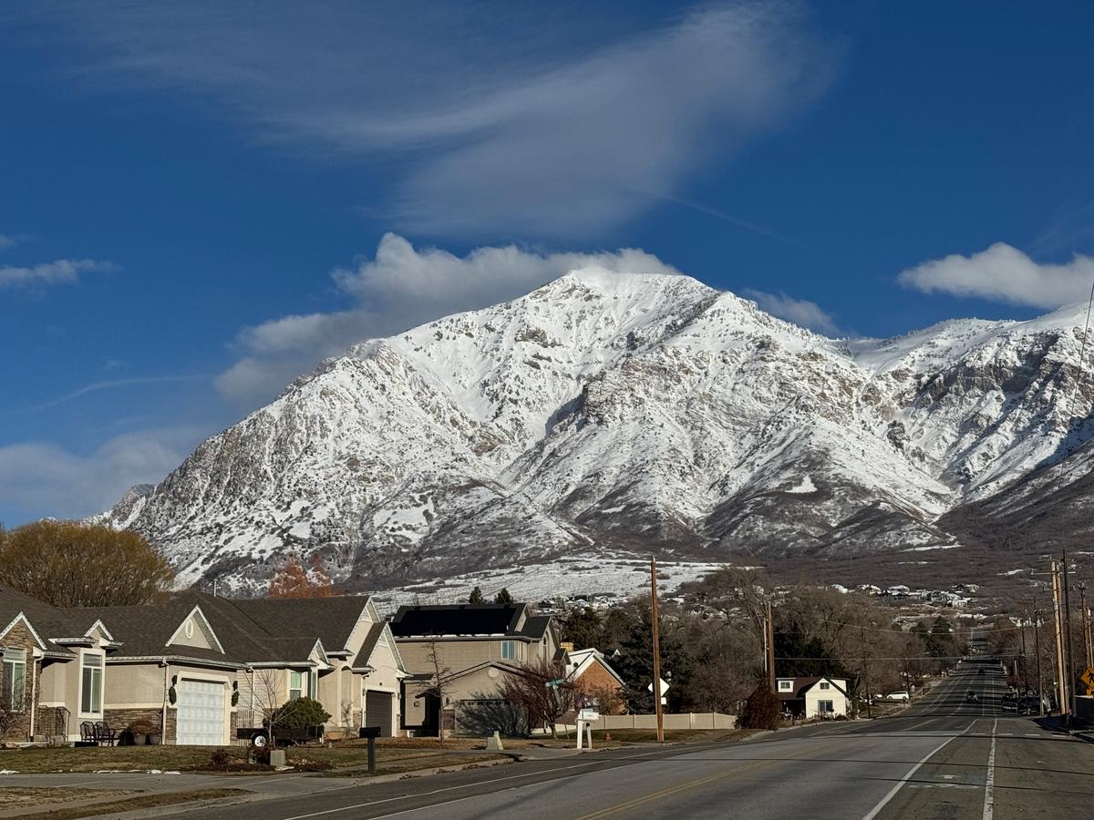
Photo of strong east winds blowing across Ben Lomond as viewed from North Ogden Tuesday morning. Bishop.
Additional Information
The accident reports for the Porter Fork and Davenport Hill Accident have been completed. You can read them HERE.
At the Utah Avalanche Center, we strive to learn from every avalanche incident and share insights to help others avoid similar accidents. We have all experienced close calls and understand how easily mistakes can happen. Our goal with these reports is to provide valuable learning opportunities.
General Announcements
This information does not apply to developed ski areas or highways where avalanche control is normally done. This forecast is from the U.S.D.A. Forest Service, which is solely responsible for its content. This forecast describes general avalanche conditions and local variations always occur.