Join us at our 2nd Annual Blizzard Ball

Forecast for the Moab Area Mountains

Eric Trenbeath
Issued by Eric Trenbeath on
Saturday morning, January 4, 2025
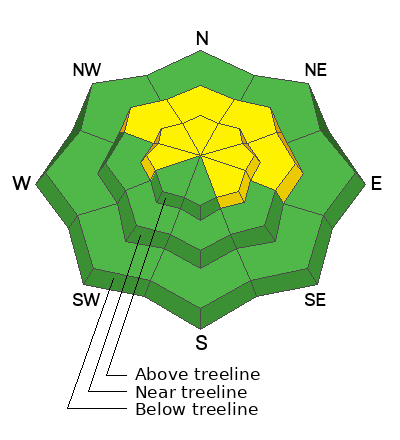
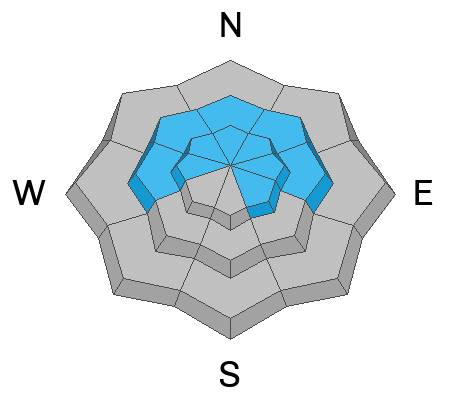
The avalanche danger is MODERATE on steep slopes above treeline that face W-N-E-SE, with the greatest danger on wind loaded slopes facing N-E. In these areas, winds have built slabs over top of weak faceted layers and human triggered avalanches 1-3 feet deep are possible. Near treeline the problem is less widespread but a MODERATE danger still exists on slopes facing the north half of the compass. Careful snowpack evalution is necessary before riding terrain steeper than 30 degrees.
Most other terrain has LOW danger. Small avalanches on isolated terrain features are possible.
It's still low tide out there and rocks, stumps, and logs are lurking just beneath the surface.
Low
Moderate
Considerable
High
Extreme
Learn how to read the forecast here
Special Announcements
Geyser Pass Road: Expect slick conditions on a hard, snowpacked and icy surface. AWD with good tires required.
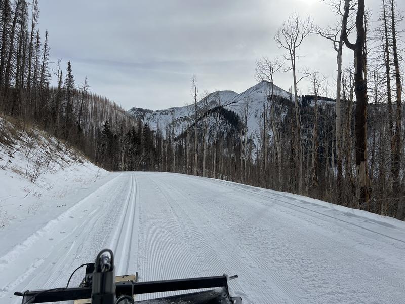
Grooming Conditions: All trails are freshly groomed and there is classic track set into Gold Basin. Probably the best thing going right now.
Now is a great time to dial in your safety gear including putting fresh new batteries in your beacons! Local shops across the state will be handing out free Batteries for Beacons now until February 1, 2025. All you need to do is fill out a quick survey and grab the AAA or AA batteries you need to keep your beacon fresh this season. Head into Moab Gear Trader to get yours!
Weather and Snow
6 A.M. Snow and Weather Data
24 Hour Snow: 0" 72 Hour Snow: 0" Season Total Snow: 52" Depth at Gold Basin: 27"
Winds on Pre-Laurel Peak: SSE 30-35 G 46 Temp: 33° F Percent of Normal (SWE): 109%
Weather
Southerly winds are cranking and it's been a ridiculously warm 24 hours up there with a high of 40°F at noon yesterday and no overnight refreeze. Today look for cloudy skies, blustery winds shifting to the NW, and a chance for snow as another storm system moves through to the north. Temperatures should drop into the mid 20's with the passing cold front. Tomorrow looks sunny and cool. A colder low pressure system will drop into the region mid-week but it doesn't look real promising at this time.
General Conditions
Soft snow is becoming more scarce each day but you can still find it on sheltered, northerly aspects below treeline. Above treeline, and on open slopes below, winds have really gotten the best of things. Overall coverage remains thin to bare on sun and wind exposed slopes. Weak layers of faceted snow exist on slopes near treeline and above that face W-N-SE, but the distribution of overlying slabs is spotty with the greatest concentration found on wind drifted slopes facing N-E.
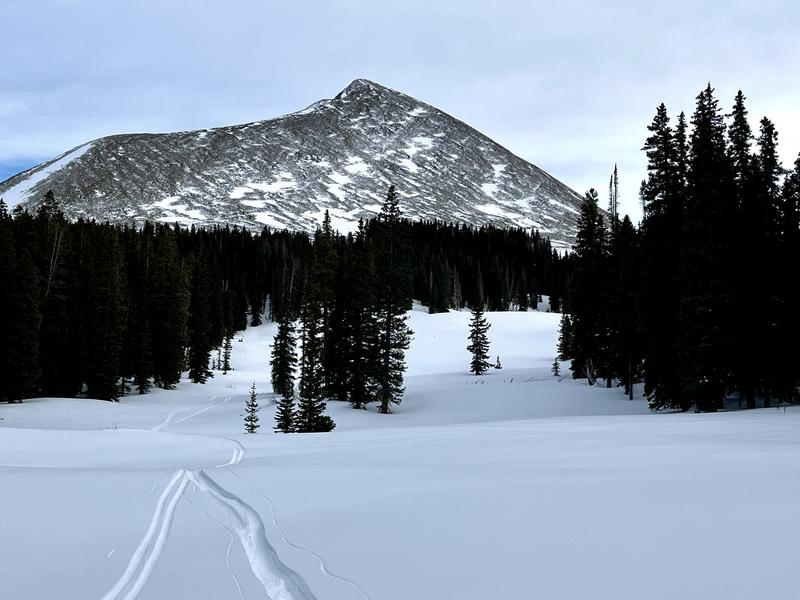
A tale of two snowpacks. Sun and wind exposed slopes are blasted down to the rocks. Soft snow remains on sheltered slopes below treeline.
Snowpack and Weather Data
Gold Basin SNOTEL site (10,000')
SNOTEL site near Geyser Pass Winter Trailhead (9600')
Wind Station on Pre-Laurel Peak (11,400')
NWS forecast for the La Sal Mountains.
Recent Avalanches
See the avalanche database here.
We are sad to report two fatal avalanches in the Wasatch Mountains. The first occured in Porter Fork on Saturday. Heavy snowfall on a buried weak layer of faceted snow was the problem. Details here. The second avalanche was in Silver Fork on Tuesday. Old buried faceted snow was the weak layer in this avalanche also. Details here.
Ad
Avalanche Problem #1
Persistent Weak Layer
Type
Location
Likelihood
Size
Description
Weak and faceted snow is widespread on the shady side of the compass. Slopes below treeline lack a cohesive slab. As you gain elevation, you may encounter thicker slabs near treeline and above. Slab formation is most pronounced above treeline, and this is where you are most likely to find avalanche problems. There are two main weak layers of concern: facets at the base of the snowpack, and very weak snow found just below the new and drifted snow. We are most concerned about the weak layer in the upper pack. Recently formed slabs are more likely to overload this layer, and avalanches will likely fail here first. Any triggered slide has the potential to entrain enough snow to step down to the basal facets, causing deeper and more dangerous avalanches. If you are skiing slopes steeper than 30 degrees, you'll need to carefully evaluate the snow for signs of a slab over a weak layer.
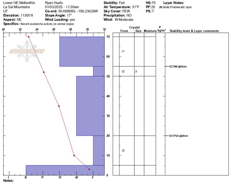
This snowpit from Ryan Huels perfectly illustrates the snow structure we are most concerned with. Note the obvious dense slab on top over weak faceted snow. The diagram also illustrates the weak faceted layer at the base of the snowpack.
Additional Information
Sign up for text alerts to get the most up to date information about changing conditions, road plowing, special avalanche announcements.
Follow us on Instagram @utavy_moab
General Announcements
This forecast is from the U.S.D.A. Forest Service, which is solely responsible for its content. This forecast describes general avalanche conditions and local variations always occur.