Join us at our 2nd Annual Blizzard Ball

Forecast for the Ogden Area Mountains

Drew Hardesty
Issued by Drew Hardesty on
Tuesday morning, December 24, 2024
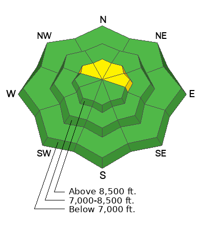
Most terrain has an overall LOW avalanche danger. Pockets of MODERATE, however, exist in the upper elevations. Here, it is still possible to trigger a slab avalanche 1-2 feet deep, failing on a persistent weak layer of sugary, faceted grains. These pockets are most pronounced on northwest to east facing slopes. By early afternoon, the overall danger will rise to MODERATE for new and developing soft slabs of wind drifted snow.
Low
Moderate
Considerable
High
Extreme
Learn how to read the forecast here
Special Announcements
Now is a great time to dial in your safety gear, including putting fresh new batteries in your beacons! Local shops across the state will be handing out free Batteries for Beacons from now until February 1, 2025. All you need to do is fill out a quick survey and grab the AAA or AA batteries you need to keep your beacon fresh this season. Find participating shops and more info here.
Weather and Snow
Merry Christmas Eve.
Ahead of the Christmas storm, it's currently mostly cloudy with light westerly winds and mountain temps in the upper 20s to low 30s.
Yesterday's storm was a bit of a sleeper, as most mountain locations picked up 2-4 inches of new snow with 0.3-0.4 inches of snow water equivalent. Precipitation fell as rain in the low elevations. This new snow will have greatly improved skiing and riding conditions in the mid and upper elevations. The good news is that more storms are on the way. Santa's plan is to bring 3-6 inches overnight into tomorrow. Today, he'll ride his sleigh on strong winds from the southwest this afternoon. Winds are expected to blow 35-45mph with gusts to 70mph. But it should be a white Christmas all the same.
The Outlook: While there is still some uncertainty on all the details, it looks like we'll have a parade of storms out of the west that race across northern Utah from Thursday through the weekend. If things line up, we'll be measuring the snowfall in feet and not inches. Moderate to strong winds are also expected.

Recent Observations for the Ogden region HERE.
Recent Avalanches
None.

Avalanche List for the Ogden region HERE.
Ad
Avalanche Problem #1
Persistent Weak Layer
Type
Location
Likelihood
Size
Description
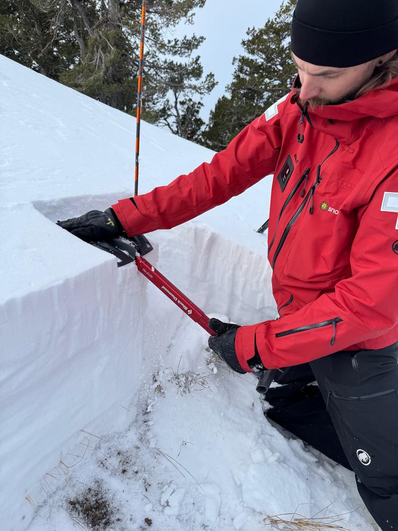
A persistent weak layer (PWL) of faceted snow exists on northerly-facing slopes. In upper elevation wind drifted slopes, it is possible to trigger an avalanche 1-2 feet deep and over 100 feet wide. Dave Kelly toured in the Hells Canyon terrain with Snowbasin avalanche teams and found a snowpack with poor structure. They experienced minor cracking and collapsing and poor test results.
Check out Dave's full observation for more photos and information.
Avalanche Problem #2
Wind Drifted Snow
Type
Location
Likelihood
Size
Description
Today's forecast strong winds will easily blow yesterday's 4 inches of new snow to create pockets of wind slab that may be sensitive to provocation. These drifts will be most prominent on upper elevation northwest to east facing slopes, but it'll be important to keep your eyes open for any recent deposits of wind drifted snow. As always, watch for shooting cracks and avoid smooth, rounded wind pillows.
Additional Information
General Announcements
This information does not apply to developed ski areas or highways where avalanche control is normally done. This forecast is from the U.S.D.A. Forest Service, which is solely responsible for its content. This forecast describes general avalanche conditions and local variations always occur.