Join us at our 2nd Annual Blizzard Ball

Forecast for the Salt Lake Area Mountains

Trent Meisenheimer
Issued by Trent Meisenheimer on
Sunday morning, December 22, 2024
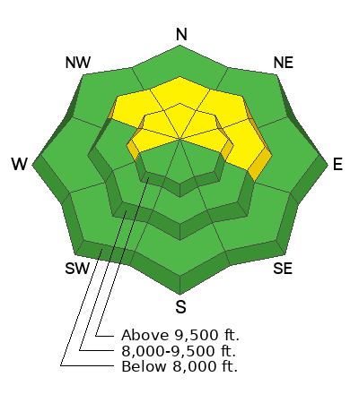
The avalanche danger is MODERATE on mid and upper-elevation slopes facing northwest through north through east and upper-elevation west-facing terrain. It is possible to trigger an avalanche 1-3 feet deep, failing on a persistent weak layer of faceted snow. Recently, wind-loaded slopes at the upper elevations have been the most prone to avalanches.

Please respect ski area boundaries at all resorts. Especially if they are doing control work.
Low
Moderate
Considerable
High
Extreme
Learn how to read the forecast here
Special Announcements
Now is a great time to dial in your safety gear, including putting fresh new batteries in your beacons! Local shops across the state will be handing out free Batteries for Beacons from now until February 1, 2025. All you need to do is fill out a quick survey and grab the AAA or AA batteries you need to keep your beacon fresh this season. Find participating shops and more info here.
Weather and Snow
Under partly cloudy skies, the mountain temperatures remain warm and range from 27-38 °F. The wind is generally from the west, but some stations read southwest, and others read northwest. In any case, wind speeds are 10-20 mph with gusts into the 20s.
Let's hope today we can squeeze some snow from two very weak storms that will impact the area later today through Monday. We should see snow begin later this afternoon that will likely spit and sputter here and there. Accumulations are expected to be 2-6 inches of snow through Monday.
Starting Christmas, the pattern looks much more active, and it looks like snow and winter will return to Utah.
Recent Avalanches
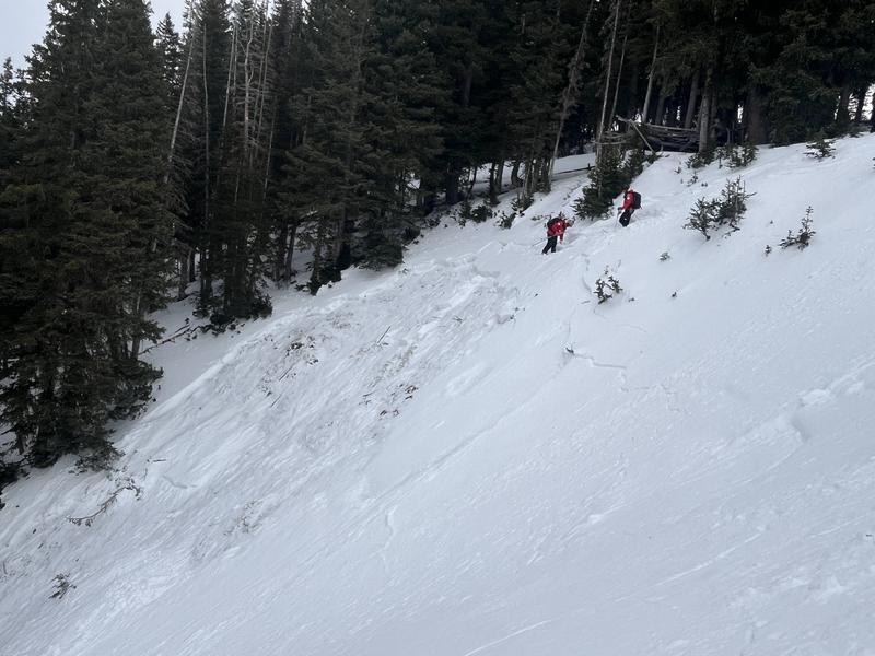
Yesterday, two avalanches were triggered. The first was in South Monitor (video below), and the other was triggered by explosive work along the Park City Ridgeline (picture below). Both avalanches failed on weak-faceted snow.
Ad
Avalanche Problem #1
Persistent Weak Layer
Type
Location
Likelihood
Size
Description
A persistent weak layer (PWL) of faceted snow exists on northerly-facing slopes at the mid and upper-level elevations where it is possible to trigger an avalanche up to 1-3 feet deep and over 100 feet wide. Avalanche activity and field work this week has informed us that the slopes that are most prone to slide are recently wind-loaded and/or have a slab of stronger snow on top of the buried PWL (see video).
Video: Greg Gagne explaining the snowpack structure.
Additional Information
Despite the current benign weather, it has been an active week with several avalanches from the backcountry. Be sure to catch up with the Week in Review:
General Announcements
This information does not apply to developed ski areas or highways where avalanche control is normally done. This forecast is from the U.S.D.A. Forest Service, which is solely responsible for its content. This forecast describes general avalanche conditions and local variations always occur.