Forecast for the Provo Area Mountains

Nikki Champion
Issued by Nikki Champion on
Thursday morning, December 5, 2024
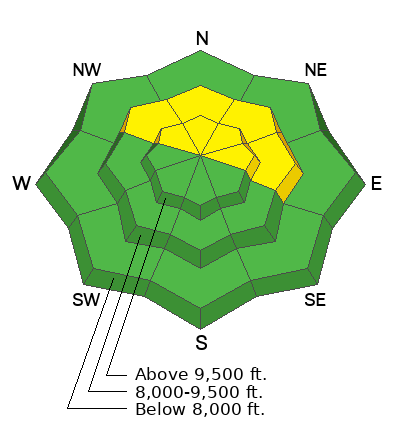
The avalanche danger is MODERATE on steep, mid- to upper-elevation slopes facing north to east. In isolated areas, it’s still possible to trigger a 1-3 feet deep avalanche failing on a persistent weak layer of faceted grains. This layering is slowly stabilizing, but it may take another day or two before the danger drops. In more wind-protected areas, small wet or dry sluffs may occur in isolated spots or extreme terrain.
Low
Moderate
Considerable
High
Extreme
Learn how to read the forecast here
Special Announcements
The 17th Annual Utah Snow and Avalanche Workshop (USAW) is scheduled for Saturday, December 7th. Information and tickets are available here.
Weather and Snow
This morning, under clear skies, an inversion is present in the mountains. Temperatures range from the upper low 30s °F along ridgelines and are in the 20s °F at trailheads. Winds are primarily from the northwest, gusting in the teens along mid-elevation ridges and into the mid-20s mph along the highest peaks.
Today will bring another sunny day, with a valley inversion likely persisting. Temperatures are expected to rise into the upper 30s to low 40s °F, while northwesterly winds will remain generally light, gusting into the mid-20s mph along the highest peaks.
The outlook remains generally grim through the weekend, but there’s a beacon of hope early next week. A cold front shows promise for light snow on Sunday and Monday, with expected water totals ranging from 0.1 to 0.2 inches and snow totals of Trace–3 inches. While modest, 1–3 inches is better than nothing.

Riding conditions remain thin, especially outside the core of the central Wasatch. That said, soft turns can still be found on aspects untouched by the sun or wind, as last week’s storm snow continues to recrystallize and facet. While this makes for enjoyable turns now, it could become a much bigger issue down the road. For more on this, check out the Forecaster’s Corner in the Additional Information section below.
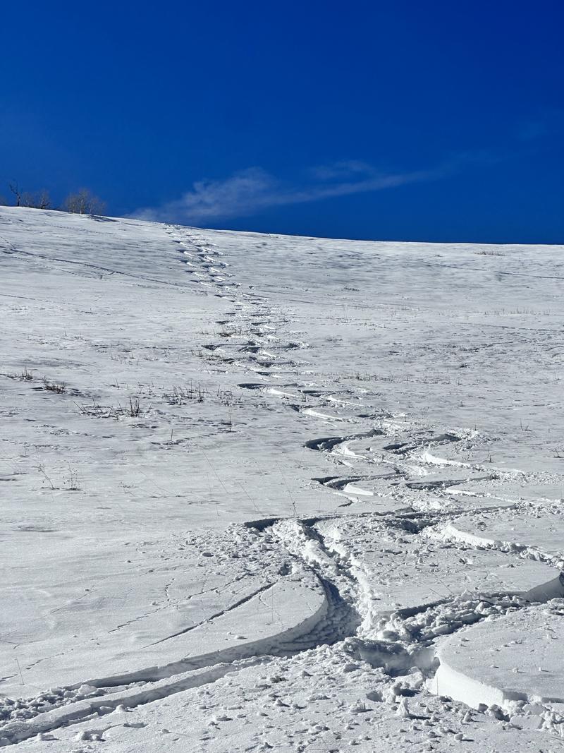
A few soft turns Joey and I found yesterday near the Ant Knolls of Snake Creek - while these turns were nice, most of the travel there was not.
If you’ve got a few extra moments, take a look at a couple of complementary essays from Drew—well worth the read!
Recent Avalanches
No new avalanches were reported in the backcountry yesterday.
Many large natural slab avalanches occurred during last Tuesday's storm, with a few more in the days after. None, that we know of, were human-triggered. The slides were 1-3' deep and a few hundred feet wide on steep north to east-facing slopes, mainly along the Cascade ridgeline in the south fork of Provo Canyon. Recently, only wet loose avalanches have been reported due to the warm temperatures.
Find all observations HERE.
Ad
Avalanche Problem #1
Persistent Weak Layer
Type
Location
Likelihood
Size
Description
A poor snowpack structure persists in the shady terrain of the mid- and upper elevations in the Provo area mountains. Here, you’ll find 1-2' of recent storm snow over about a foot of early season weak, sugary faceted snow. While recent field observations have shown signs of stabilization—such as no cracking or collapsing and improved stability tests within snow pits—the weak structure remains, and we are still less than a week out from the last natural avalanche in this area. As a result, caution is still advised in steep terrain.
This layering is slowly stabilizing, but it may take another day or two before the danger decreases. We need more data, confirmation, and consensus before we can confidently lower the danger to LOW.
The concern extends beyond just today. Once we move out of this high-pressure period and begin to see more snow or wind loading, those faceted layers are likely to become active again, significantly increasing avalanche danger.
For now, we can enjoy soft turns and sunshine, but it’s important to stay aware of where the snow is faceting and where the surface feels damp. Areas holding cold, faceted snow will pose the greatest risk when we transition back into a period of low pressure.
Additional Information
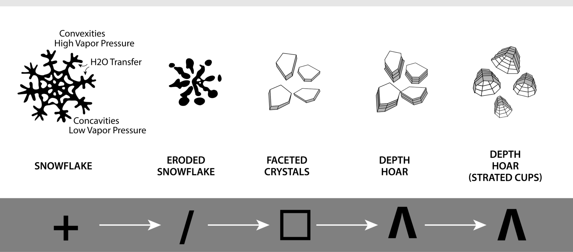
Clear, cold conditions can be tough on the snowpack, and high pressure only makes things worse. The strong temperature and vapor pressure gradient transforms new snow crystals into sharp, angular, faceted grains. This is especially noticeable on shady aspects, where the snow feels almost like skiing or riding through sugar. But today’s snow surface will soon become tomorrow’s weak layer—our next Persistent Weak Layer. More on the faceting process HERE.
General Announcements
This information does not apply to developed ski areas or highways where avalanche control is normally done. This forecast is from the U.S.D.A. Forest Service, which is solely responsible for its content. This forecast describes general avalanche conditions and local variations always occur.