Check out our Holiday Auction - Sign Up for the Utah Snow and Avalanche Workshop (USAW)

Forecast for the Uintas Area Mountains

Andrew Nassetta
Issued by Andrew Nassetta on
Friday morning, November 29, 2024
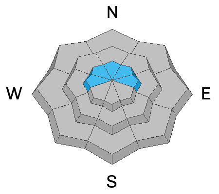
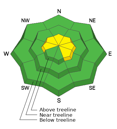
Today's avalanche danger is MODERATE above treeline on steep, wind-drifted slopes facing west through southeast. It is POSSIBLE that today’s avalanches can be triggered by a human and break deeper and wider than you might expect..
Avalanches can be triggered remotely from below, above, or even an adjacent slope from a distance. I am avoiding the problem by seeking lower-angle sheltered terrain, out of the windzone without any steep slopes connected to me .
Low
Moderate
Considerable
High
Extreme
Learn how to read the forecast here
Weather and Snow
Nowcast
At 0500 AM things sit slightly inverted with ridgeline temperatures just below 20℉, and trailhead temperatures hovering under 10℉. Winds are working out of the SW at 15-20mph, gusting to 25 at 10,000'.
Forecast
Winds die down as temperatures warm to 20℉ up high and near 30℉ at trailheads. A few lingering clouds burn off mid-morning leaving clear skies and sunshine behind.
Futurecast
A settling high-pressure ridge sets the tone for mild daytime temperatures with sunny skies and cold, clear nights. Ideal conditions for faceting, and weakening of the snowpack.
Snowpack & Travel
Heading out today I am keeping a few observation objectives at the top of my list to evaluate, and avoid the hazard:
  • Snow depths are 1-2' across the range and vary from zone to zone.
  • Areas where the snowpack is thin produce more red flags than deeper areas.
  • In areas where wind has added to the hardness of the slab, we are seeing avalanches.
  • In snowpits I am looking for poor structure, and propagation in my extended column test (ECT) to evaluate our PWL.
Recent Avalanches
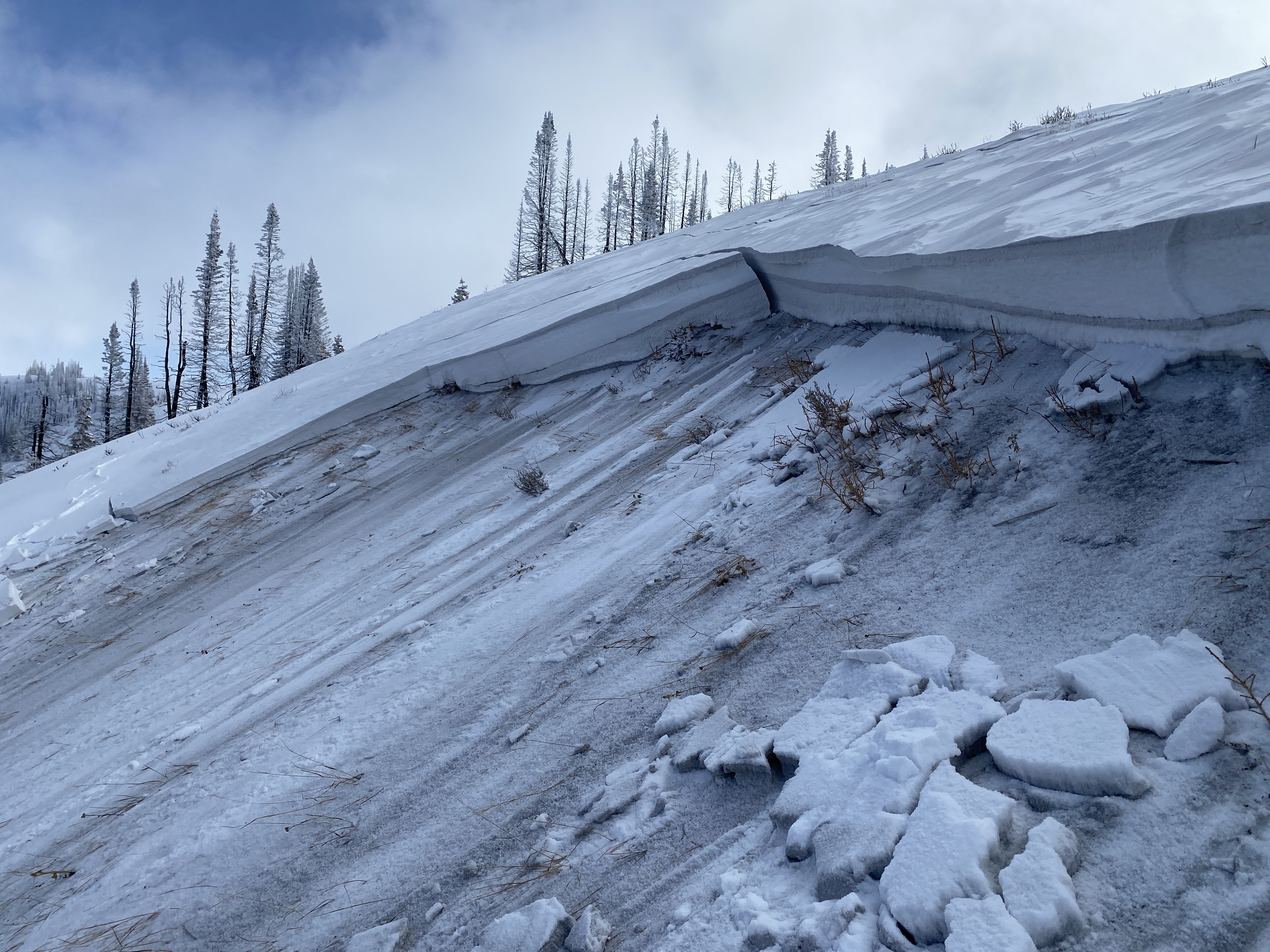
On Wednesday, avalanches were remotely triggered on our persistent weak layer in steep, heavily wind-loaded areas. An example in the photo below, courtesy of Bo T, is on a wind-loaded, NNW facing slope at 9,600'.
Today’s avalanche will look similar and can break wider and deeper than one might expect. My greatest concern is that we can remotely trigger these from below, above, and even from a distance away.
For the low-down on these avalanches and more observations click here!
Ad
Avalanche Problem #1
Persistent Weak Layer
Type
Location
Likelihood
Size
Description
Old, faceted snow at the ground from late fall and early winter continues to be the main problem and focus. We are giving the PWL its first real test this week with an inch of water from the storm and consistent wind – To no surprise, it is failing the test.
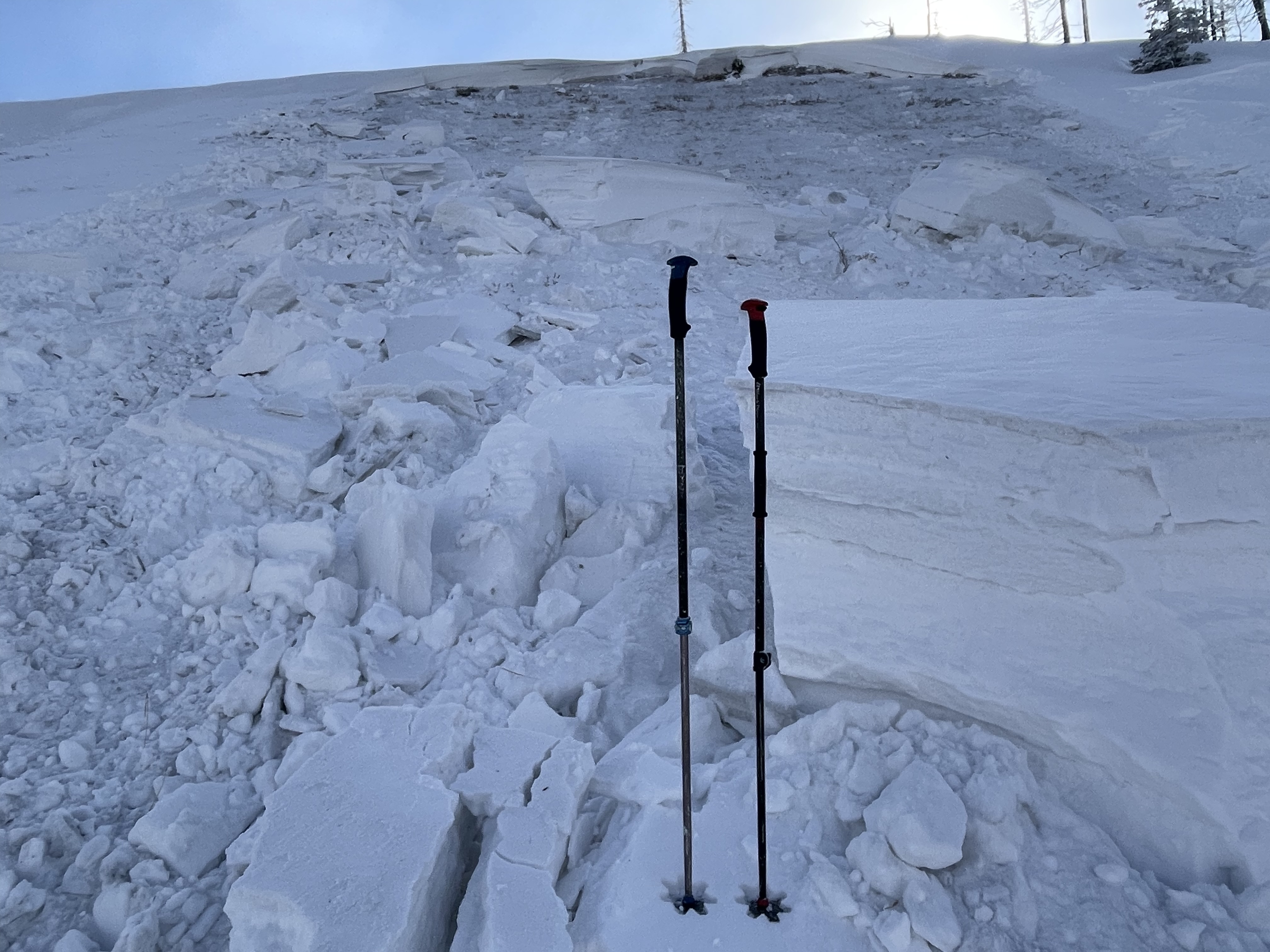
Avalanches can be remotely triggered from a distance,as well as from below or on adjacent slopes. In wind-drifted areas where a hard slab exists that I can barely get a knife into, are most reactive to the additional weight of a rider. Break out the shovel, dig down, and look for this setup of strong snow over weak snow and look for shooting cracks, audible collapses or whoomphing, and recent avalanches -- obvious signs of this hazard.
The photo above is of a north facing slope at 9,500' in the Wolf Creek Pass area. This avalanche was triggered on Wednesday from a thin spot in the snowpack, and low on the slope.
Avalanche Problem #2
Wind Drifted Snow
Type
Location
Likelihood
Size
Description
Watch for lingering wind-drifts that could be reactive to the additional weight of a human, today. This hazard is specific to steep slopes greater than 30° facing west through east. Look for and avoid rounded pillows and drifts that can be hard or soft, and sound hollow like a drum underneath us.
General Announcements
Additional Information
The Uinta weather station network was upgraded this summer and all that real-time info is found here. Simply click on the "Western Uinta" tab and then the "Weather Stations" tab to find all your weather needs.
Save the Date
- Statewide Avalanche Awareness Week is running from December 1st-7th -- Check out the list of events and happenings across the state here!
- 17th Annual Utah Snow and Avalanche Workshop (USAW) | Saturday, December 7 | Information and tickets are available here.
We are always looking for snow and avalanche observations or just general riding conditions. So... if you see something, say something. You can reach our team directly by contacting Craig at [email protected], 801-231-2170, or Andrew at [email protected], or 860-460-8142.
General Information
This forecast is from the U.S.D.A. Forest Service, which is solely responsible for its content. This forecast describes general avalanche conditions and local variations always occur. This forecast was issued on Thursday, November 28th at 0630 AM and expires 24 hours after it was issued. We will update the forecast as conditions change, and in the meantime reach out to us with questions, or if you see anything in your travels.