Check out our Holiday Auction - Sign Up for the Utah Snow and Avalanche Workshop (USAW)

Forecast for the Uintas Area Mountains

Craig Gordon
Issued by Craig Gordon on
Saturday morning, November 30, 2024
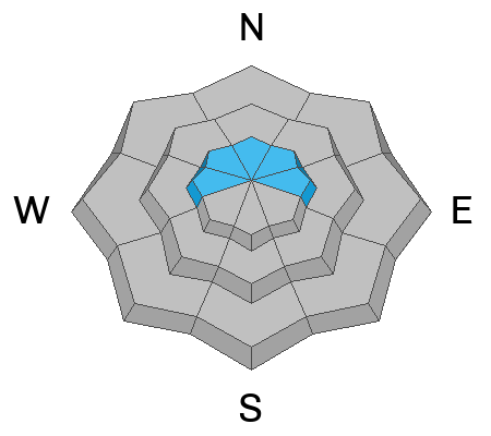
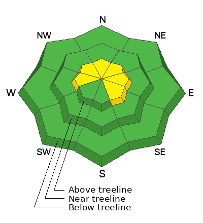
Today you'll find MODERATE avalanche on steep, shady, wind drifted slopes. While the snowpack is shallow and it doesn't look like there's enough snow to slide, human triggered avalanches breaking deeper and wider than you might expect are POSSIBLE, especially in the wind zone above treeline, and particularly on slopes facing the north half of the compass that held early season snow.
HEADS UP- you might still be able to initiate an avalanche from a distance and any slide triggered is gonna reveal a myriad of season ending obstacles. Note to self... think slamming into stumps, rocks, or dead fall.
Your exit strategy is an easy one.... you can have a blast today simply steering towards low angle slopes with no overhead hazard.
Low
Moderate
Considerable
High
Extreme
Learn how to read the forecast here
Special Announcements
Save the dates and please join us this week!
- Avalanche Awareness Week kicks off at Sugarhouse Park on Monday December 2nd from 4:00- 7:00 and there's statewide events throughout the week, Check out the full list of happenings across the state HERE!
-The week wraps up Saturday December 7th from 4:00-7:45 PM at the University of Utah with our 17th annual Utah Snow and Avalanche Workshop. Deets and tickets HERE!
Weather and Snow
Nowcast-
Skies are clear and temperatures slightly inverted, hovering in the single digits near the trailheads and mid teens along the ridges. Westerly winds bumped into the 20's Friday afternoon with a few gusts in the 30's near the high peaks and continue in that spirit at o'dark thirty this morning.
Forecast-
A few high clouds drift into the Uinta region as a storm system churns to our north and ushers in slightly cooler air. High temperatures climb into the upper 20's with overnight lows dipping into the teens and single digits. West and northwest winds bump into the upper 30's near the high peaks by days end.
Futurecast-
Dang... nuthin' but severe clear for the foreseeable future.
Current conditions-
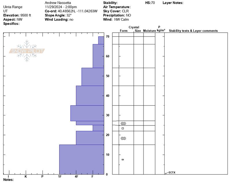
It's still super thin and travel is limited to road rides and grassy meadows. Andy and I were near Wolf Creek Pass yesterday... here's the setup.
Recent Avalanches
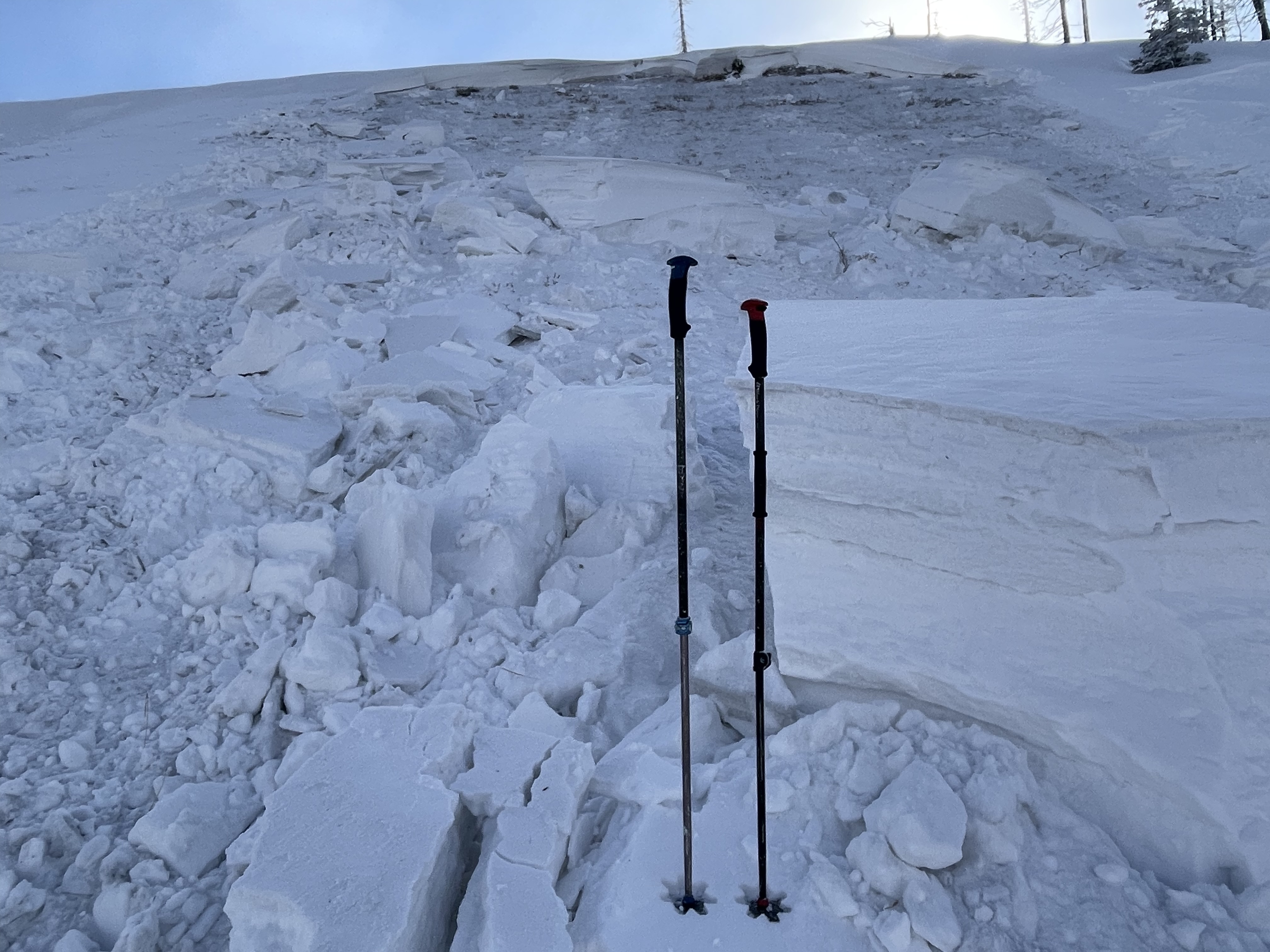
On Wednesday, several remotely triggered avalanches broke near the ground on our problem child, a persistent weak layer of snow or what we call PWL. The image below submitted by Bo Torrey clearly illustrates the issue, on a steep, heavily wind-loaded, NNW facing slope at 9,600'.
Perhaps not quite as sensitive as midweek, today’s avalanches will look similar and can break deeper and wider than you might expect. And yeah... they'll pack a punch and can easily roll ya..
For the low-down on recent avy activity and more observations click here!
Ad
Avalanche Problem #1
Persistent Weak Layer
Type
Location
Likelihood
Size
Description
Of course we've seen worse looking snowpacks and it's no shock that our problem child (persistent weak layer or PWL), the sugary, faceted snow near ground is gonna gives us some heartburn. It's a classic, early season, strong snow resting on weak snow structure. Now for the inside line... all the snowpros, I knows, are giving this setup a wide berth because we realize it's a tricky combo.
Here's where it's deceiving... in areas where the pack is deep, the snow will feel strong and bomber underneath us. However, all we need to do is find a thin spot, maybe around a bush or rock, collapse the slope, and now we're staring down the barrel of a moving piece of snow that could ruin our day. In many areas the snowpack has relaxed somewhat and we might not be experiencing in yer face, red flags like cracking or collapsing, But the layering is there and recent avy acitvity on the same types of slopes we wanna ride is the biggest bullseye clue.
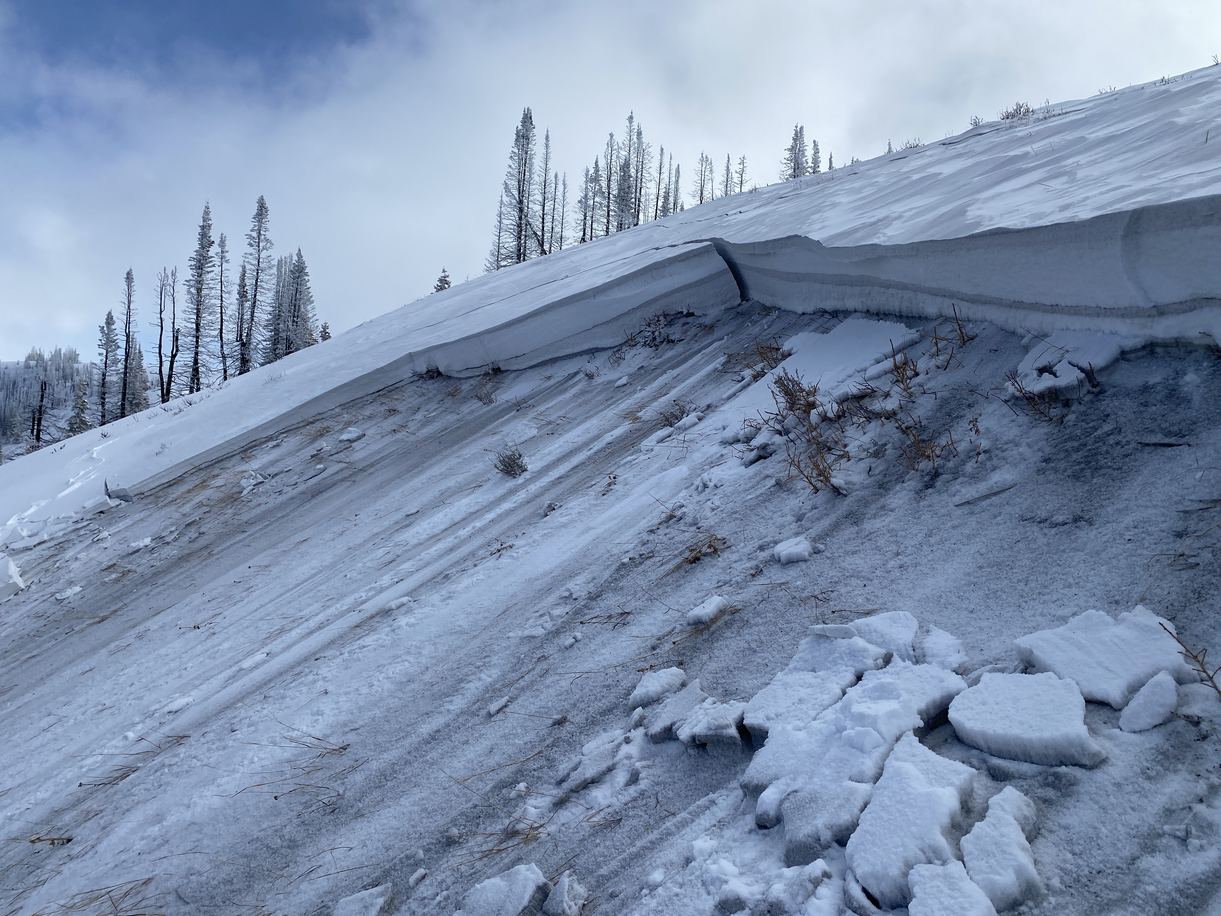
The photo above from Wednesday is on a north facing slope at 9,500' in the Wolf Creek Pass area. The avalanche was triggered low on the slope, essentially kicking the legs out from underneath in a thin spot of the snowpack,
Avalanche Problem #2
Wind Drifted Snow
Type
Location
Likelihood
Size
Description
A tired, old, lingering wind-drift may still react to our additional weight, but this hazard is pretty straight-forward and specific to upper elevation, shady terrain. Today, I'm looking for and avoiding fat, rounded, hard pillows of snow, especially if they sound hollow like a drum under my feet. Lose the wind and you lose the problem :)
General Announcements
Additional Information
The Uinta weather station network was upgraded this summer and all that real-time info is found here. Simply click on the "Western Uinta" tab and then the "Weather Stations" tab to find all your weather needs.
We are always looking for snow and avalanche observations or just general riding conditions. So... if you see something, say something. You can reach our team directly by contacting Craig at [email protected], 801-231-2170, or Andrew at [email protected], or 860-460-8142.
General Information
This forecast is from the U.S.D.A. Forest Service, which is solely responsible for its content. This forecast describes general avalanche conditions and local variations always occur. This forecast was issued on Saturday, November 30th at 0430 AM and expires 24 hours after it was issued. We will update the forecast by 07:00 tomorrow. But, in the meantime reach out to us with questions, or if you see anything in your travels.