UDOT PLANNED AVALANCHE CLOSURES!!

Observation: Silver/Days

Observation Date
2/1/2024
Observer Name
Kelly, Gagne
Region
Salt Lake » Big Cottonwood Canyon » Silver/Days
Location Name or Route
Days Fork
Weather
Sky
Scattered
Precipitation
Light Snowfall
Wind Direction
Southwest
Wind Speed
Moderate
Weather Comments
Winds were moderate to strong blowing from the south-southwest throughout the day. The winds were much stronger on the ridgetops. Air temperature was cooler above 9600' which matched the dampness of the snow surface. Fog and more overcast skies as the afternoon went on. Rimed crystals were falling and we saw no rain during our tour.
Snow Characteristics
New Snow Density
High
Snow Surface Conditions
Faceted Loose
Melt-Freeze Crust
Snow Characteristics Comments
Southerly facing (solar) aspects were a stout melt-freeze crust on the ascent and softened up below 9600' on the descent. Northerly facing slopes had a layer of NSF on the surface that was drier above 9600'. Below that elevation, the surface was damper. Travel was still soft on lower-angle north-facing slopes. There was just under an 1/2" of new snow that fell throughout the day.
Red Flags
Red Flags
Recent Avalanches
Poor Snowpack Structure
Red Flags Comments
Poor snowpack structure is particularly an issue in steep, rocky terrain with a thin snowpack.
Avalanche Problem #1
Problem
Persistent Weak Layer
Trend
Increasing Danger
Problem #1 Comments
The PWL remains an issue on slopes with a thin snowpack. With more snow on the way, the trend for this problem is now increasing.
Snow Profile
Aspect
North
Elevation
10,200'
Slope Angle
35°
Comments
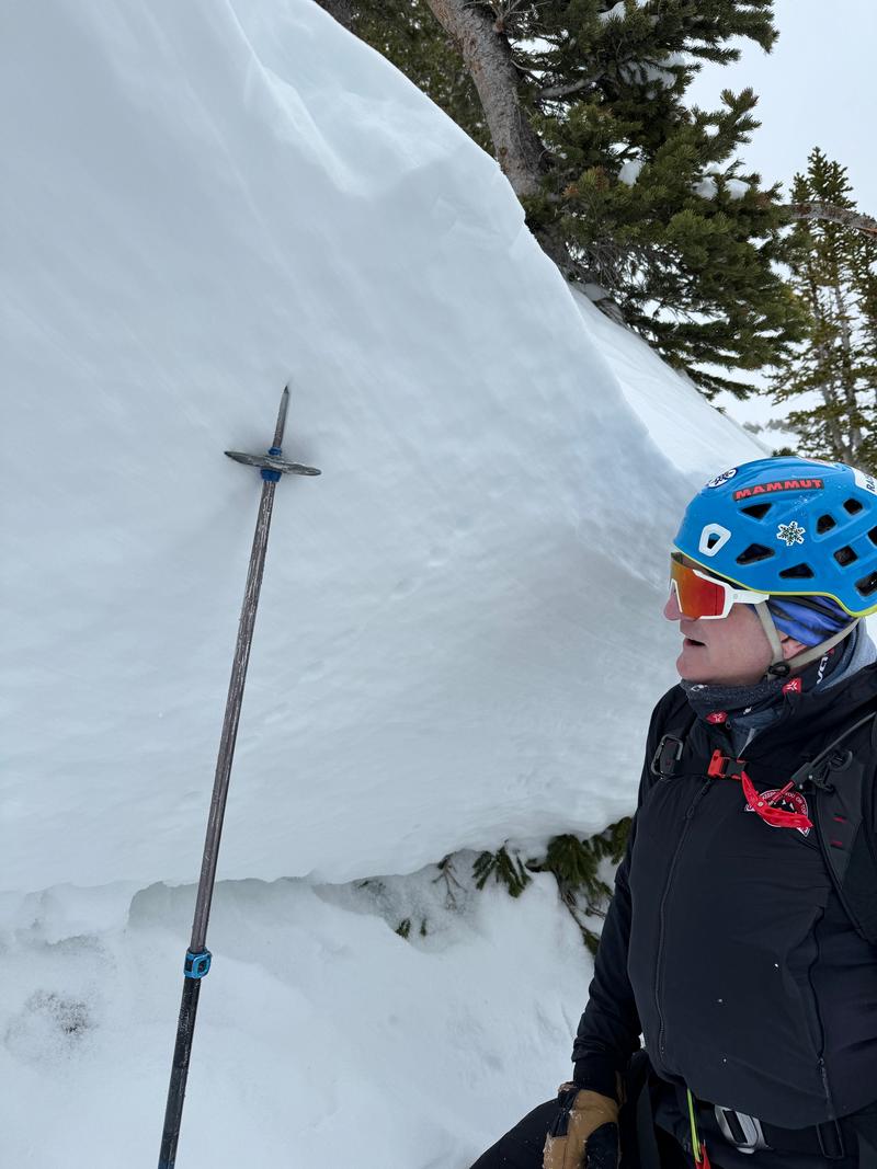
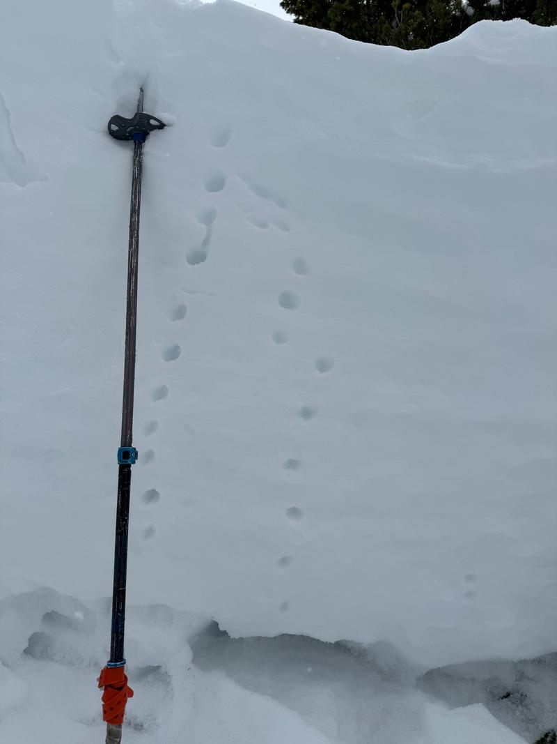
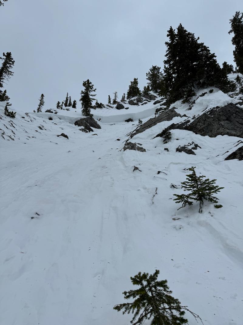
We went to look at a skier triggered slide in Days Fork. This avalanche was triggered on January 30, 2024 and you can read more about it HERE.
This structure matches what Andy and I found in Cardiff on January 30th. This snowpack structure is poor and there are still weak dry facets under a slab of snow. In some areas like what G.Kazickas/Babbitt found on Toledo, the facets near the ground are healing (moist with rounded edges) but without knowing what I am traveling on I am continuing to assess steep terrain before committing to a slope. It's the tale of two snowpacks: one could avalanche and the other may not.

It's always a good idea to map the snow surface ahead of an incoming storm. The only areas we were finding weak snow at the surface was on north aspects at the upper elevations - above about 9,500'. Elsewhere, the snow surface was damp or crusted. With sustained southerly winds, fresh wind drifts at the upper elevations on Friday may be reactive as they'll be forming on top of this weak snow.
Video
Today's Observed Danger Rating
Moderate
Tomorrows Estimated Danger Rating
Moderate
Coordinates