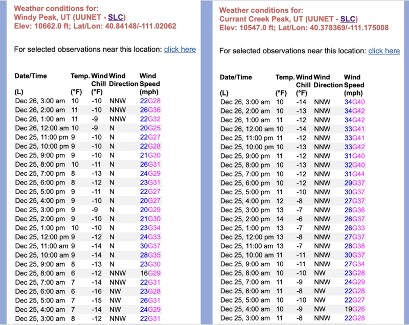
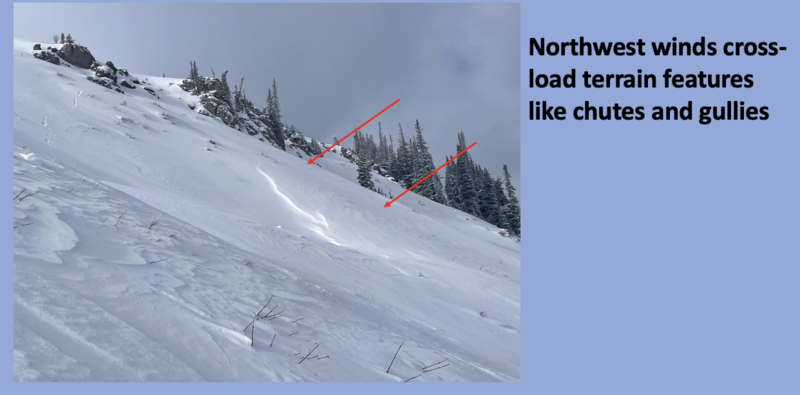
Nowcast- With clear skies overhead, a nearly full, Cold Moon, casts a beautifully illuminating light on our mountains this morning. While temperatures start the day shift in the teens and single digits, northerly winds earned a little extra holiday dough and worked though the weekend along the high ridges, racking up hourly averages in the mid and upper 30's.
Forecast- After a sunny start to the day, clouds increase and a stray snow flurry or two isn't out of the question late this afternoon. Winds blowing in the 30's from the north and northwest are gonna be a nuisance near the high peaks. Temperatures climb into the mid 20's with overnight lows dipping into teens.
Futurecast- High pressure returns midweek, with another very weak system bumping through for Thursday. A few more minor impulses graze by over the weekend and into early next week, but don't get too excited... these look like meager snow producers at best.
Not much has changed since this snowpit image was captured at Gold Hill last week on a NW facing slope at 9800 ft.
Generally there's about two feet of snow in the Uinta's although you can find a few places at upper elevations with closer to three feet. There are three basic layers in the snowpack seen in the photo above with a few inches on top from Saturday's storm.
No avalanches have been reported in the Uintas. There have been just a few small wind slabs triggered by ski patrols in the Wasatch.
Trip reports and the latest observations are found
HERE.


