Join us for the 17th Annual Professional Snow and Avalanche Workshop (PROSAW) on November 4 - Purchase tickets here!

Forecast for the Logan Area Mountains

Toby Weed
Issued by Toby Weed on
Wednesday morning, December 20, 2023
The danger remains LOW, with generally stable snow in the backcountry. Avalanches are unlikely on most slopes, with exceptions in shady terrain down low where warming soft snow is moist and gloppy. People might trigger small, wet, loose avalanches on slopes steeper than 30°.

Normal caution is recommended.
Low
Moderate
Considerable
High
Extreme
Learn how to read the forecast here
Weather and Snow
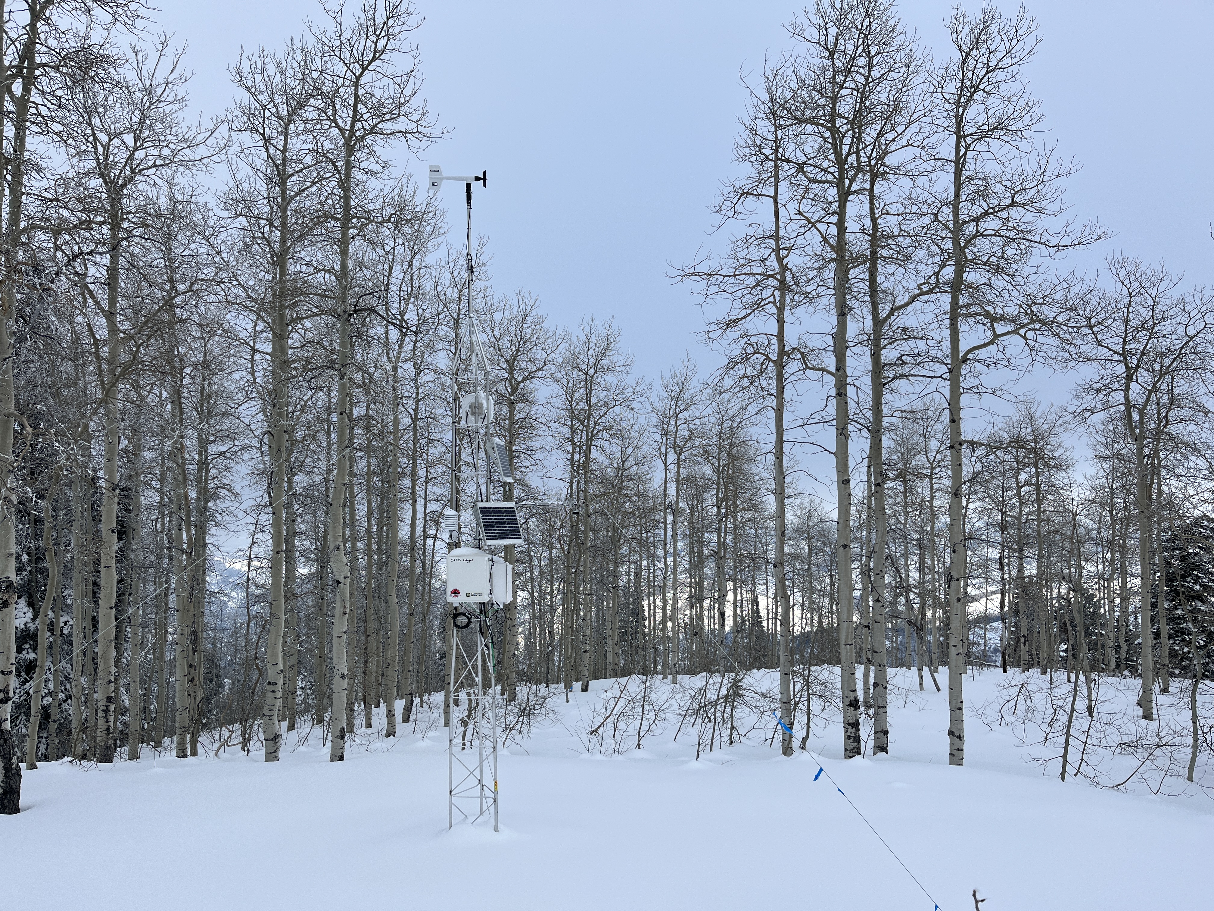
The Tony Grove Snotel at 8400' reports 44 inches of total snow, with overnight temperatures again above freezing. The CSI Logan Peak weather station at 9700' reports 28° F and 20 mph winds blowing from the south. Temperatures are hovering around 32°F at the new Card Canyon weather station with 33" of total snow on the ground.
Today will be cloudy and mild in the mountains, with a chance of light snow up high and a little rain lower. The inversion will persist through the workweek, with partly sunny conditions and mild daytime temperatures expected on Thursday and Friday. Snow is likely this weekend, with 3 to 5 inches of accumulation possible on Saturday, and snow continuing through Sunday. There is a chance of a little snow on Christmas Day, also with partly sunny skies.

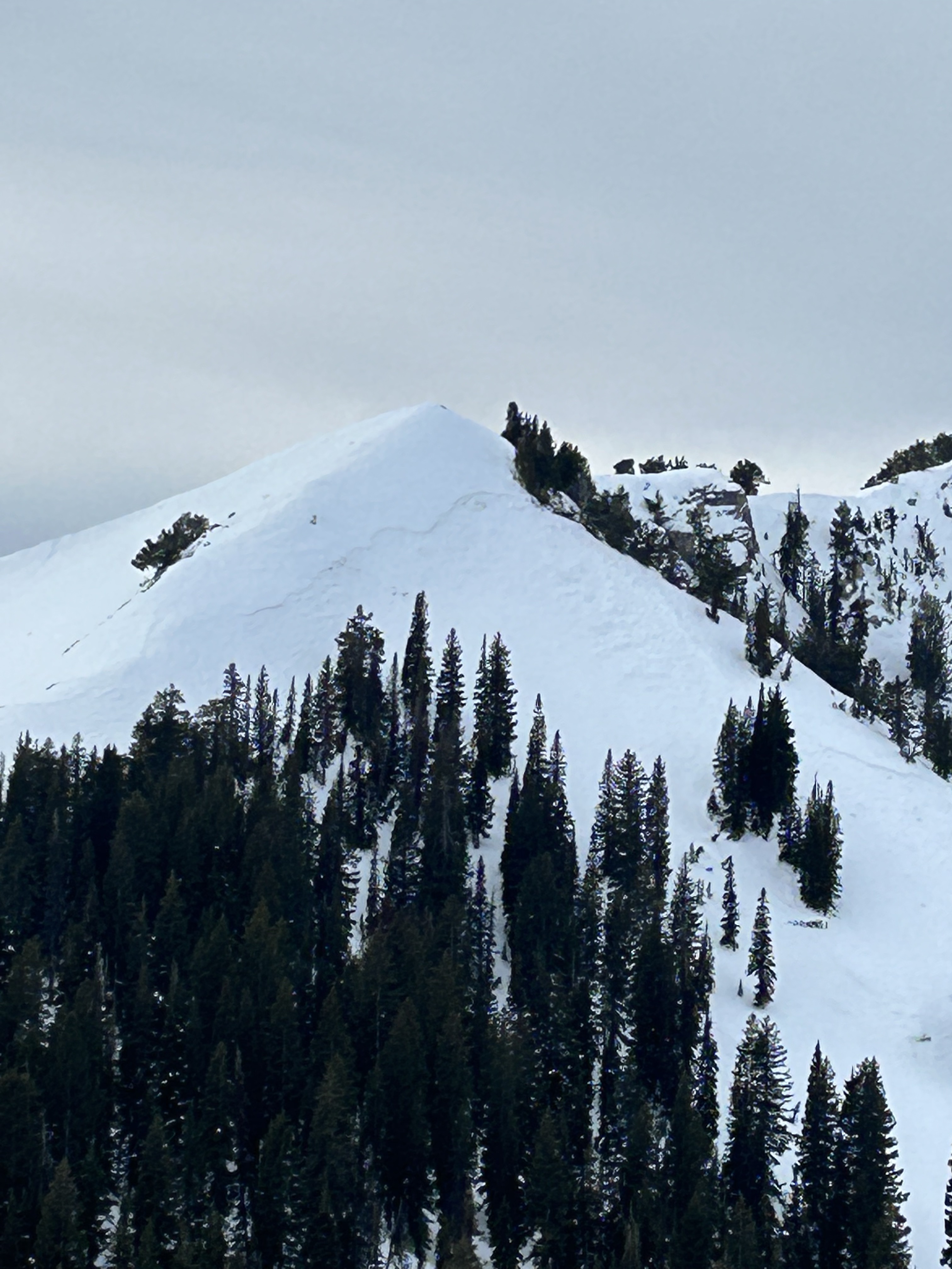
We found stable snow and pockets of good riding on and around Naomi Peak yesterday. Upper-elevation slopes have good coverage with pretty hard, right-side-up snow (softer near the surface and harder deeper). We found average total snow depths of more than 5 feet at around 9500'. Cloudy nights and warm air moisten the snow at low elevations, and it got sticky and gloppy on shady slopes yesterday. The good news is that the warmth and cloud cover is damaging much of the feathery surface hoar, and thin crusts now cap weak surface snow (consisting of near-surface facets) that was widely observed across the zone last week and over the weekend.
Recent Avalanches
No recent avalanches were reported in the Logan Zone.
  • Local observations are available HERE.
  • Visit our avalanche page to check out this season’s activity across Utah.
Ad
Avalanche Problem #1
Normal Caution
Type
Location
Likelihood
Size
Description
Even when the danger is LOW, always follow safe backcountry travel protocols when traveling on or under slopes steeper than about 30°:
  1. Be sure everyone in your party has working avalanche rescue equipment, including a transceiver, probe, and shovel. Practice with this equipment regularly, and include and instruct new partners.
  2. Cross avalanche paths and runout zones one person at a time, with the rest of the party watching from a safe place.
  3. Reevaluate and be willing to change your plans if you encounter apparent signs of instability, even if the forecast says the danger is LOW.

Low danger means avalanches are unlikely, not impossible. There are a few potential avalanche problems that you could encounter, especially in very steep or extreme mountain terrain.
  • Warmth and light rain may cause the snow at low elevations to be soft and saturated, and loose, wet avalanches are possible in some very steep, rocky, or cliffy terrain. The biggest problem with loose avalanches is being swept into terrain traps below, like trees, or off a cliff.
  • Winds are fairly light currently, but drifting from stronger winds is possible later in the week, and when drifts or wind slabs form on the weak surface snow, they may become sensitive and easily triggered by people.
  • Up high and on slopes facing west, north, and east, dangerous avalanches failing on a persistent weak layer remain possible in isolated outlying terrain where previously wind-drifted snow overlies weak, sugary snow from November.
Additional Information
Tuesday an observer spotted this crown of a natural avalanche in the Mt Naomi Wilderness that appears to have occurred more recently than those in the widespread natural cycle at the beginning of the month. It's on an ENE facing slope at around 9200' in elevation at the very top of Cherry Creek Canyon.

This fall, we installed two new weather stations in the Logan Zone. The Paris Peak Weather Station (available HERE) and the Card Canyon Weather Station (available HERE)
The Card Canyon weather station on Red Pine Ridge looks at 8700' total snow depth.
General Announcements
  • Taking time to check your companion rescue gear and practice with your transceiver is essential. Watch a short video here.
  • IMPORTANT: Read Mark's blog about electromagnetic interference of avalanche transceivers HERE.
  • We will update this forecast by Friday morning at 7:30 AM.
This forecast is from the U.S.D.A. Forest Service, which is solely responsible for its content. This forecast describes general avalanche conditions, and local variations always occur.