Join the UAC, Weston Backcountry, Utah Mountain Adventures, and more vendors this Sunday, January 29 for the Brighton Beacon Bash near the Milly Chalet from 9 am to 4 pm. Beacon practice, backcountry ski and board demos, and much more! Click
HERE for more info.
This morning, skies are overcast. Temperatures are in the single digits and low teens. Winds are blowing from the north northwest between 10-15 mph with gusts up to 25 mph at mid-elevations. At upper elevations, winds are gusting up to 40 mph. Overnight another trace to 2" of new snow fell.
Today, it will remain partly cloudy with the potential for occasional light, low-density snowfall. Accumulation would be minimal, with another trace to 2" of snow. Temperatures will climb into the low 20s F. Winds will remain north northwesterly, averaging 5-15 mph with gusts up to 25 mph at mid-elevations. At upper elevations, winds will average 20-30 mph, with gusts up to 55 mph.
Many observers have noted a weakening snow surface, or weak snow just below the wind-drifted snow. With a few inches of new snow, and a weakening snow surface small loose avalanches are possible in protected steep terrain at all elevations. If the sun comes out at any point today, look for warming on any solar aspect at mid and lower elevations and avoid traveling underneath these slopes as an avalanche in steep rocky terrain could lead to an injury.
Yesterday there were multiple reports of sensitive soft slab avalanches of both wind-drifted snow and new snow along upper-elevation terrain and ridgelines.
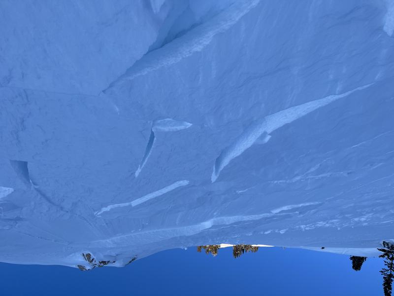
A small wind slab triggered along the Pine Creek/Snake Creek Ridgeline while traveling the uphill. Read the full observation HERE.
Glide cracks are visible in areas of
Broads Fork, including Bonkers and Stairs Gulch. Open glide cracks can lead to full-depth glide avalanches, though the timing between the initial appearance of a crack and an actual glide avalanche can be anywhere between seconds and months. Glide avalanches are unlikely to be triggered by a person, but natural failures are very challenging to predict. Practice safe travel techniques of exposing only one person at a time while traveling underneath these open cracks.
Catch up on backcountry observations
HERE.


