Join us at our 2nd Annual Blizzard Ball

Forecast for the Salt Lake Area Mountains

Dave Kelly
Issued by Dave Kelly on
Tuesday morning, January 24, 2023
The avalanche danger is MODERATE on upper-elevation slopes where you may trigger wind-drifted snow avalanches. The avalanche danger is LOW on mid and lower elevation slopes where there is less wind-drifted snow.

With increased wind and new snow forecasted this afternoon be on the lookout for changing surface conditions as that will be your indicator to rising avalanche hazard.
Low
Moderate
Considerable
High
Extreme
Learn how to read the forecast here
Weather and Snow
Under partly cloudy skies temperatures are in the single digits F. Winds are blowing from the northwest 25 gusting to 40 MPH at the highest ridgelines and 10 gusting to 25 MPH at the 9,000' ridgelines. Last night 1-2" of snow fell. For today, winds will blow from the northwest 20 gusting to 35 MPH at the 9,000' ridgelines and 30 gusting to 55 MPH at the 11,000' ridgelines. Wind speeds will increase this afternoon. Skies will be partly cloudy with mountain temperatures 16-20 F. Expect increasing clouds and 2-4" of snow this afternoon.
Small loose avalanches are possible in steep terrain at all elevations. Yesterday, even with temperatures barely creeping into the mid 20's F there were reports of wet loose activity on steep solar aspects. Look for warming on any solar aspect at mid and lower elevations and avoid traveling underneath these slopes as an avalanche in steep rocky terrain could lead to an injury.
Recent Avalanches
Yesterday there were reports of natural dry and wet loose avalanches in steep terrain in the Provo area mountains; and small skier triggered wind-drifted snow avalanches above the town of Alta and in the Snowbasin backcountry.

Catch up on backcountry observations HERE.
Ad
Avalanche Problem #1
Wind Drifted Snow
Type
Location
Likelihood
Size
Description
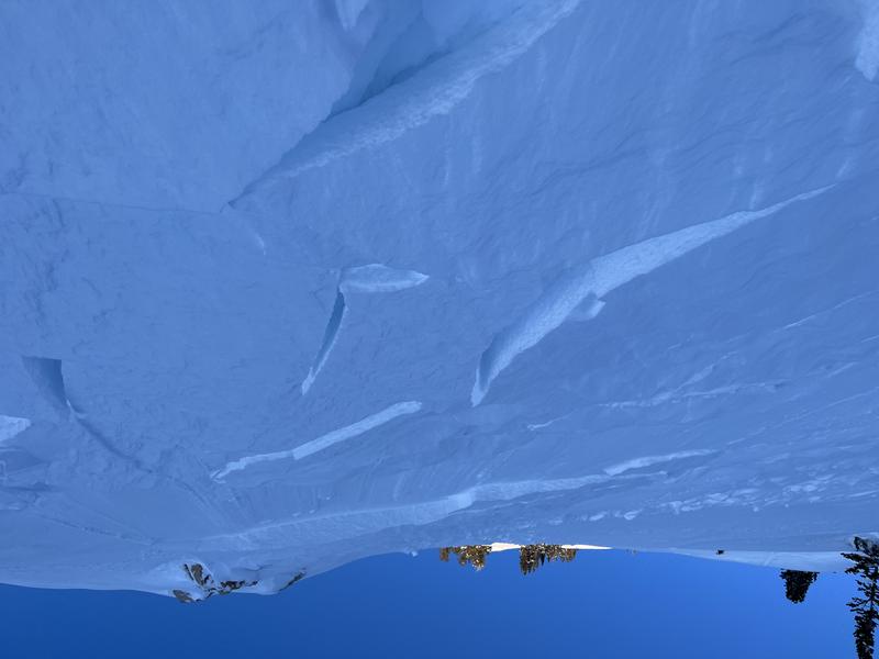
Soft slabs of wind-drifted snow is the concern for today. Variable wind directions over the last twenty-four hours have loaded snow onto all aspects in upper elevation terrain. Look for shooting cracks and avoid smooth and rounded deposits of new snow as these are places where you could be swept off your feet.
A small avalanche can be consequential if it takes you over a cliff band or through trees.

Wind-drifted avalanche on a south facing slope at 9,200' (Photo-Karol)
General Announcements
This information does not apply to developed ski areas or highways where avalanche control is normally done. This forecast is from the U.S.D.A. Forest Service, which is solely responsible for its content. This forecast describes general avalanche conditions and local variations always occur.