UDOT PLANNED AVALANCHE CLOSURES!!

Forecast for the Salt Lake Area Mountains

Greg Gagne
Issued by Greg Gagne on
Friday morning, January 13, 2023
The avalanche danger is MODERATE on all slopes. Watch for fresh wind drifts 6-12" thick at the upper elevations. On aspects facing northwest through north and east at the mid and upper elevations, avalanches may break down several feet deep and hundreds of feet wide.
Warm temperatures may cause both natural and human-triggered small, wet-loose avalanches on all aspects at the low and mid elevations.
Low
Moderate
Considerable
High
Extreme
Learn how to read the forecast here
Special Announcements
There have been wildlife sightings, including a Momma moose with two calves in Mill D North. Although we all have appreciated the bountiful snowfall this winter, it has been hard on wildlife. Please be respectful of any wildlife you are fortunate enough to encounter by giving them a wide berth.
Weather and Snow
This Morning: Temperatures have slowly risen overnight with many locations right around 32 F, give or take a few degrees. Winds are from the south/southwest and are light through the mid elevations with gusts in the teens, but are much stronger at upper elevations with averages in the 20's mph and gusting into the upper 30's mph. Warm temperatures and sunshine have left behind a crust on most sunny aspects.
Today: Mostly-cloudy skies with temperatures rising well into the 30's F. South/southwest winds will increase by late morning, with gusts in the 20's mph at mid elevations and into the 50's mph at upper elevations.
This Weekend: Increasing winds today are in advance of a series of storms which should bring snow throughout much of this coming week. A few inches of accumulation by late Saturday afternoon, with more substantial snowfall expected Sunday and into the Dr. Martin Luther King holiday on Monday.
Recent Avalanches
Two small, skier-triggered avalanches were reported from Thursday: a pocket of wind-drifted snow in Wolverine Cirque and a shallow soft slab in Butler Trees. There were also reports of minor sluffs in wet-loose snow.
Thursday's clear skies provided for first class avalanche viewing, and although I encourage you to spend a few minutes reading through all the recent observations and avalanche activity, three natural avalanches from Wednesday and Thursday are particularly noteworthy:
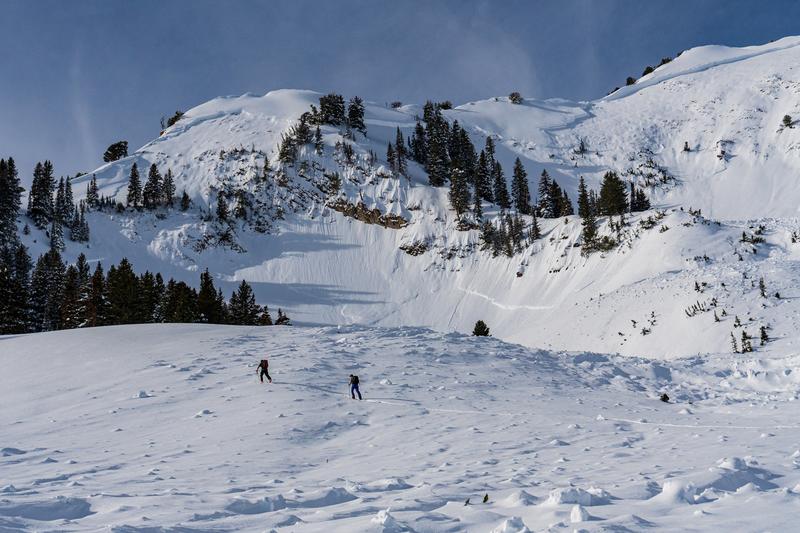
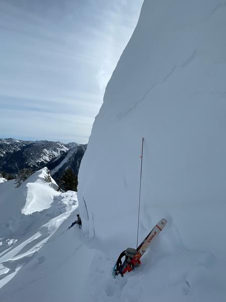
  • Gobblers Knob into Butler Basin. NE aspect at 10,200. 6-8' deep, 3,500' wide, ran close to 2,000' vertical. Failed on November facets. Trent visited the site on Thursday with retired UAC director Bruce Tremper, and Bruce said he has never seen that avalanche path run this big in his entire career in the Wasatch.
  • Mineral Fork. The entire west wall of Mineral Fork, from Barrieto to Moonlight.
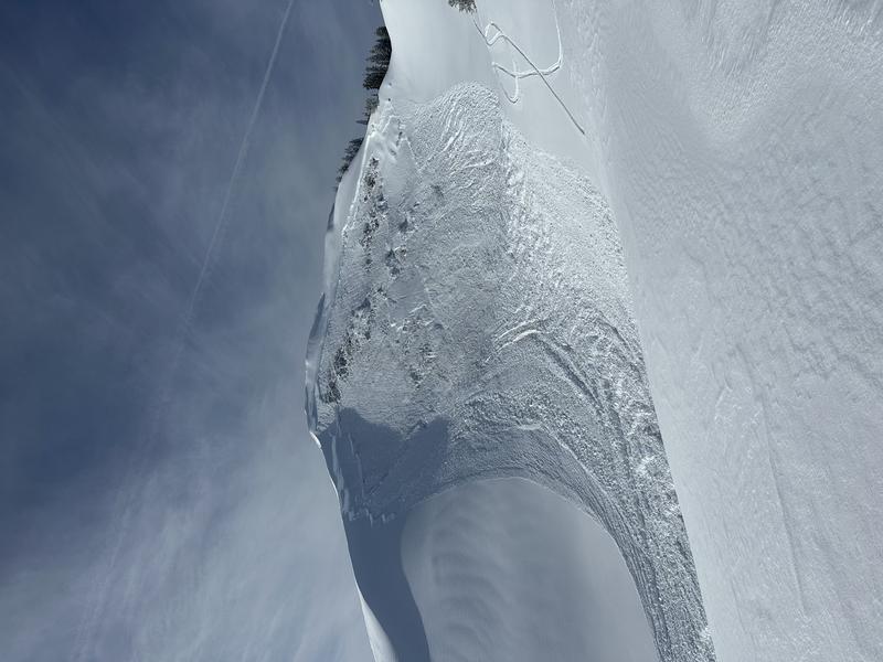
  • Grandview Peak (photo below). Estimated 6' deep and 500' wide.
Ad
Avalanche Problem #1
Persistent Weak Layer
Type
Location
Likelihood
Size
Description
Although the PWL of faceted snow has gained significant strength and is now buried over 6' deep in most areas, heavy/dense snowfall and strong winds over the past several weeks were going to ultimately find a weak layer. The photos below from the Gobbler's Knob natural avalanche that ran on November facets illustrates the possible size of an avalanche failing on this PWL. Although triggering one of these avalanches is unlikely, consider these consequences if you choose to get onto a slope where the PWL can be found. Suspect spots include heavily wind-loaded slopes in thinner snowpack areas, such as slopes adjacent to rocks, or in outlying regions, such as Lambs Canyon and Mt. Aire.
Avalanche Problem #2
Wind Drifted Snow
Type
Location
Likelihood
Size
Description
Today's south/southwest winds may create sensitive soft slabs of wind-drifted snow at the upper elevations, especially this afternoon as wind speeds increase. Watch for cracking in fresh wind drifts as an indication of unstable snow. Travel well back from corniced ridgelines as large cornices have developed this past week and today's winds may only increase their size and sensitivity. (How far back? Yesterday, my partner and I were traveling along the corniced ridgeline on Gobbers Knob above Alexander Basin and we were staying at least 30' from the edge.)
General Announcements
This information does not apply to developed ski areas or highways where avalanche control is normally done. This forecast is from the U.S.D.A. Forest Service, which is solely responsible for its content. This forecast describes general avalanche conditions and local variations always occur.