Join us for the 17th Annual Professional Snow and Avalanche Workshop (PROSAW) on November 4 - Purchase tickets here!

Forecast for the Logan Area Mountains

Trent Meisenheimer
Issued by Trent Meisenheimer on
Monday morning, January 9, 2023
There is CONSIDERABLE avalanche danger on all mid and upper-elevation slopes facing west, through north, and east. Here, people could trigger large and dangerous avalanches failing on a persistent weak layer buried 2 to 5 feet deep.
A MODERATE avalanche danger exists on all steep slopes with fresh soft slabs of wind-drifted snow. Here, human-triggered avalanches 1-2' deep are possible.

At lower elevations, we have a LOW avalanche danger where avalanches are unlikely to happen.
Low
Moderate
Considerable
High
Extreme
Learn how to read the forecast here
Weather and Snow
The National Weather Service has issued a Winter Storm Advisory that's in effect from 11:00 am this morning and will last into Tuesday. This two-part storm will begin with an increase in southerly winds that could reach speeds of 30-40 mph this morning. The storm starts warm, and the rain/snow line will ebb and flow around 6,000' in elevation. Snow will begin to fall around lunchtime, lasting into the overnight hours, and could stack up to 11-15 inches of new snow by tomorrow morning.
The second wave moves in late Tuesday evening and will last into Wednesday, where we could see an additional 8-10 inches of new snow by Thursday morning. A drying trend will follow on Thursday/Friday, with another storm on tap for the weekend.
This morning on Logan Peak, the southerly winds are blowing 25-30 mph with mountain temperatures at 19°F. There is powder and excellent riding conditions on almost all aspects and elevations. On sunlit terrain, you will find a slight zipper (melt-freeze) crust that will make riding less enjoyable.
Recent Avalanches
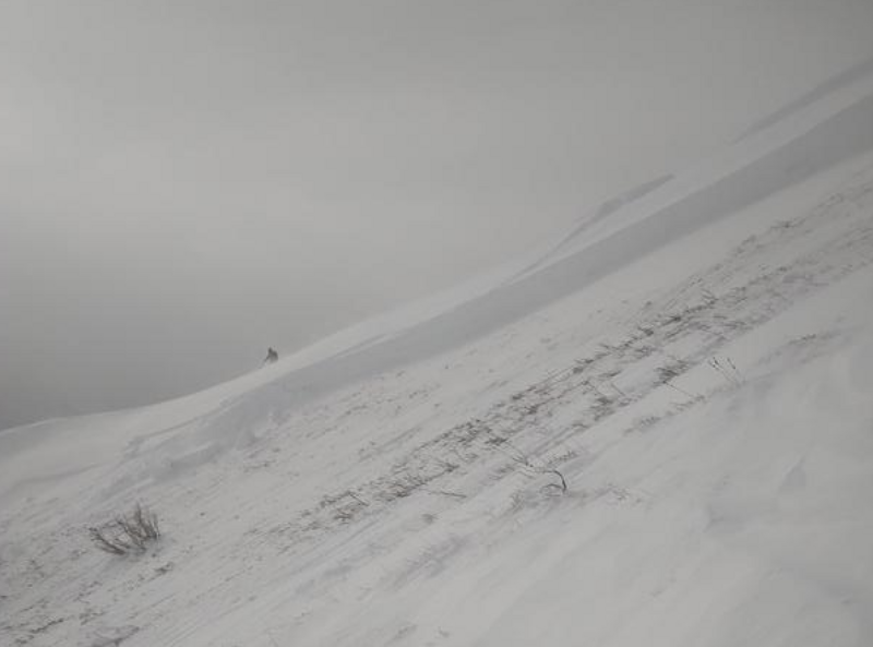
Yesterday a party of skiers had a close call in the Wellsville Mountain Wilderness in South Bowl. As the skiers descended, they triggered a very large slab avalanche 6 feet deep and 175 feet wide, running 1,500 vertical feet downhill. Thankfully nobody was caught in this avalanche, as the outcome would have been traumatic. Thank you for writing up this avalanche and submitting an observation.
In zones south of Logan, backcountry riders reported many wind slab avalanches, and in the Central Wasatch Range, we had three people swept off their feet and took rides in avalanches yesterday. Check out this video.
Photo: Rouse showing the crown of the avalanche.
Ad
Avalanche Problem #1
Persistent Weak Layer
Type
Location
Likelihood
Size
Description
In many places, people could trigger large and dangerous avalanches failing on a deeply buried, sugary persistent weak layer. Such an avalanche could be triggered remotely, from a distance or below. The persistent weak layer from November is now buried 2-5 feet deep, and any avalanche that fails on it will likely be hundreds of feet wide.
Stability has significantly improved in upper-elevation terrain in areas with a deep snowpack (greater than 5 feet deep). However, poor snow structure still exists in many places where a person could trigger the slope from an area where the slab is shallower, and a dangerous deep hard slab avalanche could result. For now, I would continue avoiding steep avalanche-prone terrain.
Avalanche Problem #2
Wind Drifted Snow
Type
Location
Likelihood
Size
Description
As strong southerly winds ramp up and blow and transport snow, they'll add more weight to slopes. A smaller wind slab avalanche overrunning a slope with a poor snow structure could cause a much larger avalanche to step down to our now deeply buried November persistent weak layer.
  • As always, look for and avoid drifts on the lee side of prominent ridges, on corniced slopes, and in and around terrain features like cliff bands, mid-slope break overs, gully walls, sub ridges, saddles, and sinks.
  • Human-triggered avalanches 1-2' deep are possible in areas being loaded by the wind.
General Announcements
  • Remember, when you leave the ski area boundary, Beaver Mt or Cherry Peak, you are entering the backcountry, and you could trigger dangerous avalanches.
  • Please submit your observations from the backcountry HERE.
  • For a list of avalanche classes from the Utah Avalanche Center go HERE
  • For information on where you can ride your sled or snowbike, check out this map of the winter travel plan for the Tony Grove and Franklin Basin Areas HERE.
This forecast is from the U.S.D.A. Forest Service, which is solely responsible for its content. This forecast describes general avalanche conditions and local variations always occur.