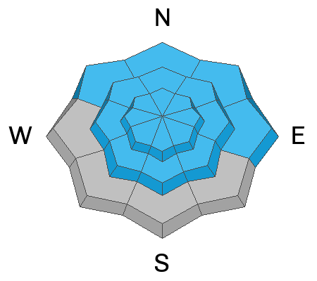
Join us at our 2nd Annual Blizzard Ball

Forecast for the Salt Lake Area Mountains

Greg Gagne
Issued by Greg Gagne on
Friday morning, January 6, 2023
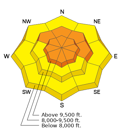
The avalanche danger is CONSIDERABLE on all upper elevation aspects and mid-elevation aspects facing northwest through north and east where human-triggered avalanches are likely and natural avalanches possible. The avalanche danger is MODERATE on all other aspects where human-triggered avalanches are possible. The avalanche danger could quickly rise to HIGH during any period of high precipitation intensity.
On slopes where there is a deeply-buried persistent weak layer, especially mid and upper elevation aspects facing northwest through north and east, avalanches may break down several feet deep, leading to large and destructive avalanches.
Fortunately there is great riding on slopes less steep than 30 degrees away from avalanche terrain.
Low
Moderate
Considerable
High
Extreme
Learn how to read the forecast here
Weather and Snow
This Morning: Temperatures are in the upper teens and the moderate to strong southerly winds on Thursday have shifted to the northwest and are gusting into the teens and 20's mph at mid-elevations and into the 40's mph at upper elevations. Snowfall totals from overnight are 8-15" along the Park City ridgeline and Cottonwoods, with the highest amount in upper Big Cottonwood Canyon.
Today: The National Weather Service has issued an Winter Storm Warning through 2 pm this afternoon, with heavy snowfall through the morning, transitioning to light snow showers this afternoon. An additional 6-10" of snow is expected by the end of the day. Winds will be from the northwest, and slowly diminish throughout the day. At mid-elevations, winds will average in the teens with gusts in the 20's mph, with upper elevations averaging in the 20's with gusts in the 40's mph. Temperatures will range through the 20's F.
This Weekend: Mostly sunny on Saturday with January-like temperatures in the 20's. Light snowfall later in the day on Sunday, with a chance for more substantial snow around Tuesday or Wednesday.

Snow Depths throughout the Wasatch
  • Cottonwood Canyons 70-120"
  • PC Ridgeline 50-90"
  • Ogden Area Mountains 70-90"
  • Provo Area Mountains 50-90"
Recent Avalanches
The only backcountry avalanche reported from Thursday occurred at 10,700' on a southwest aspect on Little Superior - where a skier was caught and briefly carried on a pocket of snow that was likely wind-loaded.
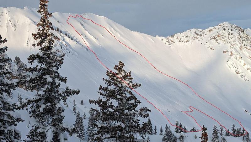
With good visibility the past two days, observers have been finding more avalanches that ran during the New Year's cycle. This includes both long-running sluffs and soft slab avalanches within the new snow, as well as larger avalanches failing on the persistent weak layer. The largest, recently-reported avalanche was on Cardiac Ridge (photo below). You can check out all of the recently reported avalanches.
Ad
Avalanche Problem #1
New Snow
Type
Location
Likelihood
Size
Description
Today's storm snow may be reactive - especially during the morning hours with periods of heavy snowfall possible. This includes long-running sluffs and sensitive slabs of new snow 12-18" thick. Watch for signs of cracking in the storm snow as indication of sensitive conditions.
The avalanche danger may quickly increase during any period of high precipitation intensity with both natural and human-triggered avalanches likely.
Avalanche Problem #2
Persistent Weak Layer
Type
Location
Likelihood
Size
Description
Our deeply-buried persistent weak layer (PWL) continues to gain strength and we are moving in the right direction. But I continue to avoid steeper slopes on aspects facing northwest through east where the PWL has been the most-reactive as any avalanche may break down several feet deep and hundreds of feet wide. A UAC team went into Broads Fork on Thursday and commented "they didn't like the structure [of strong snow over weak snow]". Visiting UAC Moab forecaster Eric Trenbeath described the PWL situation well in the following video:
With wind-loading and today's storm snow putting an additional stress on this buried weak layer, it is still not yet time to venture into terrain steeper than 30° where the PWL is present.
Avalanche Problem #3
Wind Drifted Snow
Type
Location
Likelihood
Size
Description
Today's northwest winds will have plenty of fresh snow to create sensitive soft slabs of wind-drifted snow, primarily at the upper elevations, but also in some exposed mid-elevation terrain. Watch for cracking in denser snow as an indication of sensitive fresh wind drifts.
General Announcements
This information does not apply to developed ski areas or highways where avalanche control is normally done. This forecast is from the U.S.D.A. Forest Service, which is solely responsible for its content. This forecast describes general avalanche conditions and local variations always occur.