Observation Date
12/7/2022
Observer Name
Staples & Sisk
Region
Salt Lake » Big Cottonwood Canyon » Bear Trap » Cone
Location Name or Route
Cone
Comments
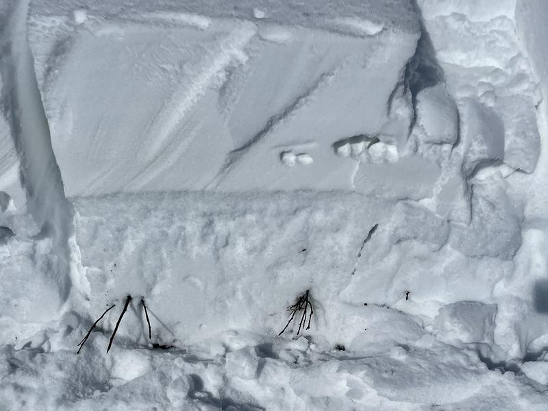
Southerly facing slopes have the Nov PWL, but it is capped by ice crusts of varying thicknesses and hardnesses. Slopes with a thick, hard ice crust will require a heavy load of new snow and/or wind-blown snow to cause an avalanche on these facets. Slopes with a more fragile crust (like ESE) wil not require as much of a load. There has basically been no avalanche activity on this layer on southerly facing slopes. One reason is that many of these slopes were scoured by very strong south winds on Nov 30th and Dec 1. Read more details about the weather HERE.
The danger and likelihood of triggering avalanches on this layer on southerly facing slopes has dropped. Until it is tested and buried by some decent storms, we can't ignore it.
Also, we did see some small surface hoar on open slopes that likely got buried by snow the night of Dec 7th. The snow surface also seemed like maybe it "dried out" a touch which usually means it faceted a little bit, but we didn't look too closely at this.

Video
Danger rating of MOD is for southerly slopes. Avalanches are still possible but the likelihood of triggering one on these slopes is less than the likelihood of triggering one on a northerly or easterly facing slope.
Today's Observed Danger Rating
Moderate
Tomorrows Estimated Danger Rating
Moderate
Coordinates


