SAVE THE DATE and TAKE A DATE... SEE YOU WEDNESDAY NIGHT!
Grab your riding posse and sign up for the 15th Annual
Utah Snow and Avalanche Workshop (USAW). You've got a couple days left to join us for an evening of solid avy education, brought to you by a remarkable group of presenters, all delivered virtually to the comfort of your own home... November 9th. Sign up and get more info
HERE.The
Avalanche Professional and Ski Patrol Snow and Avalanche Workshop (PROSAW) will be during the day of November 7th. Sign up and get more info
HERE.
Get your avy savvy groove goin'-
It's never to early to start thinking about avalanches. A few things to consider doing:
Attend USAW and learn more about avalanches and decision making.
Sign up for an avalanche class.
Take the
online courses listed on the KBYG website (Develop skills -> Online Learning).
Get your avalanche rescue gear ready for winter. Put fresh batteries in your transceiver and update the firmware. Inspect your shovel and probe. Get your airbag backpack ready by possibly doing a test deployment and update the firmware if it is an electric version.
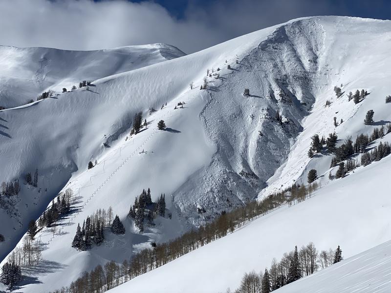
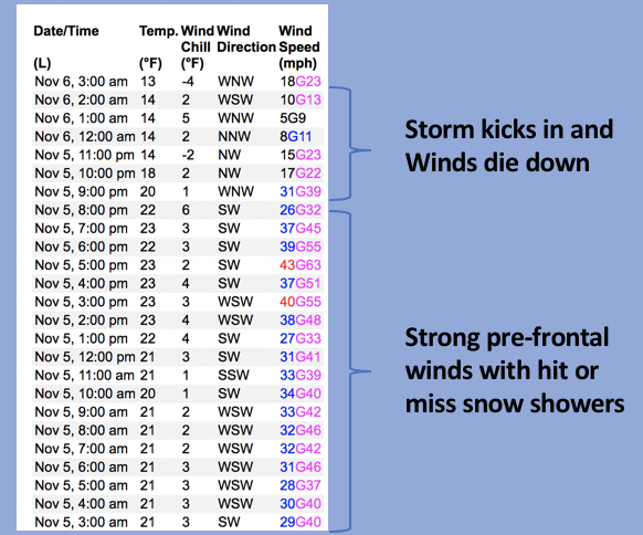
Nowcast- Our storm was unfashionably late to the party, but it rolled in none-the-less, right around 8:00 last night, quickly stacking up 8" of dense snow with nearly an inch of water. The recent storms have favored the North Slope and I think there's close to a foot of fresh snow in the Whitney Basin zone. Yesterday's cow tipping west and southwest winds blasted the ridges, but died down as the storm arrived, switched to the northwest and currently blow 10-20 mph along the high peaks. Temperatures register in the low to mid teens across the board. Total snow depths average 18"-24"... just enough coverage for a few turns on a grassy meadow or a quick rip with the sled on a smooth, rock free road.
Forecast- Expect a few lingering snow showers this morning with light west and northwest winds blowing in the teens and low 20's along the high ridges. Winds shift to the southwest and bump into the 30's as the day progresses. High temperatures rise into the upper 20's and low 30's.
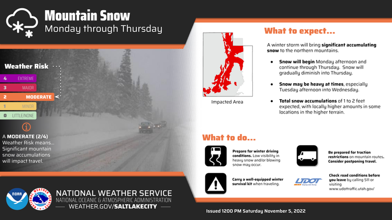
Furturecast- Southerly winds crank into the 30's and 40's overnight as another solid blast of moisture heads our way. The storm kicks into gear Monday afternoon and lingers through Wednesday. A foot of snow is a good bet.
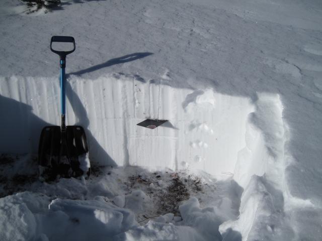
Ted snagged this recent pit profile from Bald Mountain which is quite representative of much of the range.
No recent avy activity to report. Trip reports are found
HERE