Forecast for the Uintas Area Mountains

Craig Gordon
Issued by Craig Gordon for
Saturday, November 5, 2022
Expect a rising avalanche danger as today's storm evolves-
Dense, heavy snow coupled with strong wind, whips up fresh drifts along the leeward side of upper elevation ridges and around terrain features like chutes and gullies. Today you'll want to avoid steep terrain facing the north half of the compass with these characteristics, especially slopes with an easterly component to its aspect. And remember... any avalanche triggered today can result in a season ending, traumatic injury.
Low
Moderate
Considerable
High
Extreme
Learn how to read the forecast here
Special Announcements
SAVE THE DATE and TAKE A DATE... SEE YOU NEXT WEDNESDAY NIGHT!
Grab your riding posse and sign up for the 15th Annual Utah Snow and Avalanche Workshop (USAW). You've got one night left to join us for an evening of solid avy education, brought to you by a remarkable group of presenters, all delivered virtually to the comfort of your own home... November 9th. Sign up and get more info HERE.
The Avalanche Professional and Ski Patrol Snow and Avalanche Workshop (PROSAW) will be during the day of November 7th. Sign up and get more info HERE.
Get your avy savvy groove goin'-
It's never to early to start thinking about avalanches. A few things to consider doing:
Attend USAW and learn more about avalanches and decision making.
Sign up for an avalanche class.
Take the online courses listed on the KBYG website (Develop skills -> Online Learning).
Get your avalanche rescue gear ready for winter. Put fresh batteries in your transceiver and update the firmware. Inspect your shovel and probe. Get your airbag backpack ready by possibly doing a test deployment and update the firmware if it is an electric version.
Weather and Snow
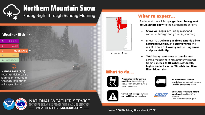
Nowcast- Hang on to your hats... if you you wear one! An atmospheric river on the doorstep ushers in thick clouds with with mild temperatures, currently registering in the low 30's... which is nearly 20 degrees warmer than yesterday at this time. West and southwest winds crank in the 30's and 40's, with a gust or two near 50 mph along the high peaks.
Forecast- Snowfall rates increase later this morning as the bulk of moisture moves into our region. We can expect 4"-6" of snow today with an additional 8"-12" of snow overnight. Westerly winds blowing in the 40's pound the ridges and gusts near 70 mph torch the peaks. Temperatures remain mild and in the 30's with overnight lows dipping into the low to mid 20's.
Furturecast- A break in the action is slated for Sunday with another storm in the queue on Monday.
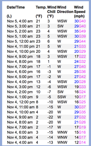
Above is a 24 hour data dump from Wind Peak (10,661')
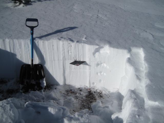
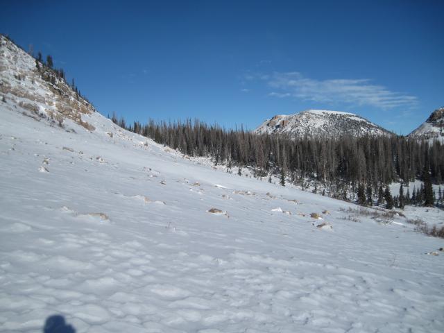
Ted grabbed this pit profile from Bald Mountain which is quite representative of much of the range.

Recent Avalanches
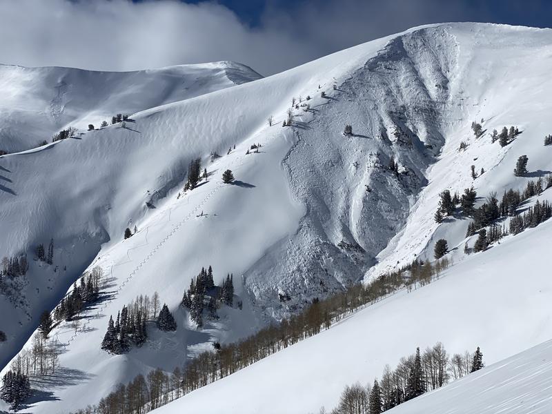
No recent avy activity to report. Trip reports are found HERE
Ad
Avalanche Problem #1
Wind Drifted Snow
Type
Location
Likelihood
Size
Description
Yesterday, Ted was in the Bald Mountain zone and Micheal J and I linked up near Wolf Creek and we all came to the conclusion of the obvious... travel is pretty limited to upper elevation terrain and that's exactly where today's hazard exists, especially on steep wind drifted slopes facing the north half of the compass. As today's storm materializes, I suspect drifts become more widespread and once triggered, have the potential to break deeper and wider than you might expect. Remember, even a small wind drift can easily knock you off your feet and slam you into a group of trees or over a cliff band.
Additional Information
Of course, early season roadside attractions like Murdock Bowl off the Mirror Lake Highway or Wolf Creek Bowl along Highway 35 become likely suspects as roadside, park n' ride grabs. Here's the deal... just 'cause you can see it from the road, that doesn't necessarily mean it's safe and good to go.
And we've been super busy this summer upgrading the western Uinta weather station network and this real-time info is found HERE (click weather stations, and then on Western Uinta tab)
Your observations are important, so please let me know what you're seeing... click HERE and contribute to this amazing community based program
General Announcements
Issued at 04:04 on Saturday November 5th, this information expires 24 hours after the date and time posted.
I will update this forecast as conditions change and then once winter kicks into gear you can expect the usual daily forecasts issued by 07:00... or perhaps earlier :)
Before it gets too crazy, now is the time to book an avalanche awareness presentation for your group, club, or posse. You can reach me directly at 801-231-2170 or [email protected]
This forecast is from the U.S.D.A. Forest Service, which is solely responsible for its content. This forecast describes general avalanche conditions and local variations always occur.