Please help support avalanche forecasting throughout Utah. For more deets about the Spring Campaign to help raise funds and support the forecasting you rely on simply click
HERE.NOWCAST-
A band of high clouds drift into the region as a big, bright, beautiful Crow Moon sets, casting a muted light on our mountains early morning. Temperatures cooled overnight and currently register in the teens and low 20's. Winds are light and westerly, blowing just 10-15 mph even along the high peaks. Riding and turning conditions remain quite good, but soft snow is becoming more elusive. If you've only got one day to ride this weekend, maybe choose Sunday when you'll be greeted with a fresh coat of white paint.
FORECAST-
The warm before the storm. Look for increasing clouds, temperatures soaring into the 40's, and southwest winds ramping into the 30's and 40's by days end.
FUTURECAST-
The storm settles in for a quick visit on Sunday, but sticks around long enough to deliver colder temperatures and snow totals in the 4"-8" range.
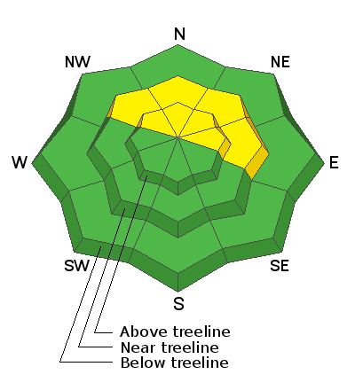
As for snow conditions- you've gotta be on your game this time of the year as the sun is high in the sky and it has baked all but the most northerly facing slopes in the alpine. But don't let your soft snow heart be troubled, there are large swaths of shallow, cold snow... just don't stray too far off aspect or you'll be dealing with varying degrees of breakable crust.
Trip reports and snowpack observations are found
HERE.
Looking for real-time temps, snow, or wind? Click HERE and then on the "western Uinta" tab for western Uinta specific, weather station network.
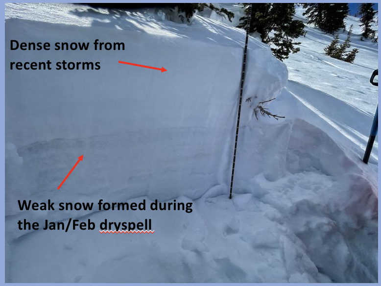
Most avalanche activity occurred last weekend (links to some of those slides below). The tail end of this week has been quiet and that is a function fewer people (aka triggers) as well as a slight decrease in sensitivity of the buried persistent weak layer.