Fall Auction is now live! Check it out now

Forecast for the Moab Area Mountains

Eric Trenbeath
Issued by Eric Trenbeath on
Friday morning, February 25, 2022
Avalanche conditions remain tricky and dangerous!
The avalanche danger is CONSIDERABLE on steep, wind drifted slopes facing the north side of the compass and human triggered avalanches are likely in these areas. A MODERATE avalanche danger exists on all other steep slopes and human triggered avalanches remain possible. Backcountry travelers need to have excellent route finding skills and know how to recognize and avoid avalanche terrain.
Low
Moderate
Considerable
High
Extreme
Learn how to read the forecast here
Special Announcements
Road Conditions: Grand County plowed yesterday but they may be up doing additional work today. Check back for updated information or head up early.
Grooming: LUNA Matt will be up grooming today.
Weather and Snow
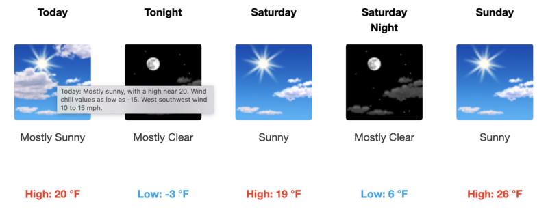
6:00 a.m. weather data:
24 Hour Snow 0" 72 Hour Snow 18" Base Depth at Gold Basin 60" Wind SW 10-20 Temp 6F
It's been great to see the return of winter and some significant snowfall! Storm totals for the week are up to around 30" at 2.0" of SWE (Snow Water Equivalent). It looks like that's going to be it for awhile so get it while you can. The good news is that conditions are going to remain cool, and winds should be pretty well behaved for the next little while so the snow should stay good through the weekend.
NWS Weather Forecast for the La Sal Mountains
Gold Basin SNOTEL site (10,000')
Storm Totals in Gold Basin
Wind Station on Pre Laurel Peak (11,700')
Snowpack
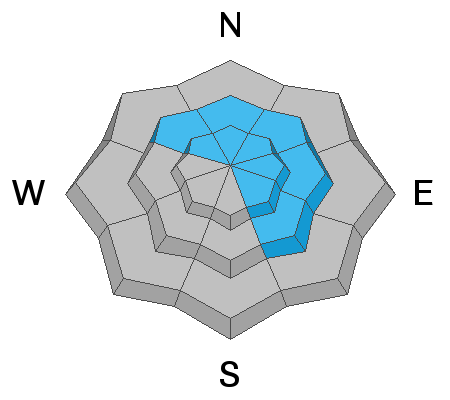
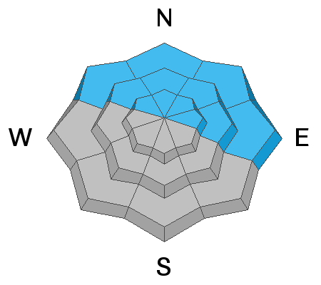
Deep and drifted snow is the story out there right now but some settling has occured. Throughout much of the storm cycle SW winds have blown and drifted snow onto leeward aspects and northerly facing slopes are heavily loaded. Drifts have formed over a variety of old snow surfaces including hard and crusted, to loose, weak and faceted. The weakest underlying snow can be found on sheltered, northerly facing slopes right around treeline. Above treeline the distribution of this weak layer is much more variable. For now however, the immediate threat comes from new and especially wind drifted snow and steep, wind drifted slopes should be avoided. As the snow settles out and the danger becomes less obvious, the presence of buried weak, faceted snow will continue to be problematic.
I was down in the Abajo Mountains yesterday and found sensitive avalanche conditions with about 16" of new snow.
Recent Avalanches
In our travels on Wednesday, UAC director Mark Staples, and I observed a handful of pockety, natural wind slab releases. Though not very wide they looked to be about 2'-3' deep. We were also able to trigger this wind drift on a steep, NE aspect right around treeline. Only about 30' wide, it measured up to2 4" deep and failed on weak, sugary, facets.
Ad
Avalanche Problem #1
Wind Drifted Snow
Type
Location
Likelihood
Size
Description
Deep, unstable wind drifts have formed on the leeward sides of ridge crests and terrain features, near treeline and above, primarily on slopes facing NW-N-E-SE. Triggered wind slabs will produce avalanches up to 3' deep or possibly greater and all steep, wind drifted slopes should be avoided.
Avalanche Problem #2
Persistent Weak Layer
Type
Location
Likelihood
Size
Description
Recent and wind drifted snow has begun to pile up on a variety of old snow surfaces and faceted, weak layer combinations. The weakest snow can be found on sheltered, northerly aspects where the degree of near surface faceting was greatest. Branching out from there, a variety of crust/facet combinations can be found. The uneven and variable type of weakness makes things tricky, but for now it should be assumed that human triggered avalanches failing on a buried weak layer remain likely.
Avalanche Problem #3
New Snow
Type
Location
Likelihood
Size
Description
Human triggered avalanches within the recent snow remain likely on steep slopes on all aspects. These could come in the form of either loose snow or sensitive soft slabs. South facing slopes have less snow on them because of prevailing winds over the last several days, but any steep slope with more than about 8" of snow should be considered suspect. Utilize smaller tests slopes and see how the snow is behaving and look for signs of instability such as cracking in the snow surface.
General Announcements
Who's up for some free avalanche training? Get a refresher, become better prepared for an upcoming avalanche class, or just boost your skills. Go to https://learn.kbyg.org/ and scroll down to Step 2 for a series of interactive online avalanche courses produced by the UAC.
This forecast is from the U.S. Forest Service, which is solely responsible for its content. This forecast describes general avalanche conditions and local variations always occur.