Join us at our 2nd Annual Blizzard Ball

Forecast for the Salt Lake Area Mountains

Mark Staples
Issued by Mark Staples on
Wednesday morning, November 10, 2021
Tuesday's storm delivered up to 11 inches of dense snow accompanied by winds from both the south and west. Wednesday morning soft slabs of both wind drifted snow and new snow could be triggered but should be stabilizing through the day unless they are resting on some weak faceted snow that formed on the old snow surface near several ice crusts.
A few things to remember:
  • Triggering any avalanche regardless of its size can produce serious trauma even if it doesn't bury you because the snowpack is so thin.
  • Hitting rocks and stumps is a real danger. Don't end your season before it starts with an injury from hitting one of these obstacles.
  • Early season avalanches are a real possibility. It doesn't matter if you are hiking, hunting, skiing, etc., be prepared with the correct rescue gear and a partner. Many people have died during early season snowstorms.
  • Ski resorts all have different uphill travel policies. These closed resorts that allow uphill travel can be great places to get in a little skiing especially in you know of a rock-free slope, but it should be treated as backcountry terrain.

We will be issuing intermittent updates and publishing backcountry observations as they arrive. When we begin regular forecasts, we will begin issuing avalanche danger ratings.
Low
Moderate
Considerable
High
Extreme
Learn how to read the forecast here
Special Announcements
The 14th Annual Utah Snow and Avalanche Workshop is virtual again this year and will be held Nov 9th, 10th, 11th evenings from 6-9 pm. More info and speaker lineup on our Events page HERE.
Check all the upcoming education HERE.
Weather and Snow
Precipitation started on Tuesday at 10 a.m. with rain in the valleys and snow above 7,000'. Snowfall was heavy at times and reported to be mostly graupel in the afternoon and then ending around midnight. Total snow and water amounts are:
Upper Little Cottonwood Canyon - 11" snow (1.5" water)
Upper Big Cottonwood Canyon - 9" snow (0.9" water)
Park City Ridgeline - 6-8" snow (0.5-0.7" water)
Temperatures dropped 7 degrees F on average since yesterday. Wednesday morning temperatures are near freezing temps at many trailheads. and they are in the mid to low 20s F above 9,000'.
Winds shifted direction during the storm, blowing from the south and then from the west. They have been averaging 10-15 mph gusting 25-30 mph at many ridgelines. On top of many peaks at 11,000', winds have been blowing 20-30 mph with some gusts reaching 70 mph.
Upcoming weather: On Wednesday, winds should ease some before increasing again Wednesday night. Temperatures should generally remain cool and not heat up much. A little bit of snow may fall Wednesday night and some riming may occur as well. The long term forecast generally looks dry, but we'll see.

The good news is that the snowpack has been solid, supportable, and dense...for now. Most direct south-facing slopes are bare. Northerly facing slopes that haven't received as much sunshine have 2-3 feet of snow above 10,000 ft. In most places, the snow surface has warmed, melted, and refrozen which is a good thing. At higher elevations, as you approach 10,000', the snow surface is a little softer and contains several thin ice crusts.
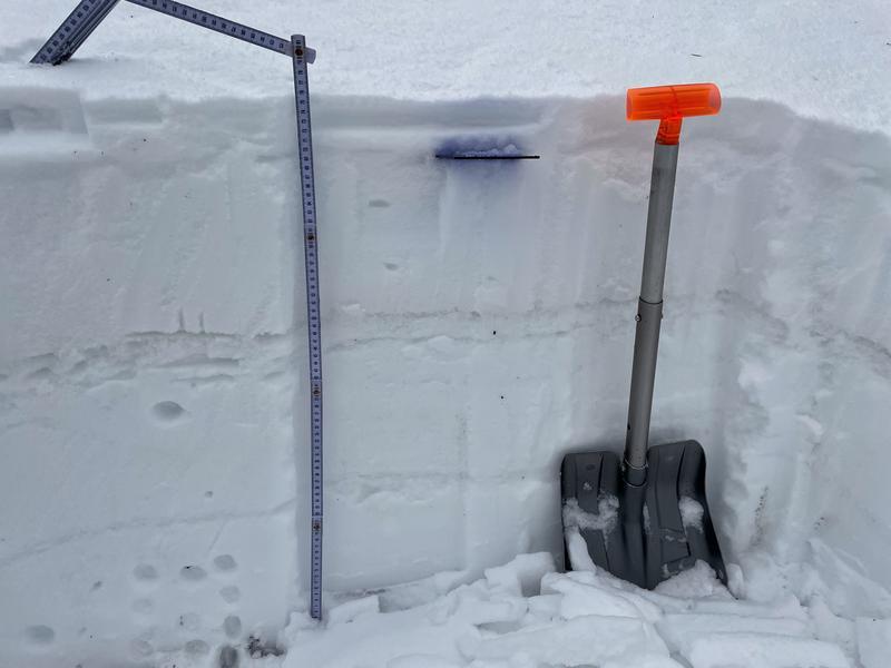
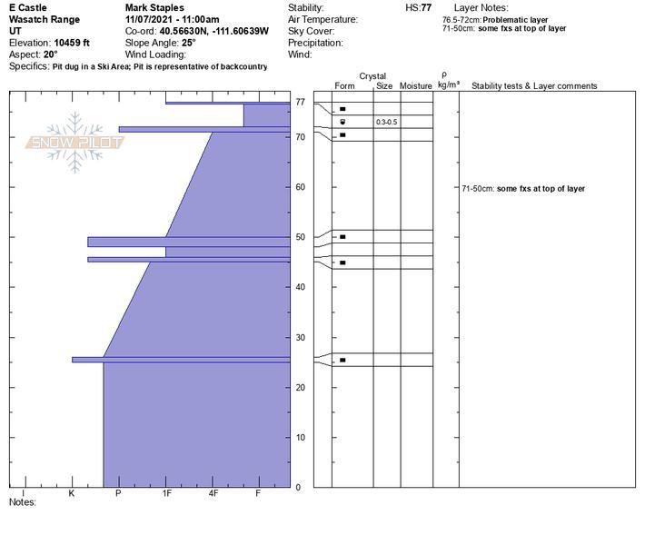
This weekend, I found some faceting and weakening had occurred in the snow around these crusts in upper Little Cottonwood Canyon (see photo and snow profile below), and another group found similar conditions on Tuesday. Below these near-surface layers, the snowpack is very hard and strong and dense. These fledgling near-surface facets are not a major concern at the moment, but a lot can change. We will also be watching what happens to the snow that falls tonight. If it sits for any length of time, it will like begin faceting as well. Now is a critical time for the development of the snowpack, so let's keep our fingers crossed that we start getting consistent snowfall before the weather gets much colder.
Recent Avalanches
No avalanches have been observed or reported; however, we did receive several excellent observations from upper Little Cottonwood Canyon yesterday. Please let us know if you see any and submit an observation here.
Ad
Avalanche Problem #1
Wind Drifted Snow
Type
Location
Likelihood
Size
Description
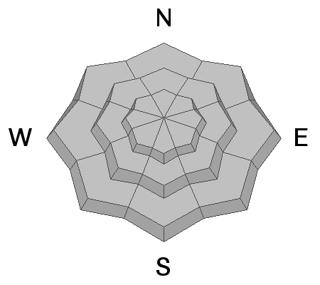
Winds on Tuesday started blowing from the south. As the storm progressed they shifted and were blowing from the west on Wednesday morning. I think fresh slabs of wind drifted snow near ridgelines would be easy to find and easy to trigger for the next 24-48 hours.
The dilemma is that where these wind slabs exist are often the slopes where we want to ride this time of year because they have the best snow cover. I doubt they would produce an avalanche large enough to bury a person (unless they involve a terrain trap), but they will likely cause trauma and end your season.

The wild card is that there has been some weakening and faceting at the snow surface prior to Tuesday's storm. We don't have a sense of how widespread that faceting has been, but the places where it has happened the most are upper elevation, northerly facing slopes....again, the dilemma being these are the places with the most snow. Watch for shooting cracks and whumphing which would be the snowpack's clue that those small facets exist and are unstable. Consider doing a few snowpack tests as well. The trouble with faceted snow is that if it exists under these fresh wind slabs, then the wind slabs can remain unstable for more than 48 hours.
Two observers (Collett & Wessler) filmed the winds yesterday morning at about 9800 feet and shared the video below.
Avalanche Problem #2
New Snow
Type
Location
Likelihood
Size
Description
During periods of heavy snowfall Tuesday night, there were likely many soft slabs of new snow that released or could have been easily triggered. I'm unsure how quickly the new snow will be settling and bonding to itself. I wouldn't be surprised to hear of some soft slabs triggered this morning, but I would be surprised by Wednesday afternoon.
General Announcements

This information does not apply to developed ski areas or highways where avalanche control is normally done. This forecast is from the U.S.D.A. Forest Service, which is solely responsible for its content. This forecast describes general avalanche conditions and local variations always occur.