


Forecast for the Uintas Area Mountains

Issued by Craig Gordon on
Sunday morning, March 21, 2021
Sunday morning, March 21, 2021
Heads up... if the sun comes out for any length of time, expect the danger of wet avalanche activity to instantly spike on steep sun-exposed slopes.
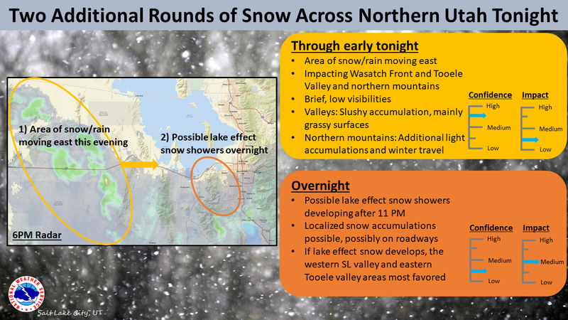
In the wind zone, at and above treeline you'll find CONSIDERABLE avalanche danger and human triggered avalanches are LIKELY, especially on steep, wind drifted, leeward slopes facing the north half of the compass.
And here's something to consider... if you're getting into steep, technical terrain, even a small slide can knock you off your ride, potentially slam you into a tree, and throw a curve ball at your day.
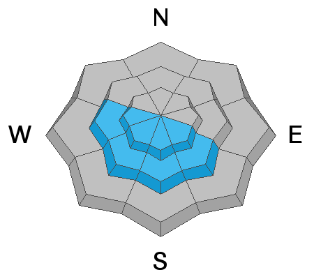
Lose some elevation and the avalanche danger is more straight-forward. Mid elevation leeward terrain offers MODERATE avalanche danger and human triggered slides are POSSIBLE on steep wind drifted slopes.
Low elevation wind sheltered terrain offers generally LOW avalanche danger.

Low
Moderate
Considerable
High
Extreme
Learn how to read the forecast here
 Special Announcements
Our Spring Avy Awareness Campaign is in full swing from March 16th- March 30th. Please help us save lives through avalanche forecasts and education. Consider making a donation to show your support.
 Weather and Snow
Nowcast-
Wow.... a nice coat of fresh, white paint developed for the eastern front yesterday, coming in warm and going on cold... just the way we like it. The North Slope received the lions share with nearly a foot of snow and .80 H2O. From Trial Lake southward storm totals are about half that amount. In either case, under mostly cloudy skies, snow showers continue this morning and temperatures are in the teens and low 20's. Yesterdays cow-tipping southerly winds switched to the northwest in the early afternoon, relaxed somewhat and currently blow just 15-25 mph along the high peaks. Riding and turning conditions went from zero to hero overnight and low angle terrain is the ticket to avoid bottom feeding on sun crusts and old tracks.
Forecast-
Expect a few additional snow showers thorough the early morning, but they should taper off before another round of light snow is slated to slide into the region later this afternoon. In the mean-time, west and northwest winds remain reasonable, blowing in the mid 20's along the high ridges. Temperatures climb into the mid and upper 20's and under clearing skies tonight, dip into the single digits.
Futurecast-
Look for a break Monday with a slightly stronger and colder storm on tap for late Monday/Tuesday.
Looking for real-time temps, snow, or wind?
Click here and then on the "western Uinta" tab for western Uinta specific, weather station network.
 Recent Avalanches

Avalanche Problem #1
Wind Drifted Snow
Type
Location
Likelihood
Size
Description
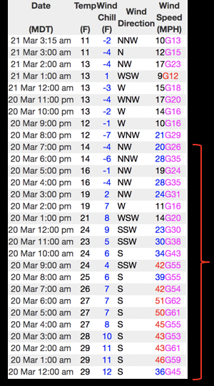
The data in the image above from Windy Peak (10,662'), clearly illustrates nuking winds through most of the morning along with a midday frontal passage, cooler temperatures, and diminishing winds.
Yesterday's very strong southwest winds conspired with fresh snow, whipping up a batch of wind drifts that'll remain sensitive to our additional weight today. While most of our issues are confined to steep, leeward, upper elevation terrain, yesterday's strong winds cross-loaded terrain features like chutes and gullies and slabs formed lower downslope than we usually expect to see. That's all pretty straight-forward... now here comes the tricky stuff because yesterday's drifts are gonna be camouflaged with fresh snow, making them hard to detect. In any case, today you'll want to look for and avoid fat, rounded pillows of snow, especially if they sound or feel hollow like a drum. And you can tweak small test slopes like road cuts to see how they're reacting before committing to big terrain or big objectives.
Avalanche Problem #2
Wet Snow
Type
Location
Likelihood
Size
Description
If the sun comes out for any length of time the danger of wet avalanche activity instantly spikes, so you'll want to get off of and out from under steep, sun exposed terrain and avoid terrain traps like gullies and road cuts where snow can pile up very deeply.
Additional Information
I will update this forecast by 7:00 AM tomorrow, Monday, March 22nd.
Your observations are important, so please let me know what you're seeing... click HERE and contribute to this amazing community based program
General Announcements
If you see or trigger an avalanche or just wanna let me know what you're seeing you can reach me directly at 801-231-2170 or craig@utahavalanchecenter.org
This forecast is from the U.S.D.A. Forest Service, which is solely responsible for its content. This forecast describes general avalanche conditions and local variations always occur.