Forecast for the Salt Lake Area Mountains

Issued by Drew Hardesty on
Tuesday morning, February 2, 2021
Tuesday morning, February 2, 2021
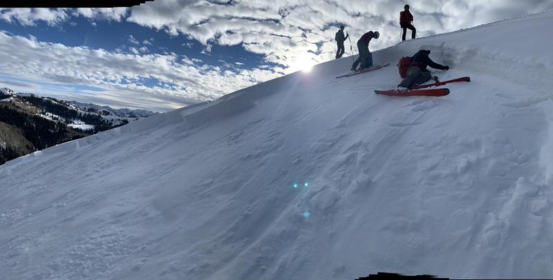
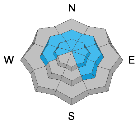
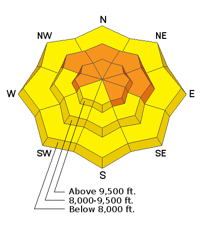
Areas of CONSIDERABLE DANGER exist on many steep west to north to southeast facing slopes at the mid and upper elevations. Human triggered avalanches 2-5'+ deep are likely and potentially unsurvivable. Don't be fooled by the lack of signs of instability today.
Pay attention to developing sensitive drifts of wind blown snow primarily on upper elevation west to north to east facing aspects today. These are to be avoided.
Depending on cloud cover, wet loose avalanches may become a problem on the solar aspects as well as some shady sheltered slopes up to the mid elevations. You'll need to watch for signs of dampening snow surfaces, rollerballs, and pinwheels and some sluffing.
If you're leaving a resort boundary through an exit point, you are stepping into CONSIDERABLE avalanche danger.
***Remember that more than half of our ski/snowboard fatalities over the past 20 years have occurred with people leaving the ski area for out of bounds.
Low
Moderate
Considerable
High
Extreme
Learn how to read the forecast here