Chris Benson
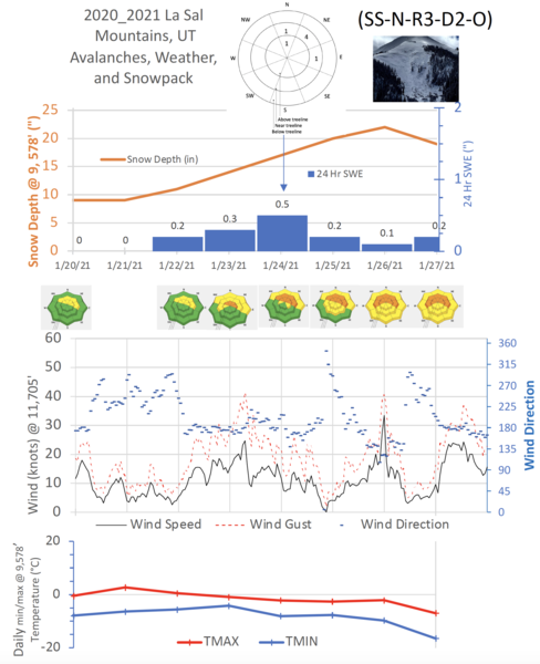
A significant storm impacted southeastern Utah beginning 1-22-2021. Southwest flow and good dynamics produced snowfall totals of 10-20" throughout the range over the course of 3-4 days.
Total snow-water-equivilent (SWE) from this storm is about 1.5". The Abajos received around 2.5" of SWE as much of this storm tracked a bit further to the south.
During the storm, miracously little wind occured as the Jet Stream was further south over New Mexico. That changed on Wednesday the 27th when consistent southerly winds picked up and gusted from 30-40 mph, transporting snow onto northerly aspects.
Several natural avalanches were reported on north, northeasterly, and eastern aspects. These ranged in size but the pattern seems to be soft slabs 1 - 2' in depth, breaking at the old/new snow interface, and sometimes stepping down into deeper persistant weak layers. In several locations, several "repeat offenders" were noted and displayed similar patterns to the late December natural avalanche cycle. Most of these avalanches probably occured sometime on Sunday, January 24th.