Forecast for the Moab Area Mountains

Eric Trenbeath
Issued by Eric Trenbeath on
Friday morning, January 15, 2021
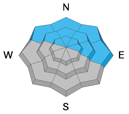
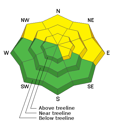
Human triggered avalanches remain likely on steep, northerly facing slopes that have enough snow to ski or ride. However, due to a lack of sufficient snow cover on the majority of the terrain, the avalanche danger is isolated to specific features and therefore MODERATE. With the current snowpack structure, steep, NW-N-E facing slopes with sufficient cover should be avoided for the foreseeable future. Blowing and drifting of snow may exacerbate this problem, particularly on slopes with an easterly component to their aspect. Most south-facing terrain has LOW danger.
Low
Moderate
Considerable
High
Extreme
Learn how to read the forecast here
Special Announcements
The Geyser Pass Road is plowed. The surface is snow packed on dirt.
The Lower Utah Nordic Alliance (LUNA) groomed Gold Basin on Wednesday and Geyser Pass on Thursday.
Weather and Snow
Moderate to strong northerly winds will continue to blow in the high country though they should begin to abate as the jet stream shifts east. Skies will be mostly sunny with high temps in the low 30's. We should see a few clouds tonight and into Saturday as a weak system brushes by to the north. A glimmer of hope appears on the horizon early next week with a chance for snow Mon-Tue.
Wind, temperature, humidity on Pre Laurel Peak (11,700')
Snotel site near Geyser Pass Trailhead (9600')
Storm totals at the Gold Basin study plot (10,000')
Snowpack Discussion
It's getting pretty monotonous describing the current snowpack because there isn't much of one. Chris Benson and Charlie Ramser were both up yesterday and their words can help illuminate the situation. Read their observations here. Both report continued signs of instability such as cracking and collapsing though instances are becoming more localized. Snow depths on northerly aspects above about 10,000' range from 12" - 24" while southerly aspects are mostly bare. The existing snowpack is very weak and faceted along with the presence of one or two crusts. Below treeline, the entire snowpack is starting to lose cohesion and there isn't much of an overriding slab. Near treeline and above, an overriding slab can be found in areas that have denser deposits of wind drifted snow. Above treeline, the snow in many areas has been ravaged by the wind, and scoured surfaces alternate with smooth, hard slabs, crusts, and in the words of Chris Benson "soul searching sastrugi." Conditions are deceiving due to the overall lack of coverage and the general inaccessibility of avalanche terrain, but if you went searching for an avalanche you could still find one.
Ad
Avalanche Problem #1
Persistent Weak Layer
Type
Location
Likelihood
Size
Description
Our snowpack is rife with persistent weak layers of loose, sugary, faceted snow along with a couple of melt feeze layers. Red flag signs of instability such as collapsing and whumphing continue to be observed though they are becoming more localized. Although avalanche terrain remains difficult to access due to low coverage, human-triggered avalanches are likely steep, northerly facing slopes that have sufficient snow cover.
Avalanche Problem #2
Wind Drifted Snow
Type
Location
Likelihood
Size
Description
Moderate to strong NW winds have blown and drifted what little snow was available for transport in exposed areas. In most cases this has resulted in cross-loading on slopes with an easterly component. Most south aspects remain bare. Wind drifts are recognizable by their smooth rounded appearance and cracking is a sign of instability. In most cases, a triggered wind drift will likely step down into a persistent weak layer of sugary, faceted snow causing a deeper, and more dangerous avalanche. Avoid steep slopes with areas of wind drifted snow.
General Announcements
This forecast is from the U.S. Forest Service, which is solely responsible for its content. This forecast describes general avalanche conditions and local variations always occur.